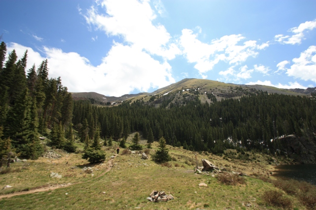
Wheeler Peak from Williams Lake
Lorri and I found ourselves in Taos, New Mexico where we could shop till we dropped (i.e. ran out of money) or we could go see the world famous Taos Pueblo where they have no electricity and you can see the natives talking on their cellular phones as their ancestors did for hundreds of years before them. The cost is only $10 per person + $6 per camera and if you have any money left when you leave you can stop by the casino! I couldn't understand how they kept their cellular phones charged but I assumed it was somehow spiritual... The third option was to head up to Taos Ski Valley, fuel up at Tim's Stray Dog Cantina then hike to the summit of Wheeler Peak in a thunderstorm the next day. Hmmm, the third option was sounding better already.
From a base camp in Unit 331 at the Sierra Del Rio condominiums ($170 for two nights and it had a full kitchen and electricity!!!) we drove up the gravel road to the Williams Lake Trailhead at an elevation of ca.9500'. At the trailhead we ran into a group of people attempting to go to all 50 state highpoints in 50 days starting from the summit of Denali. One member of the group was apparently a meteorologist.
We started hiking somewhere around 6:15AM under mostly cloudy skies. Within 15 minutes of departing the trailhead we started hearing thunder and within 30 minutes it was hailing as a thunderstorm passed through the area. We kept hiking thinking we could at least go to Williams Lake and see what the route up Wheeler Peak was all about. By the time we got to the lake (ca.11,050') things were looking better. The meteorologist had a lengthy explanation but before the end of the day I had a theory of my own... My theory involved a lot of hot air and a meteorologist.
|
Wheeler Peak from Williams Lake |
|
|
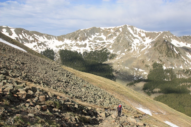
From the lake there is a path that leads up a gully on the southwest side of Wheeler but the description I read said if you reach the lake you have gone too far so we wondered around in the woods for a while before heading toward the sound of hot air escaping from a meteorologist. There were a few remaining patches of snow in the gully but for the most part the path had melted out.
|
On the climbers path above Williams Lake |
|
|
At about 12,000' the path disappeared in the snow for a few hundred feet but the way was obvious as the route gets out of the gully and heads for the small saddle between Wheeler Peak and Mount Walter. The hike to the saddle was a mixed bag of loose rock and tundra but eventually we found the path again and the going became easier except the lack of oxygen. It was a little unclear whether the lack of oxygen was due to the altitude or if it was because the meteorologist was using it all up to maintain his constant chatter and leaving us with just carbon dioxide?
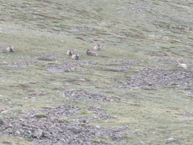
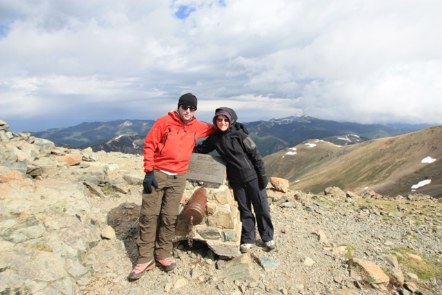
From the Wheeler Peak-Mount Walter saddle it is a short easy hike to the summit of Wheeler Peak where we arrived about 3.5 hours after leaving the trailhead. The summit views are nice and there was a heard of big horned sheep lounging around on a grassy slope below the summit. It was fairly breezy and we didn't know just how long the thunderstorms where going to stay away so we didn't stay long.
|
Big Horn Sheep a few hundred feet from the top |
|
|
|
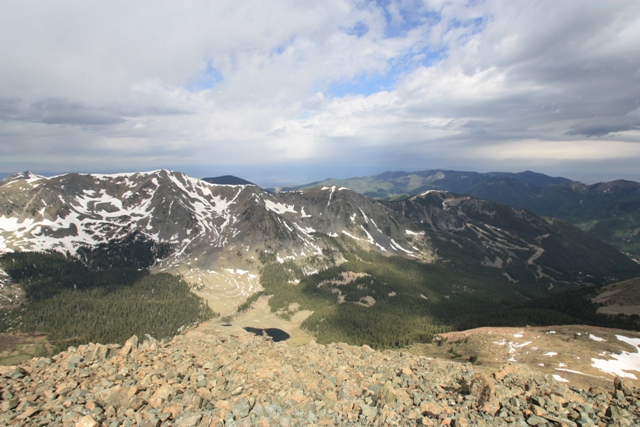
View down to Williams Lake and Taos Ski Valley from the summit |
|
|
We forgot to sign the summit register which is a real work of art... the people that take summit registers because they think it is unnatural will have trouble with this one... Maybe they could take the meteorologist instead?
|
The summit register on Wheeler Peak |
|
|
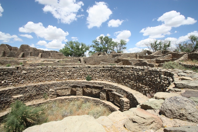
After we left Taos we headed to Aztec, New Mexico and stopped at Aztec Ruins National Monument where we saw several kivas. A kiva is a circular room partially underground that is believed to have been used for spiritual ceremonies. Some scientists believe the unique shape of the kivas was used to focus the signal of their cell phones into the sky so they would have fewer dropped calls when talking to the spirits.
|
A Kiva at Aztec Ruins National Monument |
|
|