WOW!!! Hawkeye Point, IA
I had once again managed to persuade Lorri to go on a state high pointing trip. This time we were heading for the corn state, the land of 10,000 lakes state, the cheese state and finally the pleasant peninsula state. Generally April would probably be a bit early to fly half way across the country to bag Minnesota and Michigan but due to the very warm and dry winter in that part of the country they were ripe for the baggin’. One thing that made April a good time of the year for this trip was that the legendary mosquitoes of this region had not yet made an appearance.
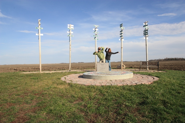
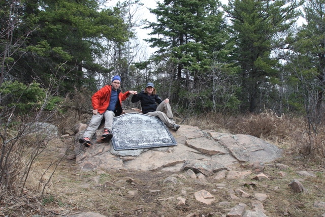
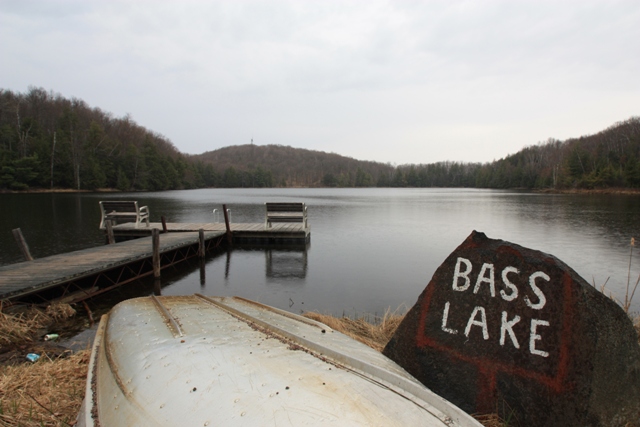
On April 10th, 2010 we departed Seatac and touched down in Minneapolis-Saint Paul where we picked up our rental car and headed south then west and drove to Hawkeye Point, Iowa (1,670 Feet). This unimpressive feature was privately owned but recently became property of Osceola County so there are no access restrictions. The most interesting thing about this highpoint in my opinion are the signs to all of the other state highpoints.
|
WOW!!! Hawkeye Point, IA |
|
|
|
Shaking our grove things at 1,670 Feet |
|
|
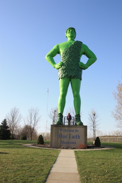
The following day we headed back to the north shore of Lake Superior to the town of Lutsen, MN. Sadly, about the most impressive thing we saw before arriving in Duluth, MN was the Jolly Green Giant...
|
A MUST see: The Jolly Green Giant |
|
|
We stayed at the Cascade Lodge near Lutsen which left us about 45 minutes from the trailhead for Eagle Mountain, MN. Cascade Lodge is on Lake Michigan and is a nice place to stay if you are looking to hotel it.
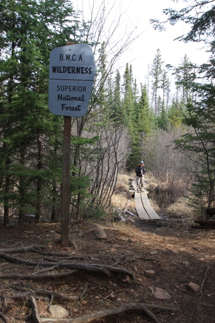
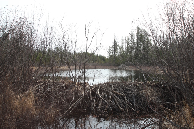
On the 12th we drove to the Eagle Mountain Trailhead (ca.1750 Feet) seeing only a few small patches of snow (the roads are plowed all winter). With a storm on the way we lucked out with the weather again. The hike to Eagle Mountain is a relatively easy 3.5 miles each way to the summit (2301 Feet). The trail enters the Boundary Waters Canoe Wilderness Area in about a mile where there is an impressive beaver dam.
|
Entering the Boundary Water Canoe Area Wilderness |
|
|
|
Beaver dam and lodge on the way to Whale Lake |
|
|
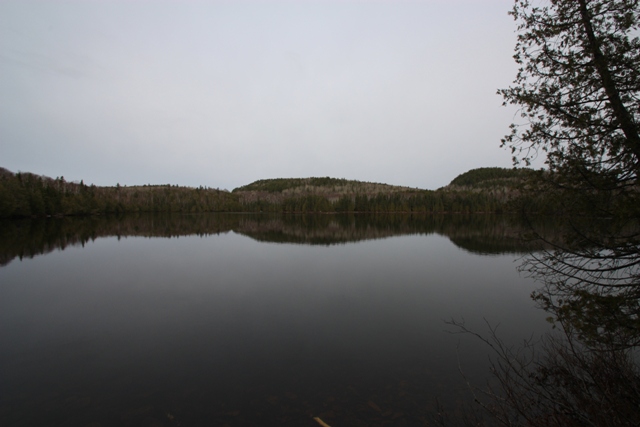
At about 2 miles the trail reaches Whale Lake. You can see Eagle Mountain from the lake but not from the trail... in other words it is not the one that the Summitpost page claims is Eagle Mountain. The trail circles part way around the lake then finally gains some elevation to gain the long ridge leading to the summit. There is no view from the summit but there are a couple of bluffs on the way that offer views.
|
Eagle Mountain (center) from Whale Lake |
|
|
|
On the summit of Eagle Mountain, MN - 2,301 Feet |
|
|
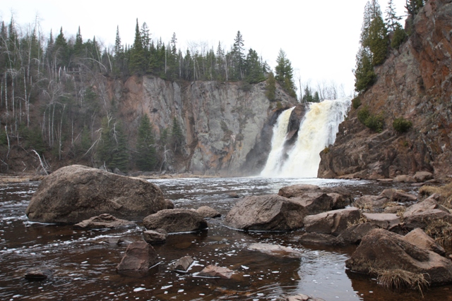
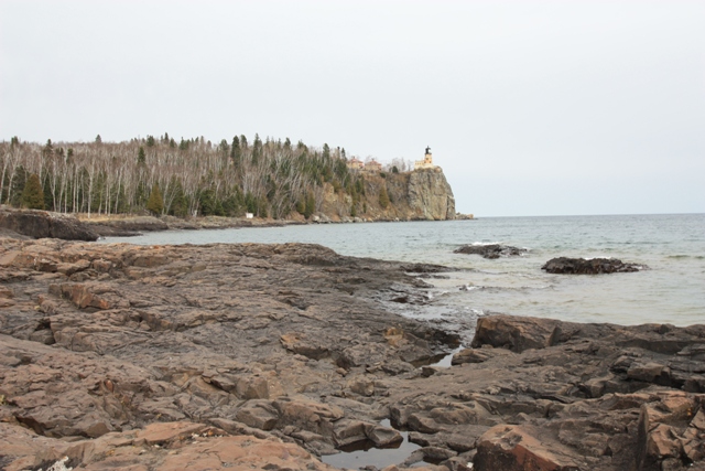
If you go to Eagle Mountain allow some time to explore the north shore of Lake Superior. Between the “mountains,” rivers and lakes there are quite a few interesting places to see. We stopped at a couple of lighthouses and High Falls on the way back to Duluth. At 60 Feet High Falls is the highest waterfall in Minnesota 60 Feet.
|
High Falls - The tallest waterfall in Minnesota |
|
|
|
The Split Rock Lighthouse on the North Shore of Lake Superior |
|
|
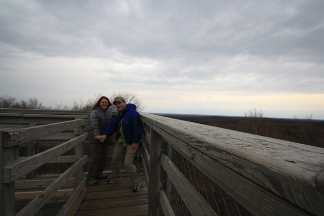
On the 13th we drove from Duluth to Timms Hill, WI (1,951 Feet). There is a good view of Timms Hill from the Hill of Beans coffee house where the summit register is kept. It was cold and windy on the summit which is reached by a short trail of about 1/4 of a mile. There is an observation tower and a radio tower on the summit. The radio tower is taller but you have to climb a vertical ladder with a cable running down it if you want to get exposed to the radio waves. Then again, there are other dangers you must consider if you are near Reinlander, WI...
|
Timms Hill, WI from outside the Hill of Beans Coffee Shop |
|
|
|
Low 5 on Timms Hill, WI - 1,951 Feet |
|
|
|
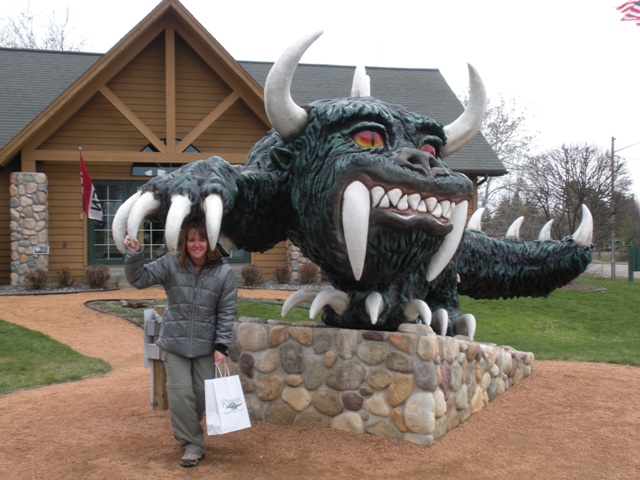
Lorri narrowly excapes a Hodag attack in Reinlander, WI |
|
|
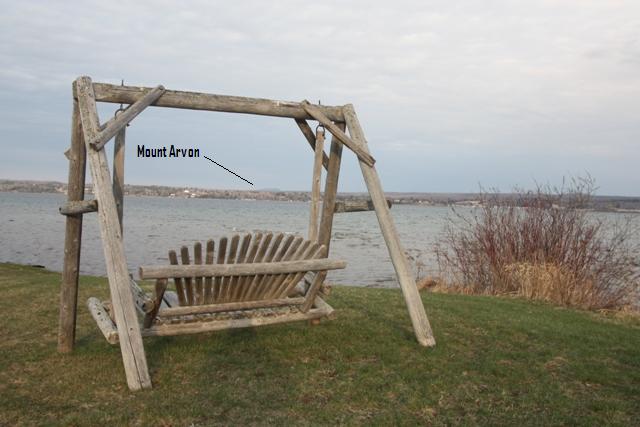
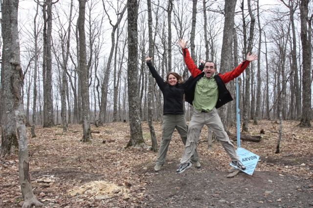
Having survived Wisconsin, at least for the time being, we headed for Michigan which was the biggest wild card. Once again we lucked out and were able to drive all the way to the trailhead for Mount Arvon, MI (1,979 Feet). If you cannot drive to the trailhead you are looking at up to 7 miles of slogging each way to the summit depending upon where the snow and/or mud start. We started up the road with a cloud of dust in the rear view mirror then hit a little mud and snow just before the trailhead. The abandoned road/trail leads to the summit in about 1/2 mile where there is no view.
|
Mount Arvon, MI towering above Lake Superior |
|
|
|
Jumping for joy on Mount Arvon, MI - 1,979 Feet |
|
|
That was our last state highpoint for this trip but we still had some climbing to do. Even if you can touch the rafters Brew City, aka Milwaukee, is a great place to see AC/DC...
|
...and then there was ROCK! |
|
|
References: