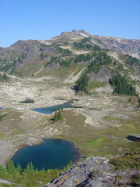
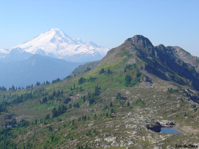
Mount Baker from the Trail
Chris Mattson, Chris Shultz and myself met in Federal Way at 5:00am. After picking up Sergio Verdina in Seattle we headed for Bellingham and the Sunset Highway (Highway 542). We continued to the DOT Shuksan Facility, about 14 miles east of Glacier. Immediately beyond the maintenance facility we turned left on Twin Lakes Road (FSR 3065), arriving at the Gold Run Pass Trailhead in about 4 and a half miles. It was a bit before 9:00 when we arrived and the trailhead was busy.
We started up the moderate Gold Run Pass Trail (FST 686) and hiked for about 2 miles to the junction with the new trail to the Yellow Aster Buttes area (this trail is not shown on most maps; the Keep Cool Trail, FST 699, has been abandoned). We continued toward Yellow Aster Butte on the new trail (FST 686.1). The trail makes a long traverse then a short descent to the many tarns SW of Yellow Aster Butte. The views of the Baker/Shuksan area from the trail are excellent but we were a bit disappointed that it was turning out to be a hazy day.
|
Mount Baker from the Trail |
|
|
|
Tomyhoi Peak from the Trail |
|
|
From the tarns we spotted an obvious trail leading toward the broad ridge SE of Tomyhoi (this portion of the trail is shown on the USGS map). On the ridge crest we were rewarded with views of Mount Larrabee, American Boarder Peak and Canadian Border Peak. The path continued up, staying more or less on the crest of the ridge then dropped to a 6300' notch. A bit of easy scrambling on the other side of the notch and we were back on easy trail. The trail continues up to the crest which becomes narrow with a snow patch on the right. We were getting close to the summit and I was starting to think this was the glacier.
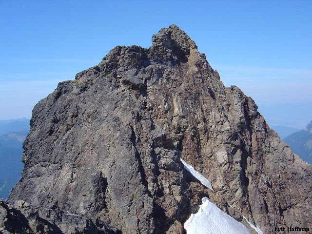
Another short descent to a notch then a rising traverse on a path reached the real glacier. I brought an ice axe and crampons for this? We traversed next to the moat on soft snow for about 100 feet then returned to rock at a notch. The glacier was trivial under the conditions we experienced (there is a 30 degree slope that ends in a flat 100 feet below, no crevasses in this area). A bit of scrambling on rock then a path on the left side of the crest reached another short descent to the final notch. From here the scramble to the summit looks harder than it actually is.
|
The Summit of Tomyhoi Peak |
|
|
The scramble zig-zags up from the notch, connecting a series of shallow gullies to reach the ridge crest. From here we scrambled the ridge crest...we could have taken the path left of the crest.
|
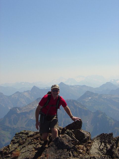
Chris Shultz Arrives on the Summit |
|
|
|
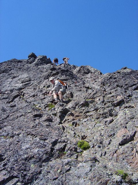
Chris S., Chris M. and Sergio in Various Stages of Downclimbing from the Summit |
|
|
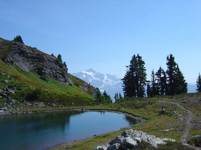
It was a warm day in the mountains. After descending back to the tarns, we decided a quick swim was in order. We all jumped in and were refreshed. The trip took us less than 7 hours car to car. This is a good social climb with no brush, great views, generally easy terrain and completed with a fun, exposed scramble that reminds you that this is a climb.
|
Mount Shuksan and the Swimming Pool |
|
|
References:
Cascade Alpine Guide, Volume 3, 2nd Edition; Fred Beckey; Page 49
Climbing Washington's Mountains; Jeff Smoot; Pages 34-36