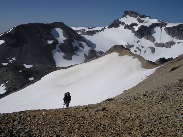
Mount Curtis-Gilbert from the approach route
Having been up Mount Curtis-Gilbert, Old Snowy and Ives Peak I felt compelled to complete the list of major summits in the Goat Rocks Wilderness… or maybe I just can’t get enough loose, precariously stacked volcanic rubble. There was also the fact that unlike Curtis-Gilbert, Ives and Old Snowy; Tieton was not on the rim of the caldera that forms the Goat Rocks, rather it sticks out into the middle offering a unique view of the surrounding peaks. I recruited Ty Nguyen since he was the only one I knew that was naïve enough to even consider going to the top of Tieton Peak.
The approach begins at Conrad Meadows (ca.4000’) and follows FST 1120 through the meadows then forest to a junction with FST 1131 at ca2.5 miles. The Tieton Peak Trail is the path less traveled. FST 1131 ascends a rib then descends and flattens out as it goes through forest and sections of marshy meadows. After about ca.2.5 miles it is best to take a hard right at a gnarled up tree with a blaze. This will avoid the largest and marshiest of the meadows (ca.4500’) by circumnavigating it counter-clockwise on game trails. Once at the west side of the marsh we were able to relocate a more defined path but it was difficult to follow. Eventually, we lost the path and just headed NW which allowed us to gain a bench at ca.6200’. We traversed the bench south until we could make a descending traverse to the SW for a couple hundred feet and gain the large bench below Tieton Peak. We set up camp at ca.6000’ on one of the few flat and dry spots.
|
Mount Curtis-Gilbert from the approach route |
|
|
The few route descriptions I found were for the SW ridge and all were somewhat vague. The following morning we continued south on the large bench as the route descriptions seemed to indicate and were able to gain the ridge by ascending a small bowl after traversing the bench for only a few hundred yards… as I looked back toward camp it certainly seemed that we could have ascended directly up via a break in the cliffs but I wasn’t entirely sure where the summit was.
|
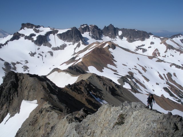
Ty gaining the SW Ridge |
|
|
I was expecting the ridge to be loose and I was not disappointed! The ridge is the rubble one would expect to find on the carcass of an ancient volcano. We surprised a small herd of mountain goats as we came over a particularly loose hump in the ridge. From there the final ascent to the summit appeared a bit intimidating but turned out to be fairly straight forward class 3 on the west side of the ridge.
|
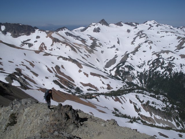
Ty on the sometimes airy SW Ridge with Mount Curtis-Gilbert in the background |
|
|
|
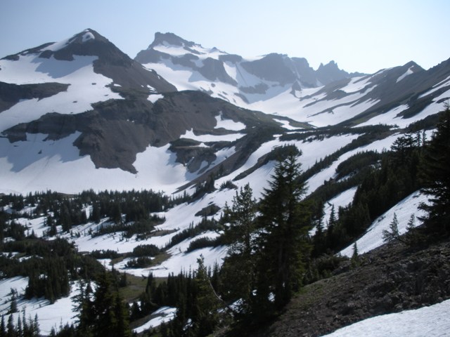
Ty on the SW Ridge with Ives Peak and Old Snowy in the background |
|
|
After taking in the views and some food we began descending the east slope. At ca.6500 a break in the cliffs allowed easy passage to the right on snow. From there we were able to descend directly to camp without having to deal with the SW Ridge and all of its good times.
I had noticed that the USGS map showed a trail on the south side of Conrad Creek. This seemed a bit more appealing than the marshy, hard to follow approach on the north side that we used to get here. Although the deep snow made it difficult to find the path we were fortunate that there were still good snow bridges over a couple of creeks that would have been difficult to cross at this time of year. At times we did locate the path so I can confirm its existence but not its route entirely. Eventually, the path comes to a junction with FST 1120 in a small basin. We had difficulty locating the main trail but finally did. There remainder of the hike out was straight forward and uneventful.
|
Looking back at Tieton Peak from the SE |
|
|
In the photo above the summit of Tieton Peak is just left of center. We gained the SW ridge in the bowl on the far left and descended the mostly snow covered east slope to the small snow patch most of the way down the slope.
References:
Cascade Alpine Guide, Volume 1, 2nd Edition; Fred Beckey; Pages 68-70