Mount Thielsen, Crater Lake and Mount Scott;


This is yet another trip to the volcano infested land known as the Oregon Cascades. On this trip I would attempt to climb Mount Thielsen and take a quick trip up to another volcanic marvel, Crater Lake.

I left the Mayfield powerhouse, my office away from the office, Halloween afternoon. I headed south to Eugene, Oregon, where I turned east on highway 58. This may or may not be the fastest or shortest way to the Thielsen/Crater Lake area. At the junction of 58 and Highway 97, I headed south for about 20 miles to the junction with highway 138. I headed west on 138 for about 23 miles before arriving at the Mount Thielsen Trailhead (c.5600') . It took a solid 5 hours in the car to reach the trailhead from the Chehalis area.

I camped at the trailhead and awoke to a temperature of 18 degrees, but the sky was crystal clear. I left the trailhead a little after 7:00am and returned at 8:15am to get my camera. Damn, I just added 3 miles to the trip. The Mount Thielsen Trail winds its way through the forest with an occasional view of Diamond Lake, Mount Bailey and Mount Thielsen through the trees. At 4 miles the trail ends at a junction at the PCT on the west ridge of Mount Thielsen. The elevation was about 7300'. The approach continues, crossing the PCT and ascending the west ridge of Thielsen.

Mount Thielsen from the West Ridge


The ridge is forested for the first several hundred feet before it gives way to scree, talus and loose rock scrambling if you want it. There are path(s) much of the way. A thin coating of snow and the cold weather had frozen the scree solid. This was a mixed blessing. I contemplated putting on crampons as I slipped around on the scree but never did. Finally, I reached the South Ridge, which is decorated with oddly shaped spires. I headed toward, then up a short gully on the SE side of the summit tower to reach its east side.


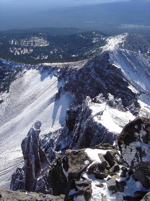
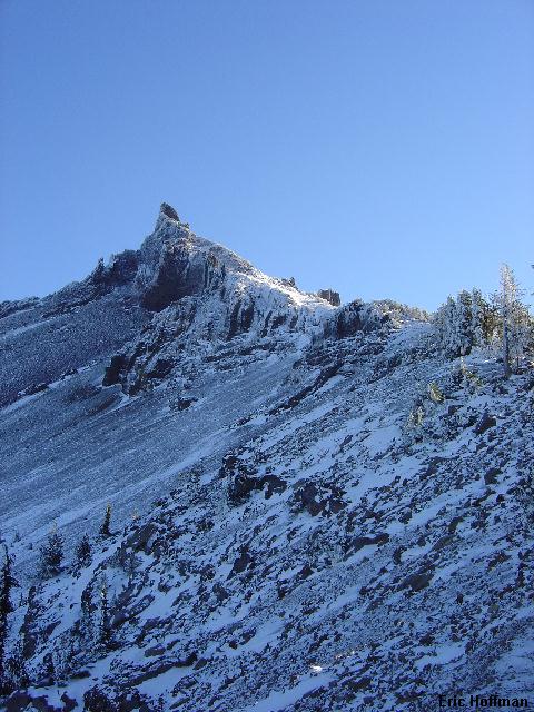
The South Ridge of Mount Thielsen


The summit horn is described as class 3 or 4. I would call it about 40 feet of easy class 4 but it is surprisingly solid and features plenty of good holds. Patches of snow added another dimension of challenge. I reached the summit in just under three hours after leaving the trailhead (for the second time). There are two summit registers, one is locked the other one is missing its cap, both are chained to a large boulder. The larger register, the one missing the cap is somewhat unique.


Mount Thielsen's Summit Register


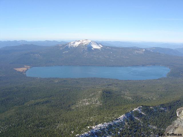
Diamond Lake and Mount Bailey from Mount Thielsen


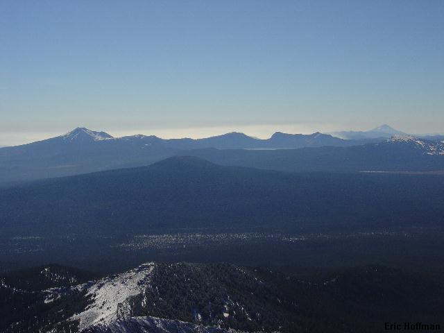
Mount Scott, Crater Lake and Mount McLoughlin


I arrived back at the trailhead just before 1:30pm, the descent taking about 2 hours. I was off to check out Crater Lake where I hiked to the Mount Scott Lookout (8928'), the highest point in the Crater Lake area. Crater Lake (6176') itself is impressive and left me wondering just how high that mountain was. The Mount Scott Trailhead is at an elevation of c.7400. The trail leads 2.5 miles to reach the lookout, gaining about 1500 feet.

Mount Scott from Crater Lake


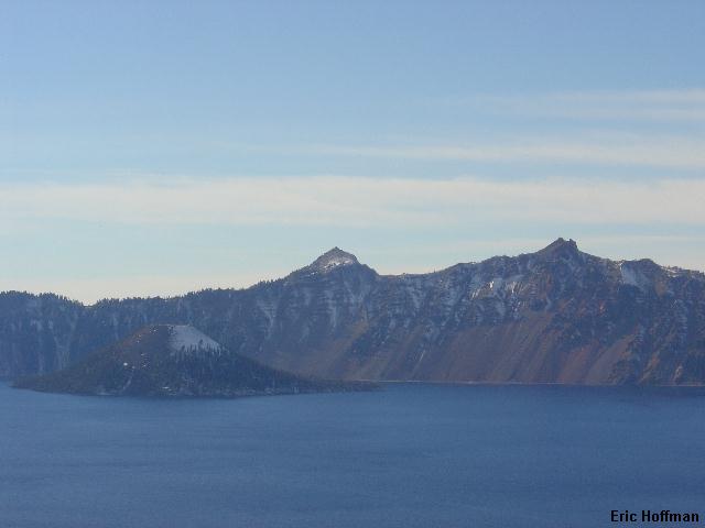
The Crater Lake and Wizard Island from Mount Scott


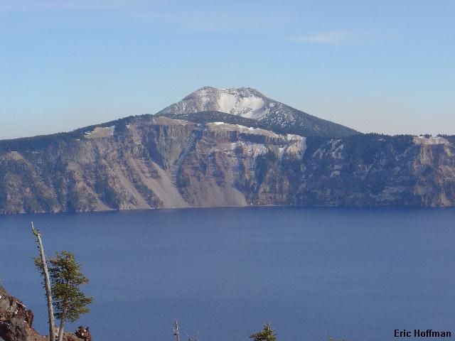
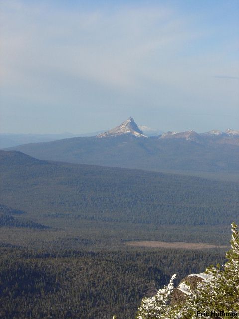
Mount Thielsen from Mount Scott

References:
Summit Guide to the Cascade Volcanoes; Jeff Smoot; Pages 156-158