![]() Click Here for a map of the
route
Click Here for a map of the
route
After going back and forth on destinations, I settled on West McMillan Spire. The difficulty in coming to this decision was the lack of information about the two routes in question. In the case of West McMillan Spire, the Terror Glacier crossing was the issue. The Beckey Guide stating that it may be difficult in late summer and Selected Climbs in the Cascades not saying much of anything about the glacier. Perhaps the glacier has changed since Fred and Helmy Beckey made the first ascent of the route in 1940. I decided to take a chance on a solo ascent, hoping that the glacier would allow safe passage. I knew that Selected Climbs in the Cascades recommended this as a 3-5 day climb and that for $900 AAI would guide you to the top...in five days. The approach is via the Goodell Creek/Terror Basin Route which is known for its brutal terrain. Given the terrain, I didn't see where carrying a five day supply of food and fuel would be beneficial and opted to attempt the peak in 2 days to keep weight down. No step of the approach is on maintained trail. Even so, West McMillan may be the easiest peak in the Pickets to "bag". Admittedly, West McMillan Spire is just barely into the Pickets and is far less challenging to approach, not to mention climb, than the majority of the peaks in the sub-range.
I called the ranger station in Marblemount on Friday to inquire about "Self Permitting" and was told that you can self permit if the area you are looking for is not full. A list would be posted at the information center along with permits. When I inquired about Terror Basin and the possibility of it being full, the ranger laughed say, "you won't have a problem self permitting for Terror Basin."
Could the approach be so bad that so few are willing to go there if for no other reason than to get a closer look at these rugged peaks? When I arrived at the Ranger Station. I read the list of closed campgrounds...no Terror Basin. Hmmm...no blank permits. Just a handful of permits filled out by people who all seemed to have Boston Basin and Forbidden Peak in mind. I filled out my climber registration form and left. I was going to spend one night if not two in Terror Basin whether I had a permit or not.
I drove to Newhalem and crossed Goodell Creek then took a paved road on the left. At the "T" I kept left passing a State Maintenance Facility. Continuing past there the road turned to gravel and came to a fork. The left fork ends at a gravel pit where there is plenty of parking but no trail. The right fork leads to a group campground. I drove to the very end where I spotted a path leading to the creek. After some investigation, I found an overgrown logging road heading upsteam. It was very overgrown. I searched around in the darkness with my headlamp and found nothing of a trail. I settled in for a night of car bivying and decided to look further in the morning. It was about 6:30am when I actually started out. It was light now but I still couldn't find anything in the way of a trail other than the short path leading to Goodell Creek and the overgrown road. I started thrashing up the old road and then decided to get out of this tangled web of black berry bushes and devils club. I worked out of the road bed and into the forest above where I soon stumbled upon the real trail. I wasn't sure where it had started, but I would find out later. The path made travel much easier even though it is somewhat overgrown and with a few obstacles (100 downed trees and a half dozen washouts), the tread starts at an elevation of 600 feet. After gaining a few hundred feet in the first mile and a half, the trail levels out for about a mile at c.1100'. It then gradually gains elevation and passes through a gap then continues on to a stream crossing at about 3.5 miles (c.1700'). Just beyond the steam, there is a cairn marking the Terror Basin Route and a small campsite.
I started up the steep path near the crest of a spur ridge south of Terror Creek. At about 3200 feet, the trail traverses north then the steepness resumes to a small talus field at c.4000'. The trail circles left then makes a rising traverse to a rock band at c.4800 feet. After traversing below the rock band for a few hundred feet, the path leads steeply up a gully where the vegetation is more that just pretty. Once above this obstacle the route enters a large bench and crosses the top of a gully then traverses to another rocky stream bed (running water now but may not be reliable). Once across the stream, follow it upstream a couple of hundred feet where a path can once again be found (c.5200'). Now the route traverses heather benches and rock to a c.6200' notch. Moderate snow led the last one hundred feet to the notch. A good camp spot is below the gap at a small flat gravelly basin (c.5800) with running water, flowers and a view that won't quit. Well I was just guessing about the last part, since I had been more in than out of the clouds. The descent to camp was via a partially melted out gully that is about 35 degrees at the top.
|
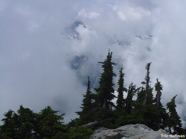
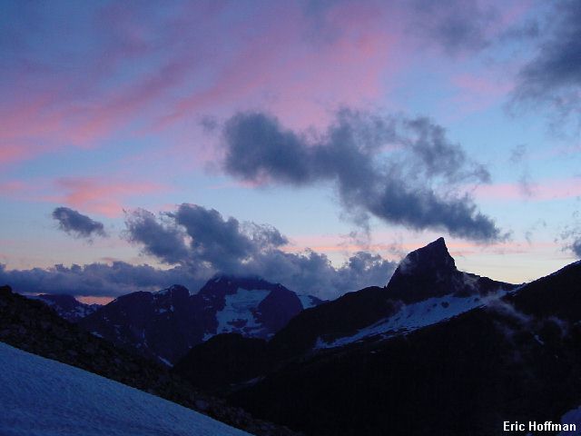
A cloudy view from the approach |
|
|
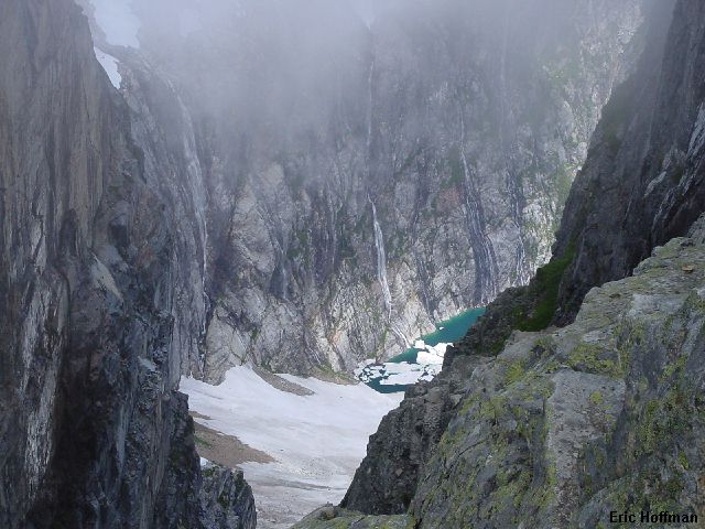
I got to camp much earlier than expected. It was only noon. I debated going for the summit now but I wanted the view. I decided to hike up to the rim of the basin for a look down to Lake Azure. Spectacular cliffs and small glaciers drop steeply to the lake.
|
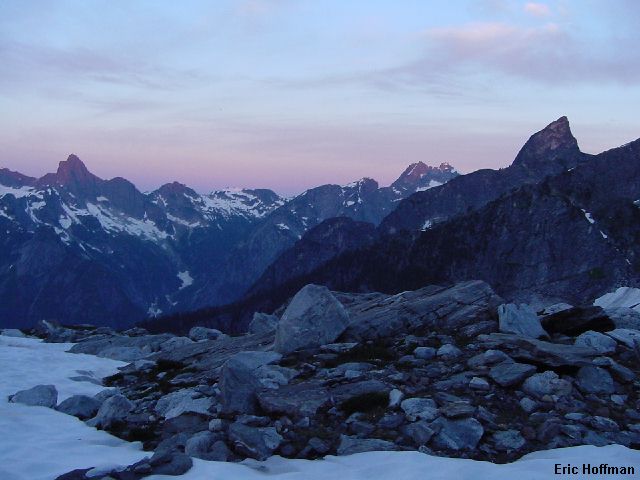
4055' Lake Azure from a 6200' notch in the east rim of Terror Basin |
|
|
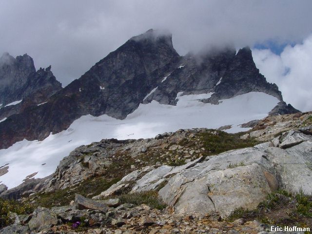
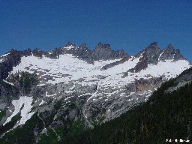
Meanwhile, the peaks above Terror Basin and well beyond were making an occasional appearance. Mt. Triumph, Mt. Despair, The Chopping Block, The Pyramid, Inspiration Peak, and The McMillan Spires. The only peak in the immediate area that stayed buried in the clouds was Degenhardt. I returned to camp and fell asleep in the sun and awoke in a cold misty cloud. As evening set on, the view continued to improve.
|
Inspiration Peak and the McMillan Spires from Terror Basin |
|
|
|
The Terror Glacier from camp |
|
|
|
Mount Despair and The Chopping Block |
|
|
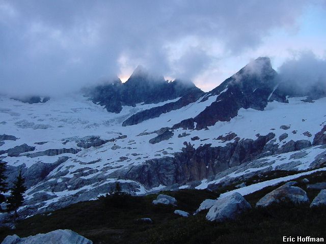
I settled in for the night. It was calm and by 10:00pm it was completely clear. It was a dark star filled sky, but on the horizon I could make out the outline of all the peaks above Terror Basin including Degenhardt. Aside from a persistent rodent that sneaked out of the rocks to chew on my sleeping pad a few times (fortunately it was not self inflating), it was an uneventful night. I awoke at 5:30am. Soon the first rays of sun started warming things up.
|
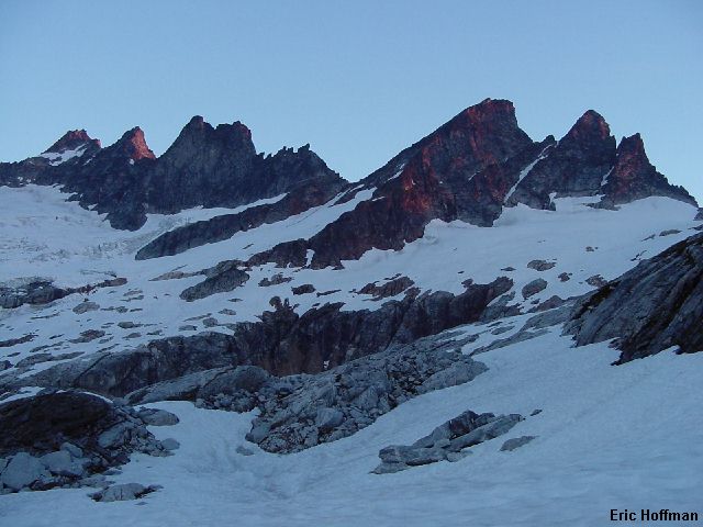
Good Morning! Mount Triumph to The Chopping Block at dawn |
|
|
|
Mount Degenhardt, The Pyramid, Inspiration Peak and the McMillan Spires |
|
|
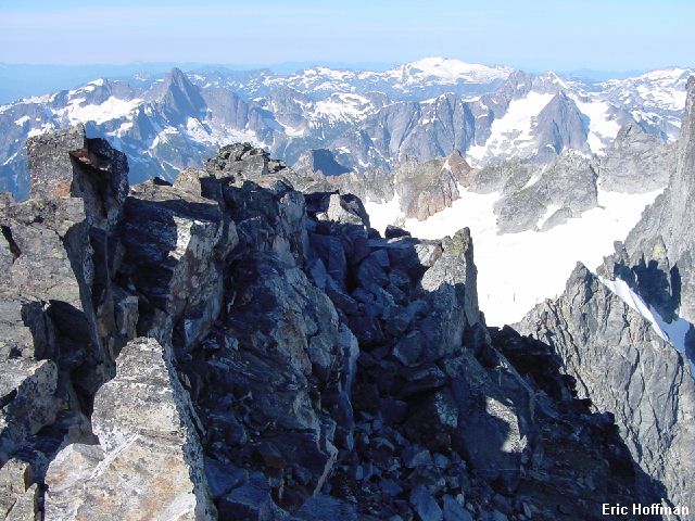
I left camp around 6:30am, making a long descending traverse on snow, slabs and heather to the outlet of a snow and water filled depression (c.5500'). More snow than water, the depression is shown as snow on the maps but appears to be a lake that is frozen solid. After crossing the outlet and traversing a couple hundred feet on heather and slabs I hiked and scrambled upward to the snow covered slabs below the Terror Glacier. The West Ridge Route of West McMillan Spire ascends what seems to be more of a snow field narrowing to a gully to reach the 7200' col between Inspiration and the objective rather than active glacier ice. Easy snow steepens to about 40 degrees for the last 200-300 feet to the col. The snow was hard but not too icy. There was a large hole about halfway across the bottom of the gully where slabs where melting out, so the run-out was not altogether safe. At the col I crossed through and circled around a rocky crag to gain the ridge (small crevasse and moat). 800 feet of scrambling and scree led to the final section of ridge which is rightly described as exposed but easy. Wow! Now that is a view!
|
Mt Fury from the summit of West McMillan Spire |
|
|
|
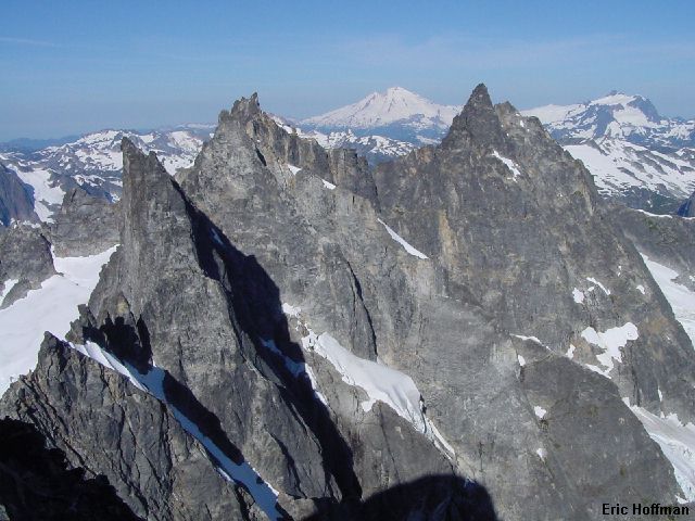
SW view from West McMillan Spire |
|
|
|
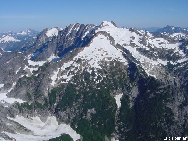
Inspiration Pk, The Pyramid, Mt Degenhardt and Mt Terror with Baker and Shuksan in the background |
|
|
I descend back to camp, facing in for the two hundred feet below the col. On my way back to camp, I saw two sets of crampon tracks in the snow. Hmmm, I didn't see them for a long time but finally saw the two climbers reaching the snow covered slabs below the glacier. I guess I can live with seeing two people on the entire trip as long as they are a mile away.
After packing up my bivy gear I headed up the gully to the gap above camp. The hike though the heather benches was spectacular. No clouds to obstruct the view. The trail seemed harder to find on the way down. On the way up the trail is sufficiently steep that you are at eye level with it most of the time. After taking everything into consideration, it was obvious that the effort of getting here was worth it.
|
Terror Basin from the Goodell Creek/Terror Basin Route |
|
|
As I neared the trailhead I returned to the question of just where did this trail begin? Soon I came to a fork. I abandon the old road and followed the right fork which quickly led to the campground. It was a couple hundred feet from where I was parked (there is a large boulder just south of the trail). The left fork appears to connect with the road to the campground but well south of the campground itself.
I returned to the Marblemount Ranger Station hoping to sign out. A post-it stuck to my climbing permit informed me that I did not have a permit and that a climbers registration form is NOT a substitute. There were a couple of rangers there. One I recognized and he recognized me. We had crossed paths last summer at the Black Warrior Mine where after checking my permit, he watched me try to climbing out of lower Horseshoe Basin on my way to Buckner. He said he had been telling people all year that that was where the route to Buckner was. The problem was that I couldn't get up that way and ended up coming down and trying in another area. There is a lesson to be learned there if you haven't already learned it. I explained to the rangers that I had called ahead and that there were no blank permits and they apologized to me, then told me "you did the right thing." Okay, that's the way I like to end a trip.
References:
Cascade Alpine Guide, Volume 3, Second Edition; Fred Beckey; Pages 94-99,
396-397
Selected Climbs in the Cascades, Volume 1; Jim Nelson and Peter Potterfield;
Pages 195-197