![]() Click
Here for map
Click
Here for map
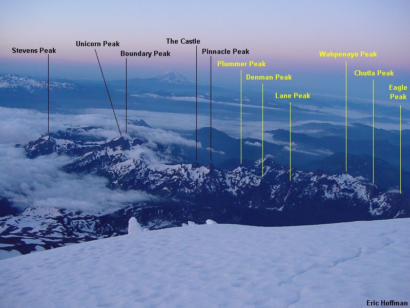
Okay, this was the second part of a trip that would be best done in two consecutive days, but due to other duties I had to return three days after doing the first part of the traverse. See the Tatoosh Traverse Part I for information on the Stevens Peak to Pinnacle Peak portion of the traverse and some general information about the range. The weather turned out to be quite different than the perfect weather I received on the first part of the traverse, it was cloudy with occasional showers and no sun breaks. With poor visibility this trip was as much a route finding problem as anything. The climbing on this portion of the traverse was mostly easier but did offer class 3 scrambling routes on three of the peaks. The peaks climbed on this part of the traverse included Plummer Peak (6370'), Denman Peak (6006'), Lane Peak (6012'), Wahpenayo Peak ('6231), Chutla Peak (+6000') and Eagle Peak (5958').
|
The Tatoosh Range from the upper Nisqually Glacier |
|
|
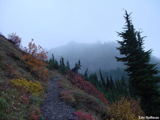
I started hiking the Pinnacle Peak Trail under cloudy skies (trailhead at Reflection Lakes). I wasn't in the clouds initially but by the time I arrived at the c.6000' saddle between Pinnacle and Plummer Peak I was. A path on the south side of ridge leading toward Plummer traversed and reached a flattish area between Plummer and Denman Peaks. Here I located a path leading south to the top of Plummer Peak. No view, no reason to stay.
|
Plummer Peak from the Pinnacle Peak Trail |
|
|
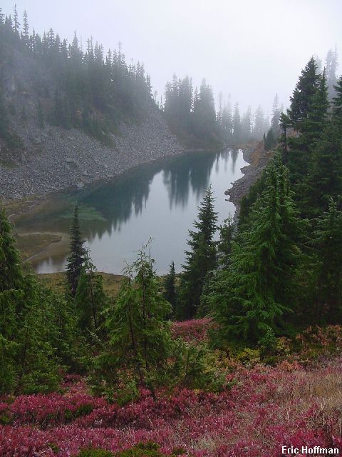
I headed back to the flattish area and continued on a path in the direction of Denman Peak. Denman is barely a distinct peak with less than two hundred feet of relief on the south. I left the path and climbed a short gully on the SW (the gully is hidden by small trees) to reach the summit. There was a faint path leading up from the north but I headed down the way I came up. I continued down the path leading in the direction of Lane Peak that I hoped would lead to the Cliff Lake area...it did. I arrived above Cliff Lake and just south of Lane Peak. A path worked up the south side of Lane to the area of a rocky gully. The gully is 100-200 feet of class 3 that reaches the summit rocks.
|
The gully on the south side of Lane Peak |
|
|
|
Cliff Lake |
|
|
|
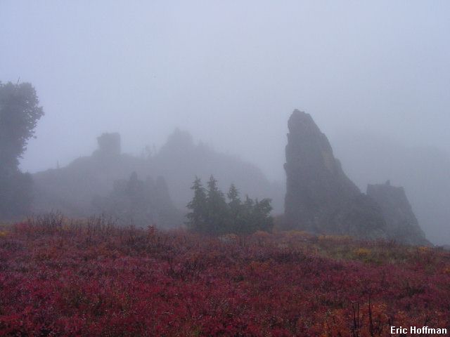
Interesting spires SW of Lane Peak |
|
|
After descending the gully and stopping to take a picture of Cliff Lake, I started traversing SW toward Wahpenayo. There are some interesting spires on the SW side of Lane Peak, the most prominent of which is point 5810'. I traversed for nearly a mile, working my way to a small snow and talus basin south of Wahpenayo. A grassy ledge gave access to the south ridge. The ridge ended below the summit area but Class 2 to the left gained the summit with no real difficulties.
|
The view from Wahpenayo |
|
|
A short Class 2 down climb on the north of Wahpenayo reached a easy gully that widened as I descended. I kept west as I descended and located the 5600' saddle between Chutla and Wahpenayo Peaks. I descended west from the saddle about 300 feet then traversed to reach the Eagle Peak Trail (this trail begins at Longmire) a few hundred feet below the Eagle-Chutla saddle (+5720'). From the saddle I first climbed Chutla Peak. There is a trail on the west ridge leading most of the to the top but there is some scrambling along the way (class 3). Eagle Peak is the more interesting climb in my opinion. From the saddle, a path leads east to a rock step (class 4, looks like there are some loose holds). To by pass the step, follow a path leftward 100-200 feet to a short class 3 gully. Climb the gully to a ledge that leads back to the top of the class 4 step. From above the step more scrambling reaches the top.
The descent should have been uneventful but wasn't. My plan was to descend from the saddle to reach the Wonderland Trail just below Narada Falls but it was raining and I was already wet. The thought of thrashing through wet brush wasn't real appealing so I decided to descend to Longmire and hitch a ride back to Stevens Canyon Road. I don't normally hitch hike, but I was in the park and it seemed harmless, not to mention dry.
A couple of weeks before this trip I was persuaded by Chris Mattson to go to a local elementary school to be part of a presentation on the mountains of Washington. Chris's wife, Kari, teaches the 19 fourth graders who made up the audience. Chris did most of the talking and gave them some good information like they should never hike alone, bring the ten essentials, etc. It was a nice chance to be a roll model of sorts.
Anyhow, back on the road to Paradise the third car to drive by my rain soaked thumb stops. Two women and 4 children are inside the mini-van and in an Australian accent I was told that they would give me a ride if I didn't mind it being a bit crowded. I got in and was immediately asked a lot of questions including what I was doing, what my name was....have you ever climbed Mount Rainier and finally "Do you know Mr. Mattson?" Damn, my first chance to be a roll model and I blew it! What were the odds that one of the 19 students who had been in Mrs. Mattson's class would be on Rainier and whose parent would stop to pick up a hitch hiker? What are the odds that that hitch hiker would be me???
Summary of peaks on the Plummer to Eagle portion of the traverse
|
Peak |
Approach |
Difficulty |
| Plummer (6370') | Easy | Class 1 with path |
| Denman (6010') | Easy | Class 1 |
| Lane (6012') | Easy | Class 3 |
| Wahpenayo (6231') | Moderate from west, more difficult from east | Class 2 |
| Chutla (+6000') | Easy | Class 3 |
| Eagle (5958') | Easy | Class 3, some exposure |
References:
Cascade Alpine Guide, Volume 1, 2nd edition; Fred Beckey; Pages 122-124
Selected Climbs in the Cascades, Volume 2; Nelson and Potterfield; Pages 28-32