![]() Click
Here for map
Click
Here for map
The Tatoosh Range is a compact sub-range of modest peaks south of Mount Rainier. There are 11 [officially] named peaks in the range mainly located on an east-west axis. A significant but somewhat removed peak unofficially called Tatoosh Peak (6310') is the site of an old lookout and is connected by a high ridge to the Boundary Peak. There is a trail beginning in the Skate Creek drainage that leads to the top of Tatoosh peak.
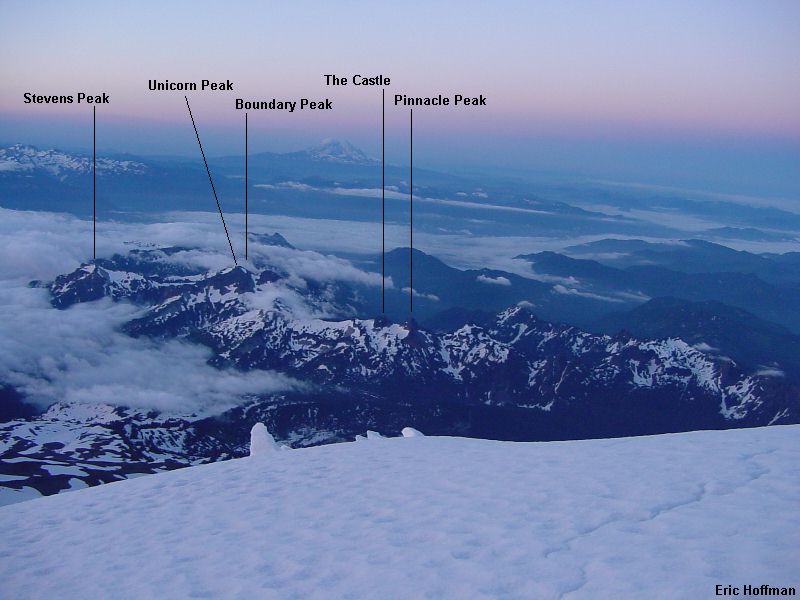
The officially named peaks (from east to west) are Stevens Peak (6510'), Boundary Peak (6720'), Unicorn (6917'), The Castle (+6440'), Pinnacle Peak (6562'), Plummer Peak (6370'), Denman Peak (6006'), Lane Peak (6012'), Wahpenayo Peak (6231'), Chutla Peak (+6000') and Eagle Peak (5958'). The lower slopes are treed and brushy but there are three trails that make approaches to the alpine areas relatively easy. On the west end a trail leads from Longmire (c.2800') to the Eagle-Chutla Saddle (+5720') in 3.6 miles. The Pinnacle Peak Trail begins at Reflection Lake (c.4900') to reach the saddle (c.6000') between Plummer and Pinnacle Peaks in 1.3 miles. The Snow Lake Trail leads from the trailhead on Stevens Canyon Road (4500') to Snow Lake (c.4700') in 1.1 miles. Beyond this there is a climbers path that leads to the talus basin NW of Unicorn Peak.
|
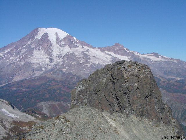
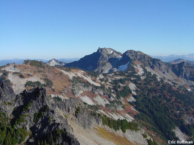
The Tatoosh Range from the Nisqually Glacier |
|
|
On this trip I was concerned with the named peaks starting with Stevens and ending with Pinnacle, a total of 5 peaks spread along roughly 4 miles of ridge. I began with Stevens Peak, the most difficult to reach but an easy hiking ascent can be made on the west slope. I started out at the Snow Lake Trailhead. After the easy hike past Snow Lake I continued south up a gully (class 2-3) to 5800'. The climber's path closer to Unicorn Peak may have been faster. From this area I made an eastward traverse on talus to cross the divide between Unicorn Creek and Maple Creek. From the divide I descended into a small talus basin and traversed below cliffs then descended to Maple Creek (c.5100') via a steep, muddy goat trail. Most maps do not show snow in the upper Maple Creek drainage but there is a significant patch that may be the largest in the Tatoosh.
|
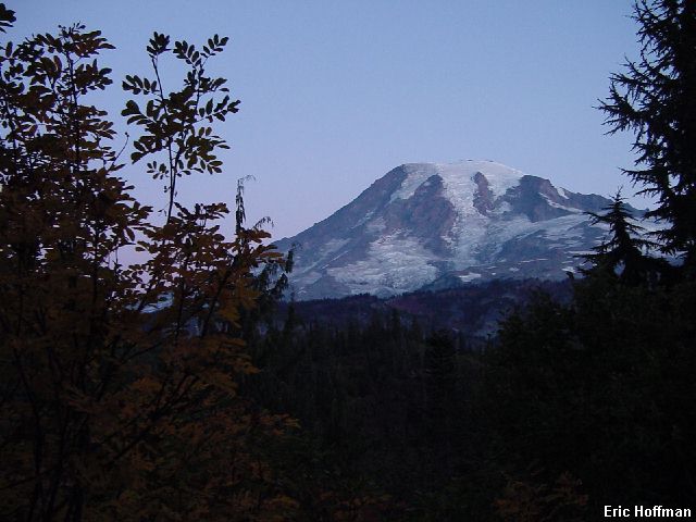
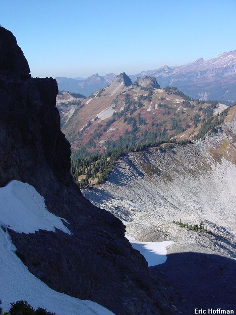
Tough to beat: Clear Skies, Autumn colors and great views |
|
|
I put on crampons to deal with the hard snow and ice and started up the toward the ridge connecting Stevens and Boundary Peaks. I reached the ridge crest at its low point (c.5800'). Once on the ridge crest I followed it a short distance then began a traverse across the west slope of Stevens Peak keeping just below rock outcrops. Once beyond the outcrops, a steep hike on open slopes reaches the summit....one down.
|
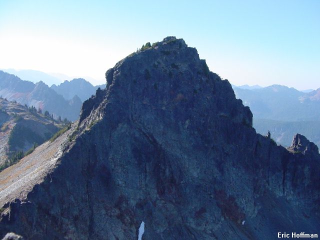
Boundary and Unicorn Peaks from Stevens Peak |
|
|
I descended to the low point in the ridge then started up to the saddle south of Boundary Peak. Once at the saddle I hiked just west of the ridge crest until below Boundary Peak. Boundary hardly deserves recognition as a separate peak. It is basically a ridge hump on the SE ridge of Unicorn Peak. The summit is most easily climbed on the SE side (class 2-3, some brush and scrub trees) but can be climbed just about anywhere on the west side (class 3 or 4)...two down.
|
Stevens Peak from Boundary Peak |
|
|
From Boundary Peak I continued NW up the ridge toward Unicorn Peak. I arrived at the summit area and found that there are three high points. The southern most is a rounded hump, the central point is an easy scramble but not the highest. The true summit is the tower on the north, which is much more impressive when viewed from elsewhere but is the most difficult summit in the Tatoosh to climb. After two attempts in two different locations I gave up on trying to reach the top. It is a short pitch of what would seem to be class 4 to low 5th class depending upon where you complete the climb. There is a rappel sling on the south side. Two down but for purposes of the traverse I will call it 3.
|
The summit of Unicorn Peak |
|
|
I started down the well beaten climbers path until just above the gap between the summit and the SW Peak. Scrambling leads to snow just below the gap. I descended in the moat to avoid having to put crampons to descend 300 feet of snow. Once below the snow patch I traversed to the ridge between the SW peak of Unicorn and Point 6524. I began up the ridge crest toward Point 6524 then traversed the SW slope about 300 feet below the top. After crossing above a rocky gully, I began descending and traversing to a tarn on the ridge crest between Point 6524 and The Castle.
|
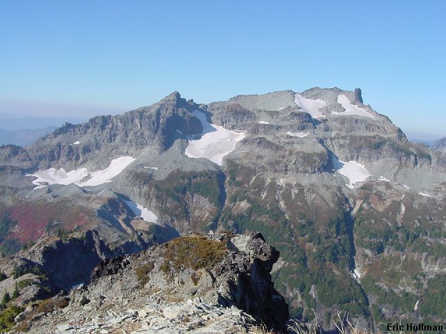
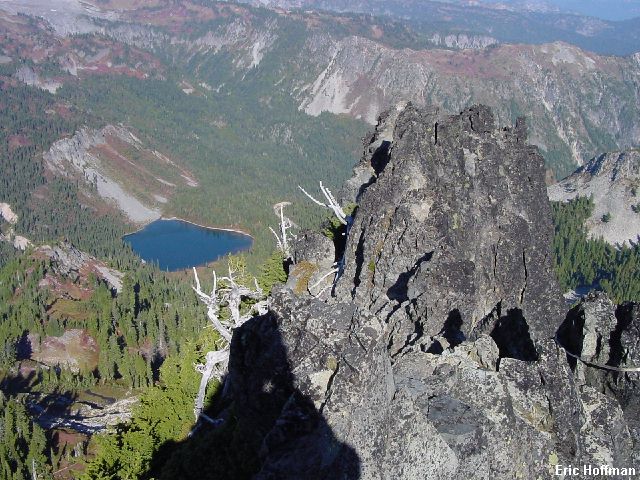
Pinnacle Peak and The Castle from near Unicorn Peak |
|
|
At the tarn I found a path along the ridge crest. I followed it towards my next destination, The Castle. Easy hiking on a path with great views from the ridge crest for a half mile ended at the south face of The Castle. It was now scree hiking on a path. I reached the obvious notch west of the top via scree slopes on the south side. From here I traversed ledges below the final cliffs. Near the east end of the face there is a gully and then class 4 to reach the summit ridge. Traversing the summit ridge to the highpoint was surprisingly easy on the north side. There are two locations with rappel slings, the shorter of which is above a 40' rappel then a short class 3 down climb...4 down 1 to go.
|
A view from the summit of The Castle |
|
|
After descending scree slopes back to the path, I continued on toward the last objective, Pinnacle Peak. This is probably the most popular ascent in the Tatoosh. A short approach on maintained trail then easy scrambling to the top of an impressive looking peak is responsible for this. Scree slopes on the SE side then scrambling (class 2-3) up a gully gained the west ridge. Hiking and scrambling up the west ridge reaches the summit.
|
Pinnacle Peak from The Castle |
|
|
|
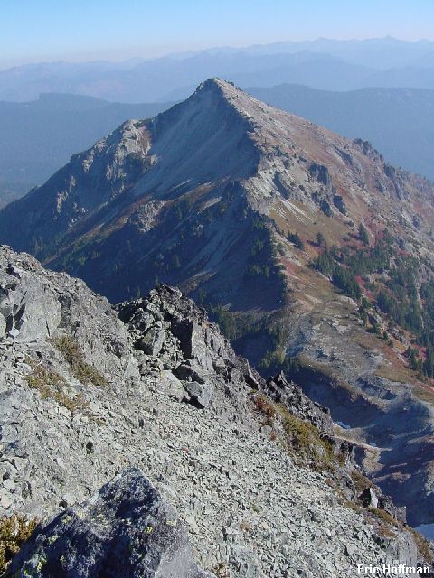
Looking back at the traverse from Pinnacle Peak |
|
|
From the summit of Pinnacle I reached the path once again and continued traversing until I reached the maintained trail at the Plummer-Pinnacle Saddle. A short hike on the trail to Reflection Lake then a road trudge lead back to my car at the Snow Lake Trailhead.
Summary of the named peaks on the traverse:
|
Peak |
Approach (on the Tatoosh Scale) |
Difficulty |
| Stevens Peak (6510') | Difficult (class 2 and easy snow) | Class 1, the approach is harder |
| Boundary Peak (6720'), | Moderate | Class 2 if you bushwhack, class 3-4 otherwise |
| Unicorn Peak (6917') | Moderate | Class 4-5, short pitch, light rack recommended |
| The Castle (+6440') | Easy | Class 4, rope recommended |
| Pinnacle Peak (6562') | Easy | Class 2-3 |
References:
Cascade Alpine Guide, Volume 1, Second Edition; Fred Beckey; Pages 122-123
Selected Climbs in the Cascades, Volume 2; Nelson and Potterfield; Pages 28-32
Climbing Washington's Mountains; Jeff Smoot; Page 310-316