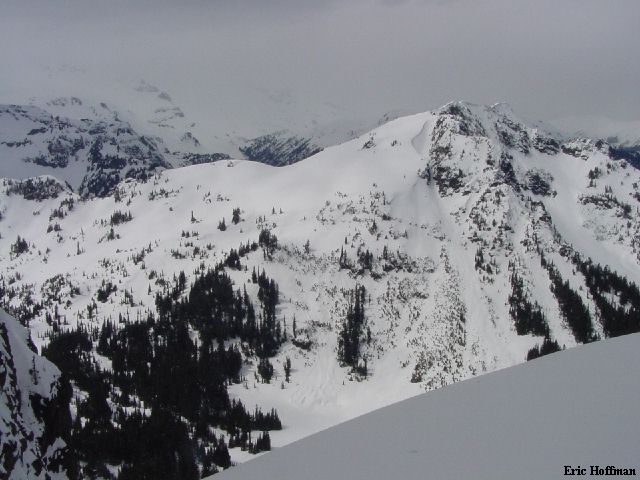
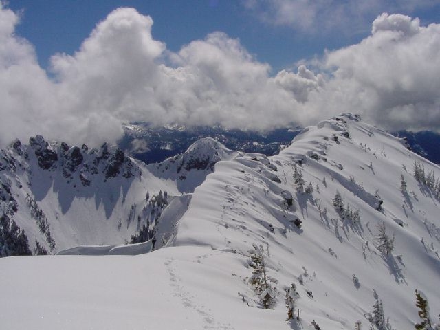
Threeway Peak from near Upper Crystal Lake (4/26/03)
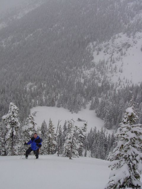
It was early on Saturday morning. Chris Mattson and I were on our way to the Cayuse Pass area in search of something to do. Rain turned to snow somewhere around 2500', winds were SE...that would be significant the next day. We continued up unplowed Highway 410 to reach Cayuse Pass (4690') where there was about three inches of new snow...wet snow. We had an objective in mind before we arrived here but decided to head into Crystal Lakes Basin instead. Chris was wearing snowshoes and I was in skis when we arrived at the lower lake. The snow was light and fluffy on top of a generally breakable crust, particularly if you were in snowshoes. We explored a couple areas in the basin before leaving when the snow became heavy.
|
Threeway Peak from near Upper Crystal Lake (4/26/03) |
|
|
|
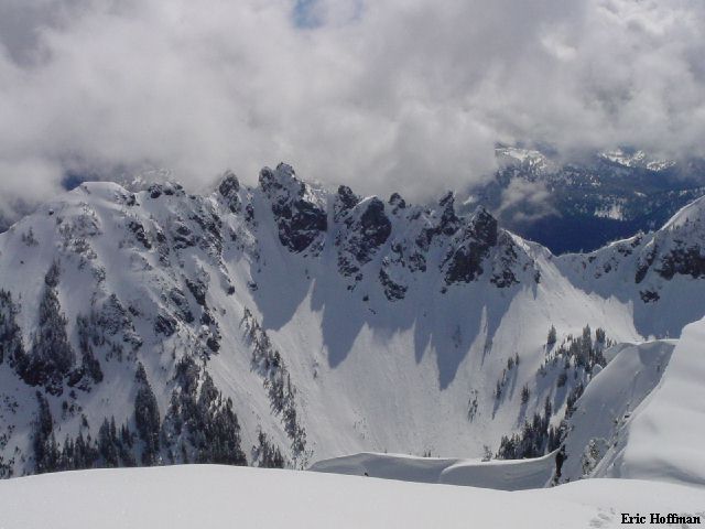
Chris above Lower Crystal Lake |
|
|
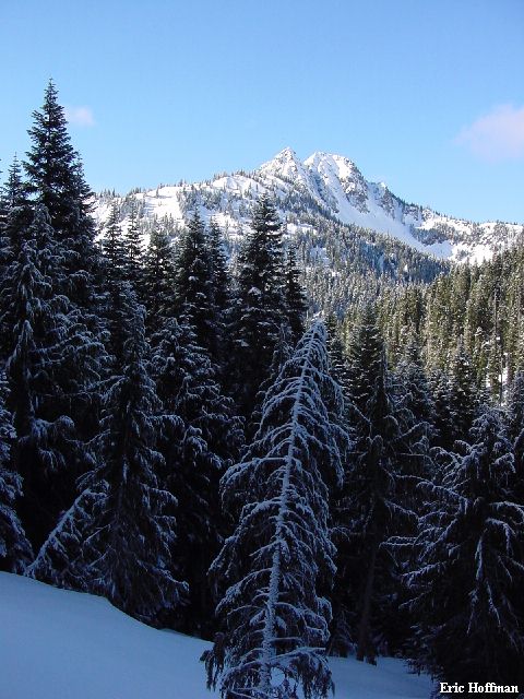
After lunch at Buzzy's (Jalapeno Burger is highly recommended) we stopped for coffee at Wapiti Woolies (makers of fine hats and espresso) where we got the latest weather forecast...and coffee. It was mostly sunny. After a brief stop at home I was on my way back to the Cayuse Pass area. Once again taking advantage of cabin privileges to get a head start in the morning. The objective would be Tamanos Mountain, which I had scoped out the week before from Governors Ridge...
|
Tamanos Mountain from Governors Ridge (4/20/03) |
|
|
The shortest way to Tamanos is from White River Road. The guide books don't agree with Green Trails map but seem to have the correct mileage (3.5 miles to Owyhigh Lake , not 4.6), but this was all irrelevant today since White River Road was closed. I headed over Cayuse Pass and arrived at the Owyhigh Lake Trailhead on highway 123 a little before 7:00AM (c.3240'). From this trailhead everyone agrees that it is 5.2 miles to Owyhigh Lake. I didn't have to go all the way to the lake, but pretty close. The trail was partially melted out but with pockets of deep snow. From the highway it immediately descends 300 feet along a waterfall and meets the East Side Trail from the south. After crossing two footbridges the East Side trail continues to the north. Numerous signs kept me on course for Owyhigh Lake. The trail follows Needle Creek closely to about 3600 feet then begins climbing higher above it to about 4000 feet where there is a series of switchbacks. I couldn't follow the trail and it probably wasn't worth it anyhow. I made a rising traverse hoping that I would locate the trail as it makes a long traverse above Kotsuck Creek. After crossing several water courses (very few snow bridges remaining below about 4600') I found the trail and put on skis. The trail was easy to follow and the snow great for skinning.
|
Double Peak from the Owyhigh Lake Trail |
|
|
The trail crosses below the steep, rocky SW slope of Barrier Peak before reaching a pass. Anything that looked like it might avalanche here already had. I continued through meadows and trees to the Pass (5320+) just above Owyhigh Lake. From here, mostly moderate slopes lead to the SE Ridge of Tamanos Mountain. I skied up the ridge until is became narrow and corniced (about 100 feet below the summit).
|
The Cowlitz Chimneys from the SE slope of Tamanos |
|
|
I continued from here without skis and with an ice axe. The map shows the summit at the NW end of the summit ridge, still a couple hundred yards to go. The ridge was corniced on the right but the wind load was on the left due to the SE winds. The ridge traverse was mostly moderate snow with some steeper sections and easy scrambling along the way. I continued to the NW end of the summit ridge which didn't seem to be the highest point, but it really didn't matter.
|
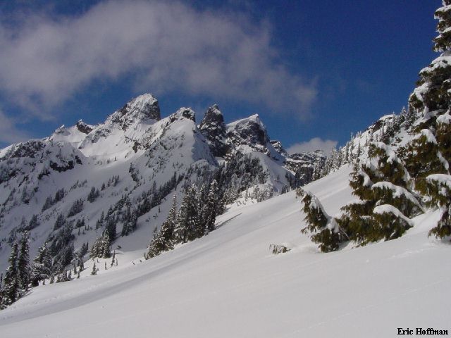
The Summit Ridge of Tamanos, Governors Ridge and Barrier Peak are in the Background |
|
|
|
A Closer Look at Governors Ridge |
|
|
After returning to my skis, I started down the SE slope which was much better than I would have thought the day before. Most of the new snow had been blown off or compacted and the base was well consolidated. It wasn't corn, but it skied like it was for the first several hundred feet. It turned to mashed potatoes at the pass and through the meadows and trees, and back down the long trail traverse to the top of the switchbacks. I removed my skis and plunged my way through deep snow and water courses until I was able to follow the trail. About three miles from the trailhead. I knew if I made it back to Greenwater by 3:00pm, Buzzy's would still be open...and serving Jalapeno Burgers. Six and a half hours round trip. Yum.
|
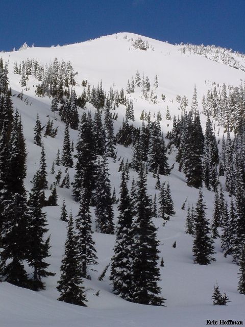
The SE slope of Tamanos |
|
|
References:
Cascade Climbers Guide; Volume 1, Second edition; Fred Beckey; Pages 132
Climbing Washington's Mountains; Jeff Smoot; Pages 319-320