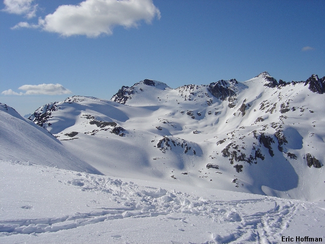
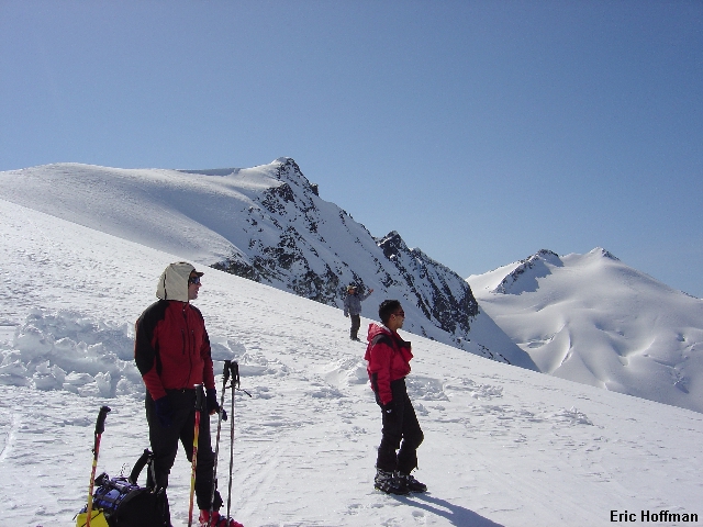
Most of the Spearhead Range from Blackcomb-Spearhead Col
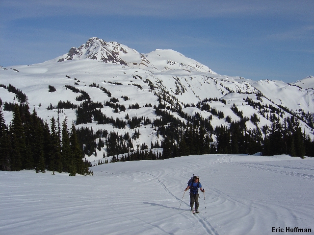
The Spearhead Traverse is a classic. Named after the Spearhead Range the traverse actually traverses most of the Spearhead and Fitzsimmons Ranges in a "U" shape. Most parties, including ours, begin on Blackcomb Mountain and end on Whistler Mountain.
I picked up Jerry Sanchez and Bo Lalovic at 6:00am. Fortunately, we had left town early and had time to get off route in Vancouver and still eat lunch before meeting Sergio Verdina at the Starbucks in Squamish at 11:00am. It was then off to Whistler Village. We paid to park in a garage believing that our vehicles and their contents would be safer there. Free Overnight parking is available in Lot 4, but it's only free if your car isn't broken into.
Sergio was on his split board, Jerry and Bo had AT gear and I, regretfully, brought my lightest telemark skis which are probably only slightly better than the skis used when the traverse was first completed in 1964. I did the math later and arrived at the following equations: narrow skis + heavy pack = hard to turn - floatation = 10 x more falling down. After completing the traverse it was apparent that it is better to do it is in a day on fat skis. Many Canadians who were doing just that passed us along the way.
We started at Whistler Base where we picked up a one-ride lift ticket at Guest Services($30 Canadian + tax). From there we took the Blackcomb Gondola then two chairs, then the Horstman T-Bar. The Horstman Glacier was the first of 13 glaciers we would set foot on during the traverse. This was as far as the lifts would take us. Somewhere around 2:00pm we began the traverse.
|
Most of the Spearhead Range from Blackcomb-Spearhead Col |
|
|
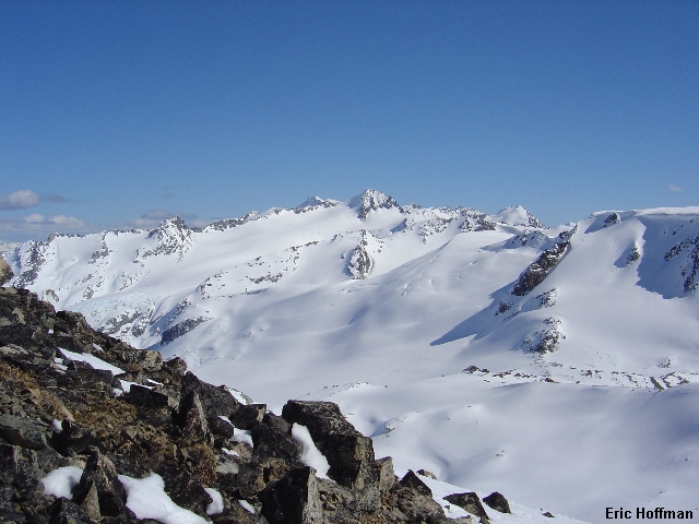
From the top of the T-Bar (c.7300') we began a descending traverse across the top of the Blackcomb Glacier then booted up to the saddle between Blackcomb Peak and The Spearhead (c.7700'). It was now time to ski again, this time descending then traversing to the Decker Glacier. We skinned up the glacier to cross the NE shoulder of Decker Mountain (c.7300'). Now we descended a gully before skiing to the flat on the Trorey Glacier. Alternately, one can go over the +7800' high point east of Decker then traverse high on the Trorey glacier. We reached a notch on the North Ridge of Mt. Pattison (c.7700') at about 5:30 and decided to camp there for the night. Surrounded by snow covered mountains and lucky enough to hit good weather we would spend the duration of the trip fighting off severe sunburn.
|
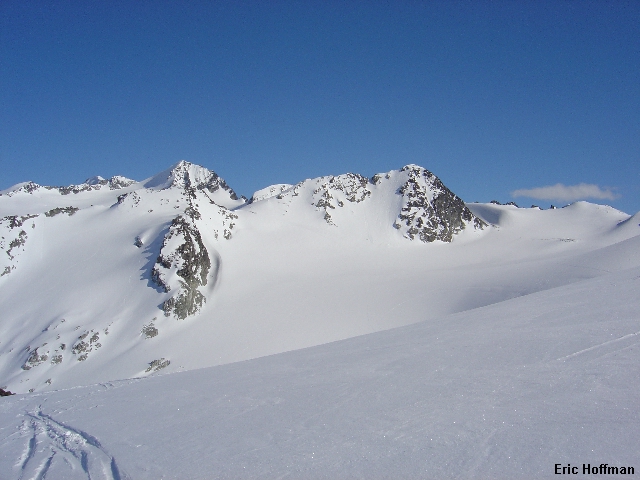
Blackcolm Peak and The Spearhead from the Decker Glacier |
|
|
|
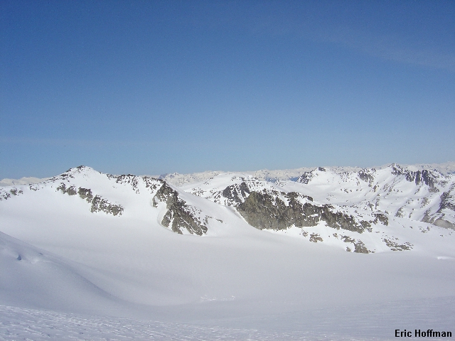
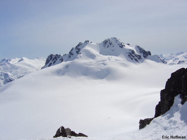
Mount Pattison and Tremor Mountain from above the Trorey Glacier |
|
|
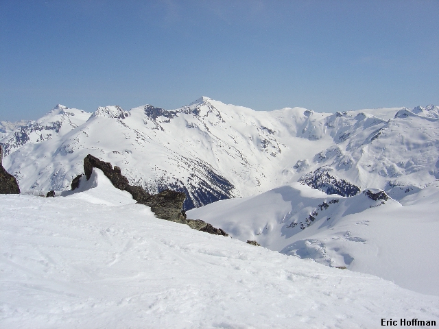
After a night of someone snoring and someone finding that their Therm-a-Rest had a hole in it we got off to an early start the next day...somewhere around 10:00am. We descended from the notch and onto the Tremor glacier noting that the steepest of lines on Tremor Mountain had ski tracks. The 1000' ascent to the Tremor-Shudder saddle (c.8500') was one of the longer ones on the traverse. From the saddle we made a descending traverse on the Platform Glacier. We stopped for food and to take in the incredible views.
After our quick lunch we skinned to the col between The Ripsaw and Quiver Peak (c.8500'). Rather than traversing the Ripsaw glacier, we decided to ski down the mellow, open slope then boot up about 200 feet to a shallow notch (c.8100'). From here we made a nearly level traverse across the Naden Glacier to the col between Mount Macbeth and Couloir Ridge (c.7900). By the time we reached the col fast moving Canadians who were completing the traverse in one day were passing us.
|
A Look Back from the Tremor Glacier |
|
|
|
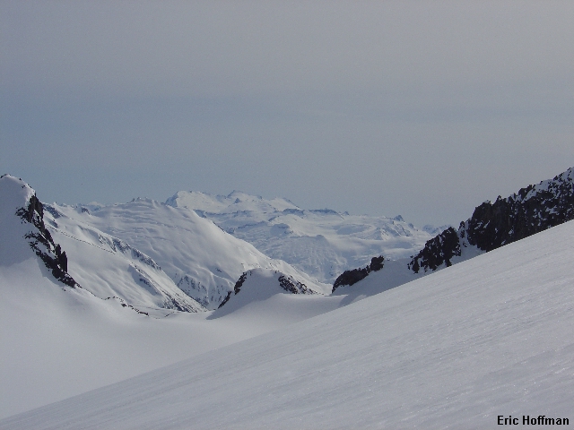
Looking Across the Fitzsimmons Drainage from Tremor-Shudder Col |
|
|
|
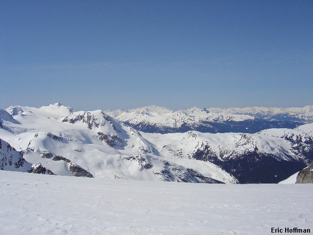
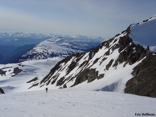
Ripsaw Ridge and the Fitzsimmons Glacier from the Platform Glacier |
|
|
We skied down the Macbeth Glacier to about 7300' where we exited to a ridge on skiers left (this was a nice run even with skinny skis). The route continues up the ridge for a few hundred yards then traverses the Iago Glacier and ascends to c.8000' immediately East of Mount Iago. From here a descent onto the Diavolo Glacier is possible (another nice run but not as nice as it would be without skinny skis).
Mount Sir Richard from above the Diavolo Glacier
|
Cheakamus Mountain from above the Diavolo Glacier |
|
|
We hung out at the bottom with a friendly Canadian who suggested that we go over Mount Benvolio, which he described as the normal route. However, the normal route that I had read about crosses the col between Benvolio and Mount Fitzsimmons. His reasoning for going over Benvolio was that there was a very large cornice hanging over the route on the north face of Benvolio and that you needed to move fast. He must have felt sympathetic and offered encouragement before we began the 1400' foot ascent to the summit area of Benvolio (c.8600'). He called this "Bonk Hill" and we soon found out why.
|
A View of the McBride Range from "Bonk Hill" |
|
|
From the top of Benvolio, we descended a bit then traversed the east and north sides of Overlord Mountain on the Benvolio and Fitzsimmons Glaciers. The description I had states that one crosses the north ridge of Overlord at approximately 7800', but we would end up crossing near 8200' with a looming wall of snow and ice hanging above. As quickly as possible I took off my skins and side slipped down a 45 degree hour glass to easier terrain below. From here we traversed the Overlord Glacier to a flat below Whirlwind Peak.
After a short skin up to the Whirlwind-Fissile saddle we were looking down the final slope leading to the Russet Lake hut. We arrived there around 6:00pm. I was tired but not too tired to set up the tent to avoid the snoring that would take place in the hut that night. My only regret was not setting up the tent farther from the hut that sounded like a drum as people walked around inside.
|
Jerry at the top of the slope leading to Russet Lake |
|
|
The following morning we all headed back up toward Whirlwind Peak to do some skiing (or boarding) without the burden of a heavy pack. We returned to the hut around 3:00 and packed up our gear for the return to Whistler Village. After a short ascent from the Lake we had an enjoyable ski down to Singing Pass and a less enjoyable ascent up Oboe, the eastern most of the "Musical Bumps". When there is good snow the Singing Pass Trail may be the better choice on the return to Whistler Village. There was a short descent to the saddle between Oboe and Flute summit before we were going up again. We traversed around the north side of the Flute to a small saddle (c.6300') where we could see the easy boundary trail of Whistler ski area. Everyone but me decided to take advantage of the slope below and ski the fall line. I took the easy way out and traversed as this would mean I wouldn't have to go up once we hit the bottom. We reached Whistler Base at about 7:00pm and stopped at the first restaurant we saw. I am sure we where happier to see the server than she was to see [and smell] us.
|
Sergio Grunting up Oboe with Fissile and Whirlwind Peaks in the Background |
|
|