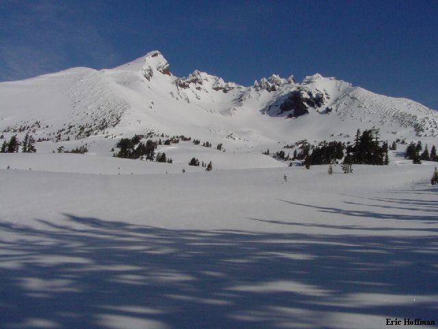
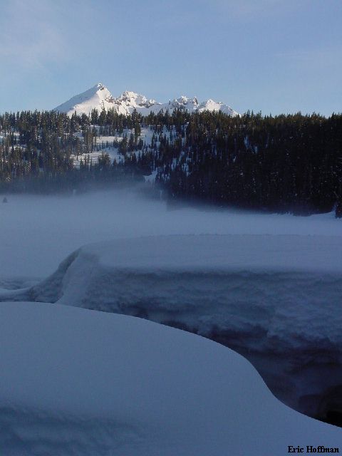
Broken Top from Todd Lake
Despite being the tallest of the Three Sisters, this isn't a difficult summit to reach. In summer a trail can be taken from the Cascade Lake Scenic Byway to the summit of the South Sister. Winter, however presents some approach problems. The Cascade Lakes Byway closes at the turn-off to the Mount Bachelor Ski Area. I would start the journey from here. I had hopes of achieving more but looking back, I had my work cut out for me to get to the top of one of Oregon's volcanoes.
I took advantage of the fact that I was going to be half way to Portland when I got off work. The fastest way to get to Bend from the Seattle area (speaking from a few experiences) seems to be I-5 to I-205 East, then take exit 13 (or 16) to Gresham and Highway 26. Highway 26 crosses the Cascade Crest immediately south of Mt. Hood then continues to Madras, where is meets Highway 97. Highway 97 south leads to Bend. A somewhat obscure but signed route directs you through town and on to Mount Bachelor, about 20 miles from Bend. If it is winter, a snow park pass is required everywhere but the ski area, which seems has signs discouraging parking there for purposes other than paying them...it looked like a day of skiing there would be fun, but I had other plans. After examining the situation at the ski area, I drove back down the highway to a Sno-Park turned Dirt-Park (c.4500') and set up camp for the night.
I had hoped to climb South Sister and/or Broken Top on this trip, but the more I looked at the map, the less likely it seemed I could possibly climb both. I started out from the ski area parking lot around 6:15am and took a short x-country trail to the Cascade Lakes Highway which is groomed for snowmobiles and skiers. I followed the highway west for a little more than a mile and then took a groomed trial leading towards Todd Lake. In about a quarter of a mile, I left the groomed trail and took a short ski trail to the Lake. I continued up the right side of the lake, leaving the last track I would see for a while.
|
Broken Top from Todd Lake |
|
|
Near the end of the lake, I headed for the ridge crest on my right then continued through park land on the south side of Broken Top. I was hoping to traverse Broken Top without gaining or losing too much elevation. Snow conditions were good for stability but not so good for snowshoeing. There was a breakable crust in most areas.
|
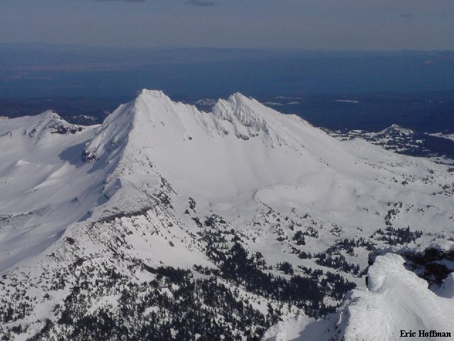
Broken Top from the South (the summit is right of the S Summit, which appears higher in this photo) |
|
|
|
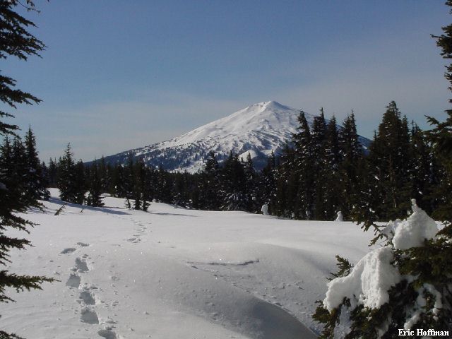
Mount Bachelor from South of Broken Top |
|
|
I began traversing, picking a route that would be safest and allow me to negotiate a cornice on a south trending ridge. This meant gaining a few hundred feet, then a hundred more to get to a location were I could get off the ridge and onto the SW slope. I had to drop a bit then traversed to a west spur. From here I could see all three of the Sisters and finally got a look at the objective ridge on Broken Top. The NW ridge is the standard route to the summit with a "very short rock step... Class 4" . The summit rocks were covered with rime. I decided to descend to Green Lake and climb the technically easier South Sister.
It wasn't all good news. I was at about 7600' and had to descend 1000 feet to Green Lake before I could start going up what appeared would be the safest route to the summit. I was also getting further from my car. I left Green Lake at about noon and started up a broad ridge south of the usual route from Green Lake. The ridge is part of the Newberry Lava Flow on the SW flank and has highpoints at +7880' and 9017'. A short scramble down from the first highpoint and a short steeper section of snow (45 degree max) and it was back to moderately angled and broad ridge crest hiking. Just below the second highpoint I began traversing to reach a minor saddle to its west side. This is were the route I took merges with the trail to the summit. The final ascend is on a ridge leading to the summit. The ridge was mainly rime with enough snow to make it tedious. I reached the crater rim just before my turn around time, 3:00pm.
|
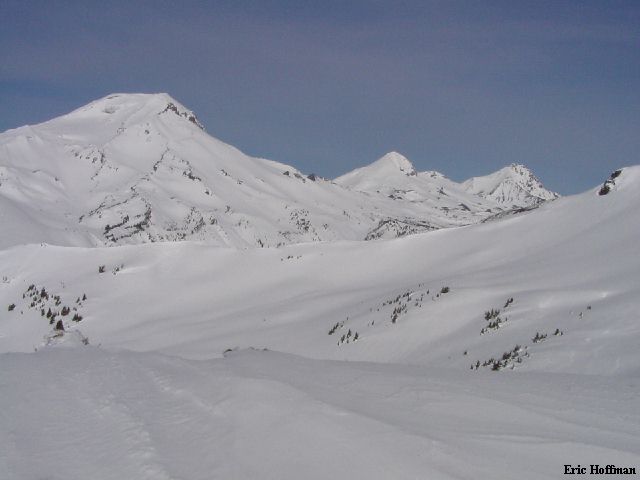
The Three Sisters from the SW Slope of Broken Top |
|
|
|
Broken Top from the Summit of the South Sister |
|
|
|
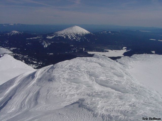
Mount Bachelor from South Sister's Summit |
|
|
|
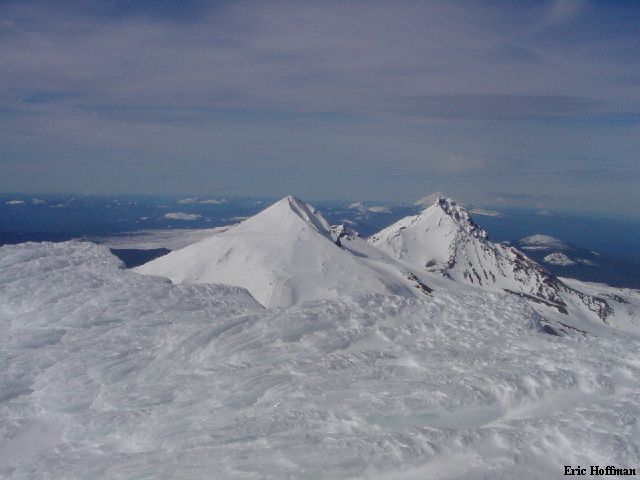
The Middle Sister to Adams (you have to look close to see Adams) |
|
|
|
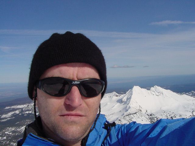
Sunburned? |
|
|
There is a real crater on top of South Sister, I post holed my way across to the summit. A pile of rime. I spent only a little time on the summit, it was a long way out. I descend the ridge back to the saddle west of point 9017'. From there I headed SE, descending between Moraine Lake and the Miller Lava Flow then followed Goose Creek back to the Cascade Lakes highway almost a thousand feet lower than the ski area parking lot. It was another 4+ miles back to the ski area, though I did manage to talk a snowmobiler to give me a ride the last mile. It was almost 7:00pm when I arrived.
References:
Summit Guide to the Cascade Volcanoes; Jeff Smoot; Pages 135, 144-146
Three Sisters Wilderness Map; Geo Graphics