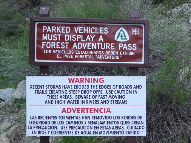
So you thought the NW Forest Pass was just going to go away... they didn't call it a "Pilot Program" for nothing
So I was being sent to Corona California for a business trip on sort of short notice. I made the necessary arrangements for air travel to Ontario International Airport opting to take a flight leaving Seattle at 6:40 AM rather than at 9:10 AM on the 25 which was going to save my employer almost $100. Hang on a minute… I get up at 4 AM for one, and only one reason. When I came to the full realization that I had severely compromised my values, I had little choice but to try to make the world right. I had never been to the Los Angeles area and had no real idea of what was nearby… sure there was Disney Land. I did a bit of digging around I was surprised to discover that there where mountains, high mountains, not far away.
Further digging revealed Mount San Antonio, the highest peak in the San Gabriel Mountains, located only 40 miles from LA and only about 20 miles from the Ontario Airport. The standard route is a 14 mile tromp, mostly on a Mount Baldy ski area service road. The road reaches 8600’ Baldy Notch then continues to the Devil’s Backbone where a trail follows the narrow ridge toward Mount San Antonio. While the name “Devil’s Backbone” was a bit intriguing, the 11 miles of road hiking wasn’t sounding all that interesting. More digging was in order.
Okay, so there is a Sierra Club hut at 8100’ at the bottom of Baldy Bowl SE of the summit. Things were sounding better. The distance was reduced to less than 8 miles and only about a mile of that was on the service road. I debated taking skis since the nearby ski area was still open but for various reasons finally decide against it.
|
So you thought the NW Forest Pass was just going to go away... they didn't call it a "Pilot Program" for nothing |
|
|
Pleased with the fact that my fight arrived on time and my progress out of the airport and to through the rental car line was quick, I arrived at the Forest Service office at Baldy Village where I would obtain my “Adventure Pass”. No, your “NW Forest” pass will not suffice. I coughed up the 5 dollars and headed to Manker Flats (c.6160’).
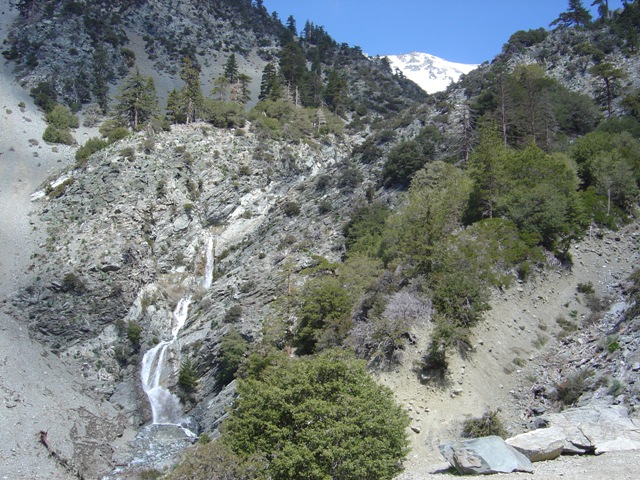
By 11:00AM I was hiking the service road and passed San Antonio Falls in less than a quarter mile. Continuing up the road I rounded a corner and located a trail on the left. The trail leaves the road in about a half mile from the trailhead. In about two miles the trail reaches the Sierra Club Hut (c.8100’). There don’t seem to be too many huts in the US that offer the comforts of the Sierra Club.
|
San Antonio Falls and the Ski Bowl |
|
|
|
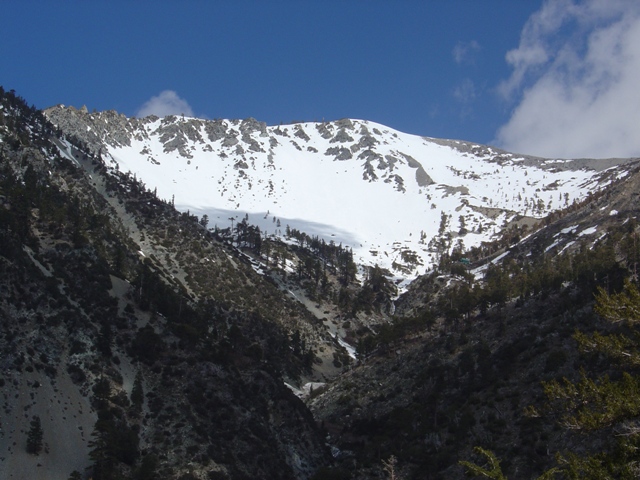
A closer look at the ski bowl. The Sierra Club hut is visible on the right side of the bowl |
|
|
|
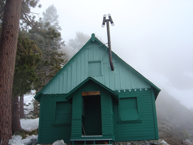
A closer Look at the Hut |
|
|
From the hut I headed up the bowl. There are a few gullies that can be taken in a more direct line (apparently the gullies reach an angle of up to 45 degrees for a short distance). I headed right of this where the angle was less but I hoped I might see a bit more from the east ridge. Unfortunately, the clouds had moved out of the valleys and were smothering the summit when I arrived around 2:00 PM. So much for the views…
I headed down the 30-35 degree slopes on what I can only describe as perfect corn snow. I descended the 2000’ feet of well covered open slopes back to the hut fully disappointed in my decision… why hadn’t I brought my skis again? Another hour of hiking brought me back to the trailhead. While I hadn't seen much of the San Gabriel Mountains, I saw enough to know I wouldn't trade them for the Cascades.
|
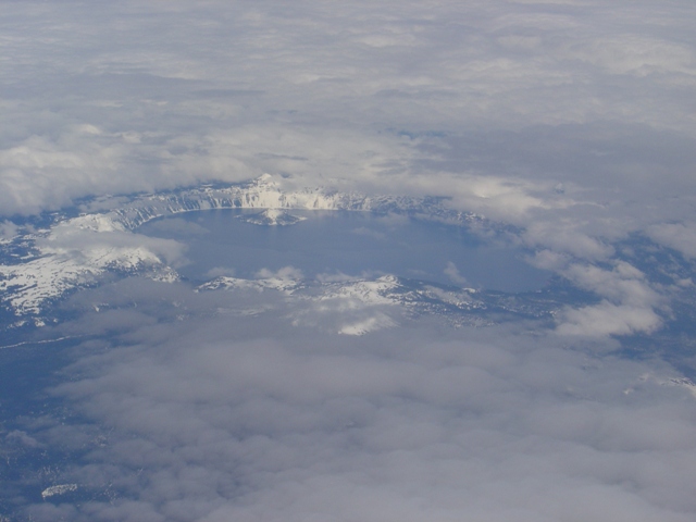
Aahh! Back to the Cascades: Crater Lake From seat 9A of 737-400 |
|
|
|
|
|
|
References:
Mount San Antonio on Summit Post