During the summer months, when Mowich Lake can be driven to, Seattle Park sees many visitors. However, once the road to Mowich Lake has been closed by winter snow, few venture into this incredible area. Seattle Park is a vast alpine area filled with flowers, streams and wild life...for a few months of the year. The rest of the year it is a desolate waste land of deep snow and wind swept rock. During the winter and spring, the only "reasonable" route into the north side of Mount Rainier begins at Ipsut Creek Campground at an elevation of c.2300 feet. This low starting point and the length of the route make any trip into this area an all day event, but ensures a sense of solitude that is difficult to find in the Park at any time of the year.
From Ipsut Creek Campground, follow the trail toward the Carbon Glacier for 3 mile to the junction with the Spray Park Trail. Follow this trail for an additional 1.5 miles to Cataract Valley Camp where the trail becomes difficult to follow when buried in snow. From here, continue south through the valley until a spur on the west side of the valley is reached. Follow the crest of the spur (steep in places) to approximately 5000' feet and the lower reaches of Seattle Park. Safely navigating through the lower park to the upper park is not necessarily easy. There will be deep snow on slopes with a potential to avalanche. Basically, there are many possible routes through the area and you are on your own to find the one that works for you!
Echo Rock is basically a jumble of talus and crumbly rock at the upper most point of Seattle Park. Getting to it may be more difficult than climbing it. The route to its summit is from the south side. Ascend the jumble of boulders, snow and a bit of ice (just to make things interesting) keeping to the west side of the summit tower and pass though a gap between the summit tower and a minor outcropping. From here, scramble upward to the north side of the summit. Once on the summit ridge, one can traverse around the west side then make a short scramble to the summit, or traverse around the east side (more exposed) and then scramble to the summit.
If Seattle Park and Echo Rock aren't enough to satisfy you, then the obvious solution is to keep going up. An excellent choice! The next logical destination is the 10,310 foot high point an Ptarmigan Ridge, but there are many other high points along the way if you aren't sure you really want to ascend 8000 vertical feet and walk 21 miles in one day. This route involves ascending the Russel Glacier, which is mainly a wind slept neve. The typical crevasses I have seen on the glacier are on its east side where it plunges steeply and merges with the Carbon Glacier and bergschunds near lower Ptarmigan ridge. It is easiest to stay toward the east side of the glacier ( a lot of up and down on the west side) and head directly toward the massive ice cliff that separates the easy climbing on the lower section on Ptarmigan Ridge, from the serious climbing on the upper portion of the ridge. The most difficult climbing on the route to point 10,310' is the final 800 feet. Two options exist, a lot of boulder hopping mixed with patches of snow and ice, or a more direct ascent on 40 degree snow and ice slopes.
From point 10,310', many of Rainier's most difficult routes can be seen including Curtis Ridge, the eastern Willis Wall routes, Liberty Ridge, Liberty Wall, Ptarmigan Ice Cliff and Ptarmigan Ridge. If your timing is right, mine was not on this trip, you may get a spectacular show as ice peels off one of the many ice cliffs in the area and tumbles as far as 4000 vertical feet down the mountain (that would be on Willis Wall).
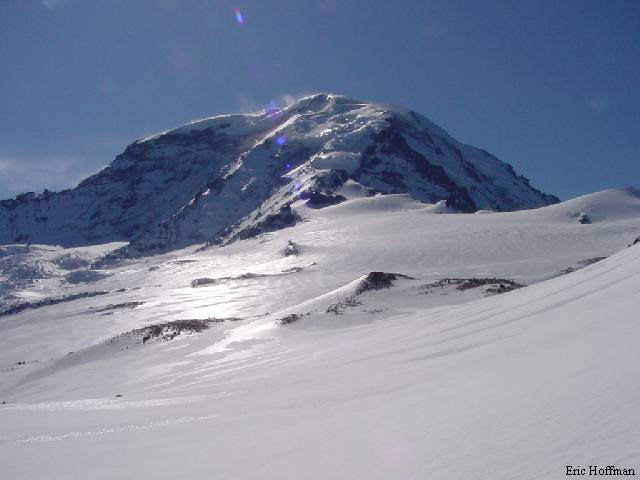
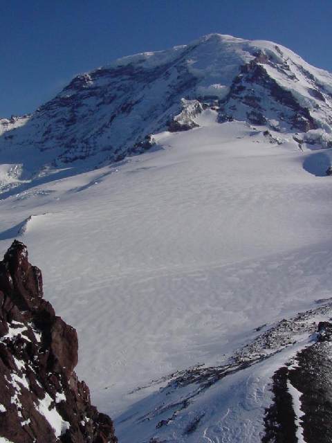
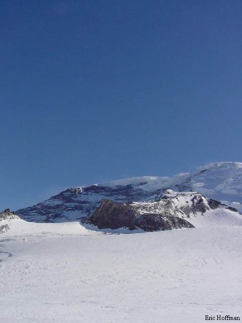
| Mt. Rainier and Pt.10,310' from 8500' on the Russell Glacier |
 |
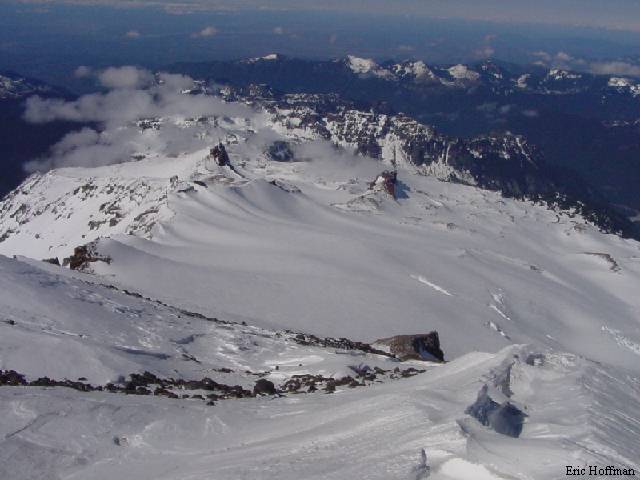
The Russel Glacier From Pt. 10,310' |
 |
References: Cascade Alpine
Guide Volume I, Second Edition; Fred Beckey; pages 108-109, 125