Map Courtesy of National Geographics, Produced with Topo! software.
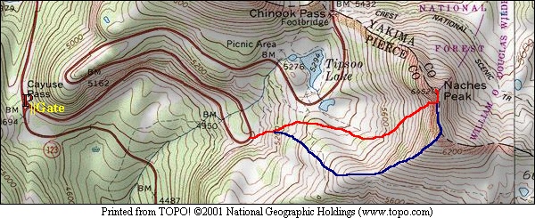
Map Courtesy of National Geographics, Produced with Topo! software. |
|
I had started the weekend on the east side of the crest where if the weather had not turned me back, the realization of an improbable ascent would have. Lightning strikes were getting close but the summit wasn't. I bailed and headed to the Cayuse Pass area to try my luck elsewhere.
|
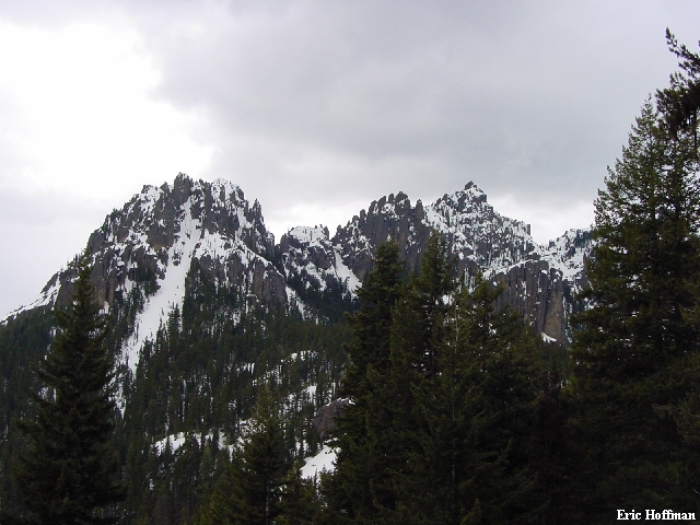
Before the Weather Turned Violent on the East Side |
|
|
It was a sunny morning west of the crest, but heavy clouds to the east were crowding in and spilling over to the still sunny west side. I decided upon arriving at the pass to try to climb the obvious couloir on the west side of Naches Peak, a very direct ascent from Cayuse Pass. The entire trip would take about 3 hours and reach the modest summit of Naches Peak which the guide describes as "...a remarkable point for a Mount Rainier Vista". The guide also describes two routes to the summit, the north and south ridges. The south ridge is generally gained from the PCT (just east of Naches). The short couloir on the west face reaches the south ridge just below the summit rocks. It had caught my eye before this season, but having spent the past few weekends in the immediate area, it was becoming harder to ignore.
From Cayuse Pass, I hiked the bare and dry asphalt of the still closed Highway 410. In about a mile I reached the first switchback above Cayuse Pass where the road maintenance crews had removed the snow from around a sign... and created a breach in the wall of snow. I left the highway and headed west up easy slopes where I passed some skiers making their way up a gully. The snow was generally solid enough to keep me from breaking through. I reached a minor crest where I got a closer look at the objective.
|
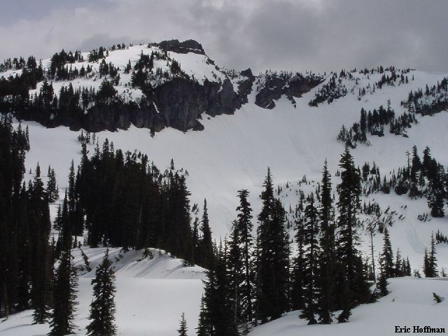
Naches Peak from the West |
|
|
I descended a bit then climbed to a treed shelf SW of the summit. The snow to here was solid but not icy, but the steeper terrain ahead prompted the use of crampons and an ice axe. I started up the 35 to 40 degree snow slope to the base of the gully where the angle increased to about 45 degrees. The couloir passes a break in the cliffs where there was a moat. Above this the angle increased to 45-50 degrees then reached another moat. The angle moderated above the second moat and I continued to the crest of the south ridge. The entire couloir is 200 to 300 feet high
On the ridge I traversed the crest to the south side of the summit rocks. The route from here is described as a short scramble. I first tried to climb steep rock at a shallow gully left of the crest but retreated (est. class 4, mantling, 1/2 inch crack on left). I didn't have a rope for a rappel and wasn't sure I was going to be able to down climb this route or the north ridge route. I crossed to the right side of the ridge where an exposed (not too far down) ledge traverses the east side. I began traversing the sometimes overhung ledge (snow free, good holds when I needed them) to reach a small tree (30-40 feet on the ledge, you can see the tree in the last photo on this page). At the tree I climbed a short, steep, rock gully then traversed a couple of moves to the right and into a second gully which led to the summit (class 3). The summit is a flat scree area, partially snow covered, and would have been a nice place to relax for a while but I was concerned about the weather turning violent as it had the day before.
|
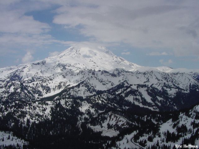
"A Remarkable Vista of Mount Rainier" |
|
|
|
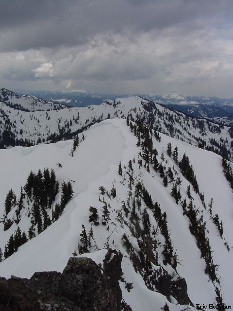
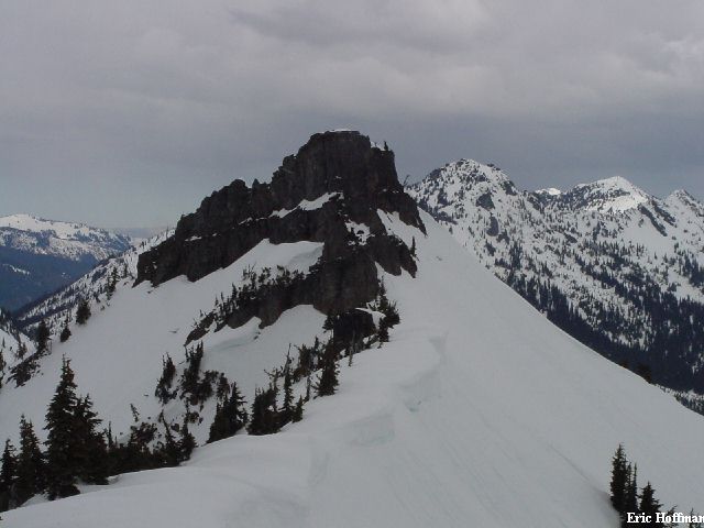
The South Ridge from the Summit of Naches |
|
|
I descended from the summit and traversed the south ridge a couple hundred yards to a hump where the skiers I had passed earlier were beginning to gather. I was more than a bit jealous as I plunged my way back down to Cayuse Pass.
|
The Summit of Naches from the South Ridge |
|
|
References:
Cascade Alpine Guide, Volume 1, 2nd Edition; Fred Beckey; Pages 133
USGS Chinook Pass; 7.5 minute Series; 1987