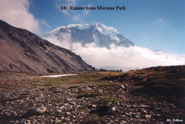
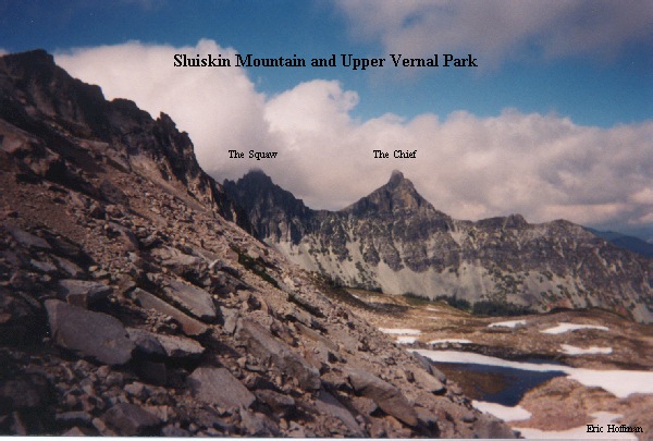
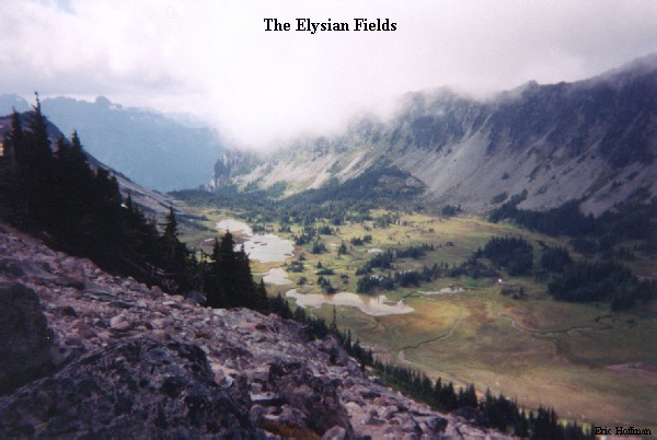
(Windy Gap, Sluiskin Mountain, Vernal Park, Elysian Fields, Old Desolate, Moraine Park)
This trip was a tour of the less traveled area to the north of Mt. Rainier with many points of interest along the route. There are other routes that reach some of these destinations, but this loop allowed a large portion of the area to be explored in a minimal amount of time.
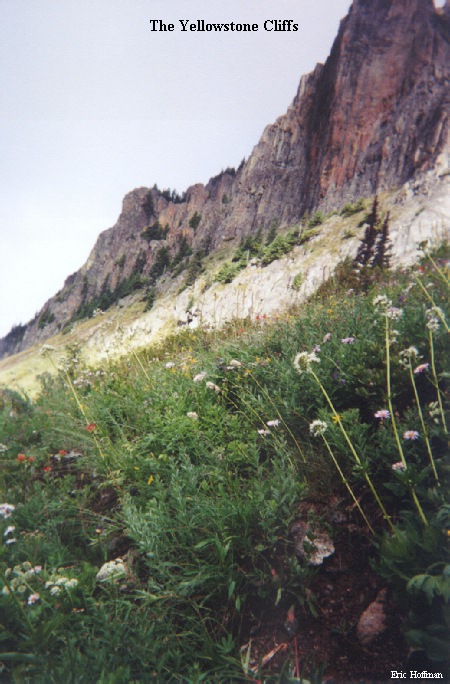
The route begins with a half mile hike from Ipsut Creek Campground to the Wonderland Trail, then continues on the Wonderland Trail to the Northern Loop Trail. The lower bridge crossing the Carbon River has washed out again, but it can be crossed if you are creative (alternatively go to the suspension bridge 1 mile upstream). The Northern Loop Trail climbs through old growth forest for about 2 miles before making its way to the Yellowstone Cliffs and more open terrain. Continue through the flowered meadows to Windy Gap trying not to get distracted by the meadow and ponds along the way.
Sluiskin mountain is a multi-peaked mass located SE of Windy gap. The two main peaks of this mountain are known as the Chief (7026') and the Squaw (6960+). These jagged peaks are prominent features on Mt. Rainier's North side. To reach the Chief and the Squaw, descend a few hundred feet from Windy Gap, then travel SE across rock fields and open meadows. Ascend to the 6500' saddle between the Chief and the Squaw on moderately steep snow or on a rock/heather rib. To reach The Chief, climb east on the ridge, then traverse to the north side of the summit. A short section of challenging class 3 leads to the summit. The Squaw is reached by hiking the ridge west from the saddle, then scrambing to it summit.
After climbing The Chief and The Squaw, I made a descent from the saddle down a steep, VERY loose gulley (gully closest to The Chief) toward Vernal Park. From above Vernal Park I traversed west on more loose rock to the ridge that separates Vernal Park and Elysian Fields, then followed the ridge south to Old Desolate. This route proved to be a great deal of work to get to the true summit of Old Desolate, but did offer closer views of the Elysian Fields. A much easier and direct route is to travel SSW through Vernal Park to its upper basin, then ascend on the east side of the basin directly to the summit.
I descended to the upper platuea of Moraine park on even more loose rock, then into its lower basin before heading west through forest to the Wonderland Trail. This is the standard route for reaching Old Desolate. A five mile hike on the Wonderland Trail returned me to Ipsut Creek Campground.