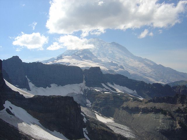
The North Chimney from the Main Chimney
(Andy Johnson; August 15, 2003)
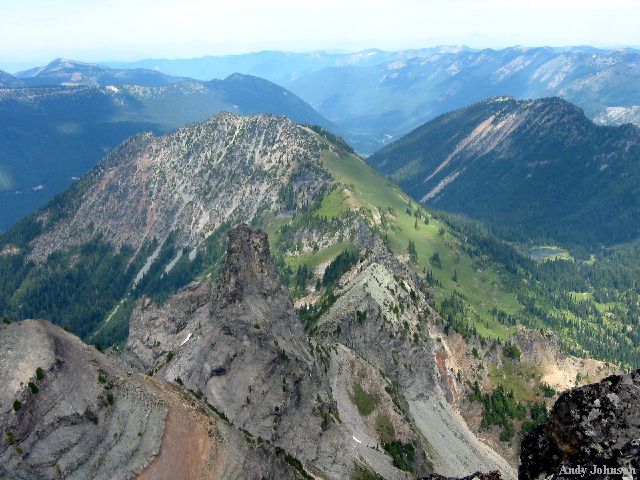
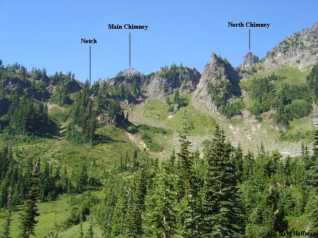
Although not the highest of the Cowlitz Chimneys, the North Chimney is the most difficult to climb and from many vantages it is the most striking. My interest in this pinnacle was sparked last summer when I viewed it from the summit of the Main Chimney. Andy Johnson who had climbed the Main Chimney a few weeks had also had his interest sparked. There is limited information available which raised some questions, but also added to the appeal.
|
The North Chimney from the Main Chimney |
|
|
We approached to the head of Needle Creek, one of the more inaccessible areas of the park. We reached the notch between the Central Chimney and the North Chimney then traversed left. The climbing became a bit harder after a short distance (class 5). We continued up and left to easier rock then continued to reach the summit....
|
Mount Rainier from the Summit of North Cowlitz Chimney |
|
|
Okay, it seems I have left out a few details, so did the guide. Let me start over...
|
North Chimney-SW Face Route |
|
|
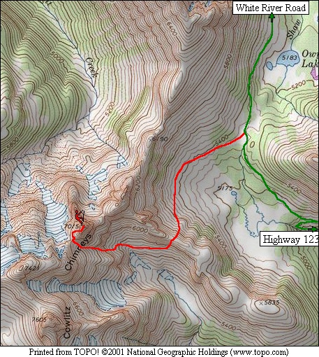
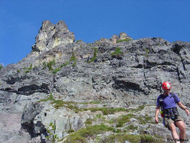
Accompanied by Andy Johnson, we reached the Owyhigh Lakes Trailhead (c.3700') on White River Road and began the 3.5 mile hike to Owyhigh Lakes (5183') at 8:20am. In a little over an hour we reached the lakes and continued to the pass just beyond. We left the trail and headed into the large basin at the head of Kotsuck Creek. From here we spotted a notch that appears to offer the easiest way over the divide between the Kotsuck Creek and Needle Creek drainages (+6320', Goat Pass?) .
|
View of the Needle-Kotsuck Divide from the Head of Kotsuck Creek |
|
|
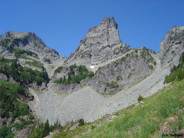
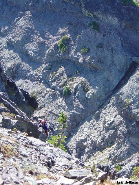
From the basin we ascended c.500 feet to reach the notch in the divide. The descent into the Needle Creek Drainage from the notch was steep, loose and unpleasant but relatively short and doable (nasty class 2/3). About 200-300 feet below the divide, we began traversing west on a grassy slope. In a couple hundred yards the grass gave way to talus in a small basin ESE and immediately below the North Chimney. We watched a goat cross the gully we were heading for then climb out of it on the other side (5.8, A2?). We climbed, without difficulty, the obvious gully through a cliff band then up talus and scree to reach the notch between the Central Chimney and the North Chimney (+6560'). The goat, obviously unhappy with our presence, occasionally kicked rocks down toward us.
|
The North Chimney from the Needle Creek Drainage |
|
|
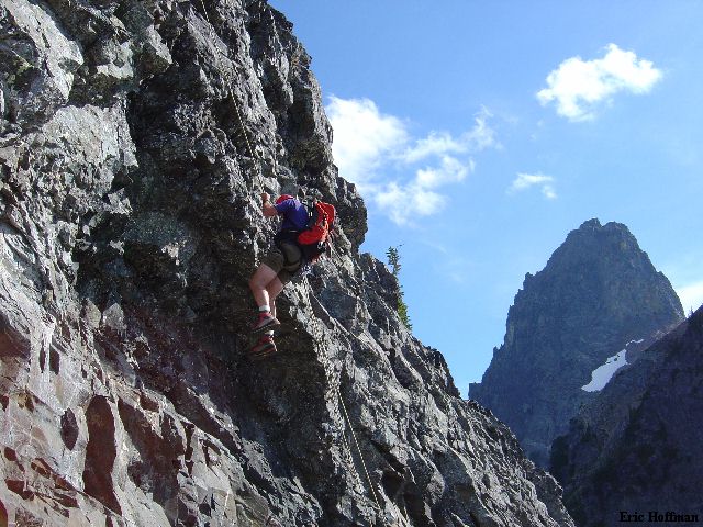
Climb left...hmmm. This was steep, exposed, friable rock. Since the guide states that there is some 5th class climbing after 150 feet, we decided to set up a belay at the notch. I started out climbing up and right, then back left to reach an arete at 100 feet. The crest is friable and the right side was not feasible so to the left side I went. Below the crest are stabs which are broken but fairly steep at the top and offer little in the way of protection (knife blade sized cracks). Farther down the slabs are lower angled. I decided to descend 50 feet down a gully on the left side where the slabs meet friable rock (left as you look down them). I set up the belay (fortunately, I had a knife blade and was able to remove it afterward) and Andy quickly joined me. The first pitch was class 3 and really didn't necessitate a belay at all.
From here we traversed across the slabs where they are broken and relatively low angled (class 2/3, cliff below). Once across the slabs one can easily climb up 75 feet on a heather/dirt/rock shoulder to the base of cliffs. We set up a belay and I led out traversing farther right than I had intended when we set up the belay. This would end up working out well other than the rope drag (Andy was out of the line of fire when I traversed back to the left above the cliffs). I climbed up the easiest portion of the cliff (class 4/5) to reach a wide, sloping ledge/ ramp cover with loose debris. I traversed left on the ledge to a tree where I set up a belay.
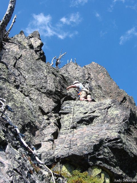
|
Andy Climbing on the SW Face |
|
|
Andy led the next pitch which was a series of ledges connected by 10-20 foot rock bands (class 4/5). He reached the ridge crest from where we would belay the final pitch. There were a couple of rappel slings on the right side of the crest that made us wonder if those who had rappelled down the east face had lived to tell about it (definitely NOT recommended). The final short pitch is on the right side of the crest. There appeared to be a couple of viable options: traverse right on looseness (easy, but exposed) then up a steep, blocky gully; or take a more direct route just right of the crest. We opted for the later as it appeared more entertaining (class 4/5). After about 50 feet the climbing turned to class 3 to reach the summit.
|
Me Leading the Final Pitch |
|
|
On descent we downclimbed the class 3 section below the summit then made a 50 foot rappel (we placed a new sling here). Finding no existing slings, we tied a new one onto a tree and made a 70 foot rappel to a broad ledge. An existing sling (a new one wouldn't hurt) allowed us to make a short rappel and be in position to make an enjoyable 85-90 foot rappel over two overhangs and back down to the slabs.
|
Andy Rappelling the SW Face, Main Chimney in Background |
|
|
|
North Cowlitz Chimney on the Descent |
|
|
All in all it was a reasonable climb with 3 pitches of class 4 to low fifth climbing and room for variation. We brought 5 cams ranging from 1/2 inch to 2 1/2 inches, a set of stoppers and a number of slings. The pitches were short enough that a 50 meter rope will handle it but a 60 meter rope will probably work out better on the descent. The trip took 11 hours car to car.
References:
Cascade Alpine Guide, Volume 1, 2nd Edition; Fred Beckey; Pages 130-132
USGS, Chinook Pass 7.5 Minute Quadrangle; 1987