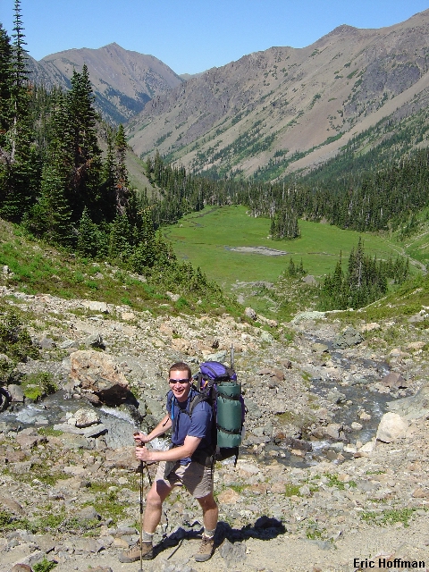
Chris Mattson reaches upper Royal Basin
The Olympics don't offer the high peaks and the quality of rock that can be found elsewhere in Washington so there must be some other reason I feel obligated to go there at least once a year. This year Chris Mattson and I would take a trip to Mount Mystery, a somewhat remote peak that does not seem to be visited very often. We opted to make it a loop trip with a traverse over Mount Mystery. The only information we found about the routes on Mystery were in the Climbers Guide to the Olympic Mountains which left me feeling a bit uncertain.
The National Park faxed our permits to "Wild Birds", a small store east of Sequim on Highway 101. Aside from picking up our permit we also had to get a bear canister to store our food in. The park service is now requiring canisters for those camping in alpine areas. We weren't necessarily happy about carrying the extra weight but we couldn't blame the park service for being proactive. We arrived at "Wild Birds" a little after 9:00am thinking the drive was going to take longer. Although the store doesn't open until 10:00am an employee that happened to be there helped us before the store opened. A three dollar donation is recommended for the use of the bear canister.We arrived at the trailhead around 10:30 after some routefinding difficulties. See the report on Mount Deception for driving information to the Dungeness Trailhead and follow the road signs closely. Note that the driving route has changed since most of the guides were published. We should have followed my directions!
We chose to do the loop in a counter-clock-wise direction since this would mean we would be ascending mostly on snow covered north slopes and descending on south facing scree slopes. Feel free to try it in a clock-wise direction... We departed the trailhead somewhere around 11:00am. The forecast for the next two days was for record breaking high temperatures and we weren't let down. After a mile we reached the confluence of the Dungeness River and Royal Creek where we kept right on the trail to Royal Basin. After more than 2.5 hours we reached Royal Lake where we took a break before continuing past shelter rock and into the upper basin.
|
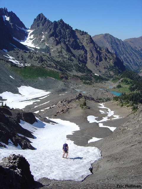
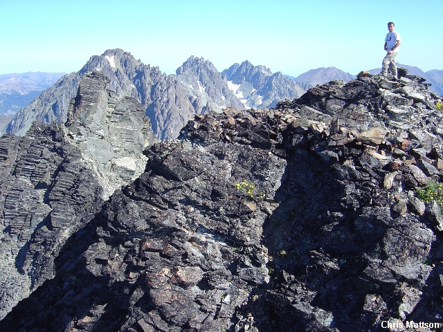
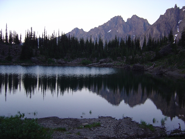
Chris Mattson reaches upper Royal Basin |
|
|
Ignoring most of the description of the "Royal Basin-Constance Pass High Route" in the guide book we headed for the lowest point in the divide between Royal and Deception basins (+6560', consult USGS Mount Deception 7.5' Quad) after taking the trail into upper Royal Basin. There may be other ways to reach Deception Basin from Royal Basin but you are taking your chances and gaining more elevation than necessary if you try elsewhere. The snow steepened to about 35 degrees for the last 200 feet to the notch.
|
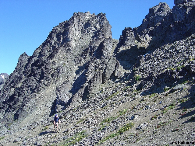
Chris nears the +6560' notch between Royal and Deception Basins |
|
|
|
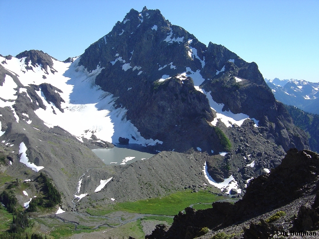
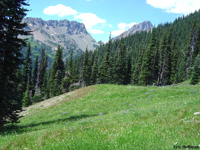
Deception Basin and Mount Mystery from the notch |
|
|
From the notch we made a leftward descending traverse on scree into Deception Basin. We camped on a gravel bar in the large flat area low in the basin. Unlike most of the places I have been there wasn't a single sign that anyone had ever been here before. Deception basin seemed untouched.
We left camp the following morning a little after 7:00am. After a short hike up talus to the Mystery Glacier's terminus lake we started up the easy Mystery Glacier. The angle is low to reach the Mystery Glacier col. However, before reaching the notch we climbed a somewhat steeper snow finger (35 degrees for less than 100') on the right to gain the ridge between the col and Mount Mystery.
|
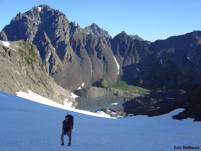
Chris on the Mystery Glacier |
|
|
With +40 pound packs Chris and I weren't necessarily looking for the most direct route up the east face of Mystery, actually we were looking for the easiest route to a notch in the South Ridge (Del Monte Ridge). The route up is described as Class 3, Grade II. We traversed left then back to the right before heading more or less up to the south ridge notch (+7400', class 2, moderate snow traverse and a lot of scree). We dropped our packs at the notch and took ice axes and a camera for the summit ascent. After traversing 100 feet we took an easy moat that led to a gully in another 100 feet. Mostly solid rock in the steeper sections (class 3/4) and much loose debris elsewhere reached the summit and a swarm of flying ants.
|
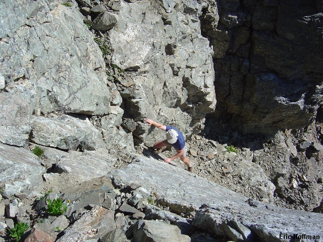
Chris scrambling in the gully on Mount Mystery |
|
|
|
Me on the summit of Mount Mystery |
|
|
We downclimbed to the notch in the south ridge where we reunited with our heavy packs and began descending to the west. After descending about 200-300 feet of the gully system (we kept right, a short class 2/3 traverse) we traversed south then made a short ascent to a broad scree bench. Once across the scree bench we descended less than 100 feet before starting to question the descent route. The guide book rates the route from Gunsight Pass (the pass between Mystery and Little Mystery) Class 3, Grade I, but in my opinion it is more difficult and equally committing as the route we had ascended. It is a solid class 3 that probably felt harder because it was unfamiliar terrain and we were descending with heavy packs. Expect both routes to be Class 3/4, grade I.
|
Traversing a scree bench on the west face of Mount Mystery |
|
|
After crossing the bench we located a short rocky gully and descended a few feet then traversed left and descended to avoid a short rock step (class 3). Ledges then led to the south ridge where we crossed through a notch to the east side of the ridge then crossed a slab back to the ridge crest. After descending a few hundred feet on or just east of the sometimes moderately exposed ridge crest we reached a steep but easy scree slope leading to Gunsight Pass. The slope funnels into a gully before reaching the pass.
Once at the pass we descended south to about 5600' where we took advantage of running water (probably won't last into late summer). Soon the bushwhacking would begin. We began traversing toward Sunnybrook Meadows trying to maintain elevation. The going was open and easy at first but then became brushy and forested with avalanche debris. It may be better to stay slighly higher for the next 1 to 1.5 miles before reaching open forest and Sunnybrook Meadows. Once in the meadows we intercepted the trail from the Dosewallips River at a small tarn at c.5600'. The trail ascends to just below Point 6576' before descending to Constance Pass. There is a spring at c.5800' that is a better water source than the tarn.
|
Looking back at Mount Mystery and Gunsight Notch from near Sunnybrook Meadows |
|
|
|
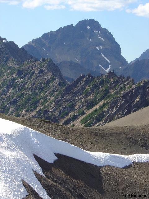
Mount Mystery's East face from Point 6576' |
|
|
From Constance Pass (5800') the trail descends to Home Lake (5308') where we would spend our second night. We arrived there in late afternoon. The water was the perfect temperature for cooling off on a blistering hot day. A three and a half hour hike the next day brought us back to the Dungeoness Trailhead.
|
Warrior Peak from Home Lake |
|
|
References:
Climbers Guide to the Olympic Mountains, 3rd Edition; Olympic Mountain Rescue; Pages 134-136, 240