The Cliff Palace, Mesa Verde National Park
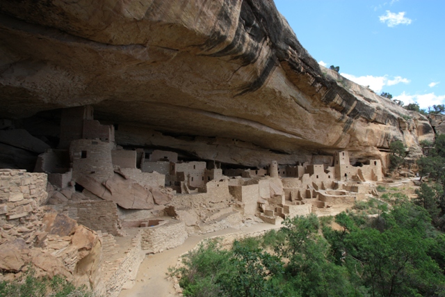
Colorado is a state with many faces featuring boring plains in the east, spectacular mountains in the middle and high desert in the west. Lorri and I saw a little bit of it all but with emphasis on the mountains. Our first stop was Mesa Verde National Park which I have wanted to visit since seeing photos of it when I was in the third grade, or somewhere around then.
|
The Cliff Palace, Mesa Verde National Park |
|
|
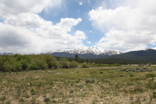
After that we took the scenic route from Durango on the Million Dollar Highway through Ouray and eventually arrived in the small town of Leadville where we feasted on pizza before heading for the Elbert Creek Campground which is across the road from the North Mount Elbert Trailhead (aka Half Moon Creek trailhead). Although the highest of the Colorado 14ers, Mount Elbert has three trails to the summit so it is not difficult technically but the altitude is an obstacle to overcome. We chose this trail because it is shortest and starts highest unless you have a 4 wheel drive (9 miles, 4500 vertical feet round trip). We stopped to scope out the trailhead where there was a large group of Texans doing the same thing.
|
Mount Elbert - The top of the Rockies |
|
|
The following morning we departed the campground around 6:00 and arrived at the trailhead (ca.10,050’) about the same time as the Texans. Our game plan was to move slow and steady trying to gain about 1000 feet per hour but the Texans were off to the races.
|
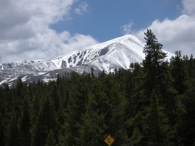
The Northeast Ridge of Mount Elbert |
|
|
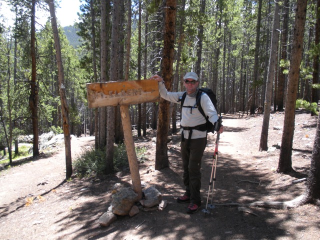
The hike begins on the Colorado Trail then at 1.3 miles you hang a right on the NE ridge trail which has a sign that simply says “Mount Elbert” with an arrow pointing to the trail. The trail is not shown on USGS maps. We began passing Texans pretty quickly and about a half hour from the trailhead we ran into the fastest of Texans taking a break then they took off again. The scene was repeated a couple more time before we caught up to them at tree line around 11,500’. We didn’t see them again until we were descending.
|
The Colorado-Mount Elbert trail junction |
|
|
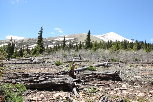
Just above tree line the ridge is indistinct, more like a pyramid shaped face than a ridge. Above that the ridge crest is more defined and we began hitting fresh snow. The snow was more of a nuisance than anything with occasional drifts up to your knees but generally only a few inches deep.
|
Near tree line (11,500') on the NE Ridge |
|
|
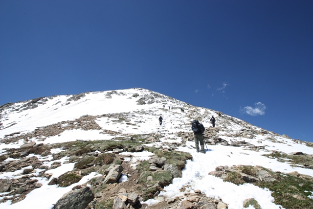
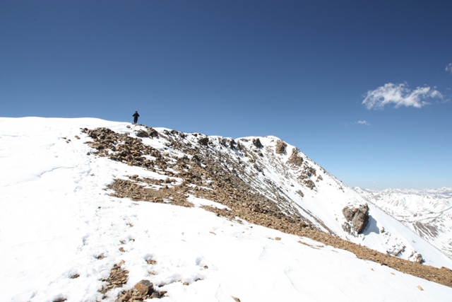
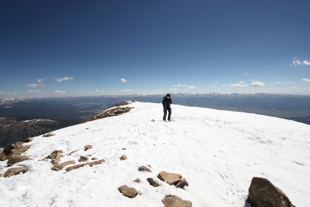
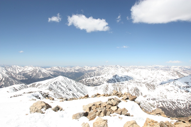
Around 13,200’ the ridge steepens a bit and the trail skirts to the right side of the crest. This steeper section was littered with Texans when we were descending. The last 600’ is again not a defined ridge crest and kept us wondering where the top was. Finally, at around 10:30 we reached the summit. Needless to say the views were good especially with the new snow to accent the surrounding peaks.
|
Bodies everywhere around 13,500' |
|
|
|
Finally, the summit! |
|
|
|
Lorri gasping at the view (and for breath) a few feet below the top |
|
|
|
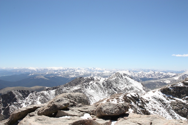
Just one view from the top of the Rockies |
|
|
After returning to the trailhead we were off to Aspen for some well deserved “Best Ribs in Colorado” at Hickory House ribs. Even though Mount Elbert is just a hike there are 14ers that are even easier. You can drive to the top of Pikes Peak and Mount Evans...
|
Why walk if you can drive? View from Mount Evans |
|
|