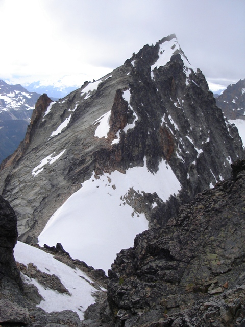
Mount Logan from Easy Pass
I left North Seattle a little after 4:00 AM with Sergio Verdina. We were hoping to cash in on a short window of good weather to take on Mesahchie Peak’s Mesahchie Glacier icefall and North Ridge. We had considered the possibility of doing the climb car to car in a single day but decided it would be wise to take lightweight bivy gear along… if things went well it would be for nothing but if things didn’t go according to schedule it would certainly make the night more comfortable. We were hiking the trail to Easy Pass by about 7:30 AM.
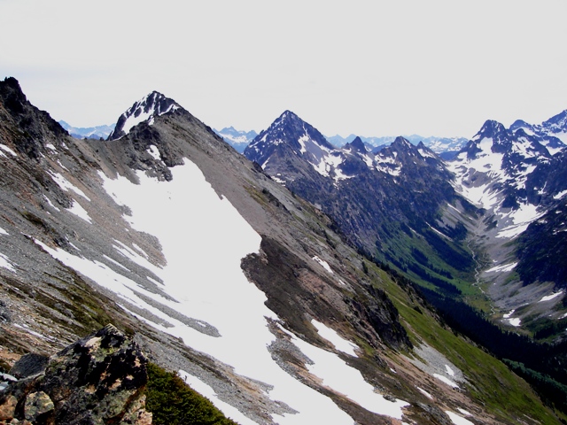
Around 9:00 we arrived at Easy Pass (+6520’) where we were greeted with excellent views of the Douglas Glacier on Mount Logan and less pleasant views of the SE slope of Mesahchie Peak. From the pass we ascended north up a heather slope for c.400’ then began traversing leftward below the craggy ridge crest. After close to a mile of traversing hard scree and loose rock we arrived at a small flat area (c.7100’) then ascended to a flat section of the ridge (+7440’) to the NW. We arrived here at about 10:30.
|
Mount Logan from Easy Pass |
|
|
|
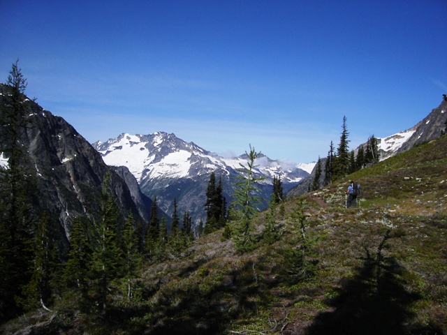
Looking back toward Easy Pass, Graybeard Peak, Fisher Pass and Fisher Peak in the Background |
|
|
Between getting tied in to the rope, putting on our helmets, gators and crampons we stuffed down as much food as possible. We knew it might be a while before we stopped again for a break but I didn’t think it was going to be 10 hours later… It was about 11:00 when we departed the ridge.
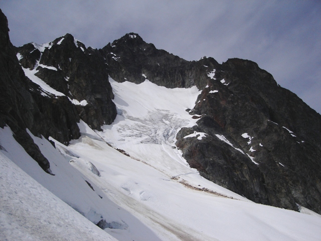
From the left side of the flat section of the ridge we began descending the Mesahchie Glacier to get around a buttress (you lose about 400’). Once around the buttress the icefall came into view. It appeared easiest to stay to the left but other options may have been equally feasible. Near the top of the icefall we hit the only minor difficulty. I put in an ice screw once above since Sergio wasn’t as well equipped as I was… a good (ie heavy and made of steel) ice axe and crampons were all that I needed. Sergio’s aluminum axe seemed to bounce right back at him (we both had a second tool available).
|
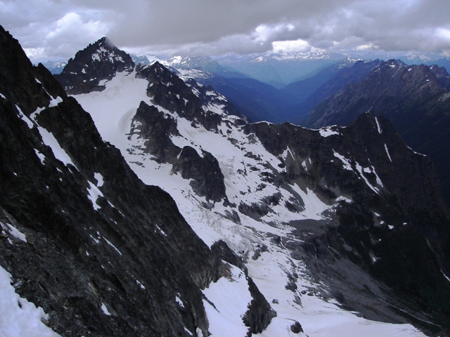
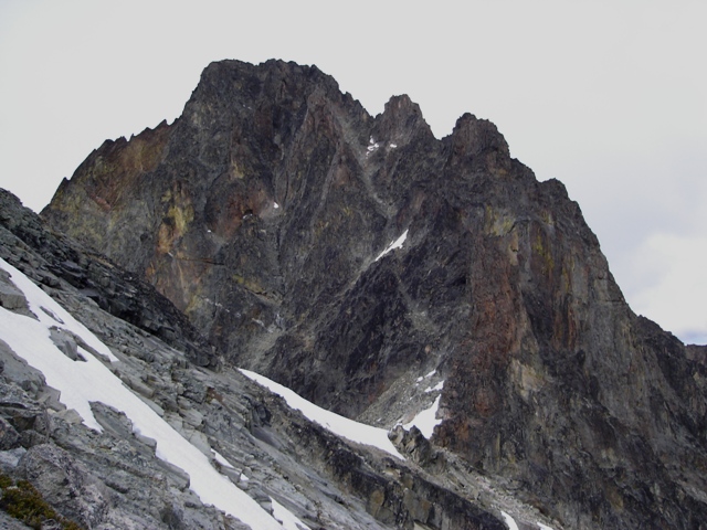
The Mesahchie Glacier and the North Ridge |
|
|
|
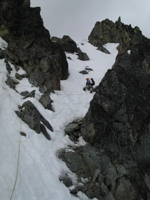
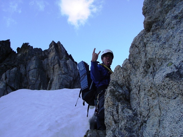
Sergio climbing the Mesahchie Glacier |
|
|
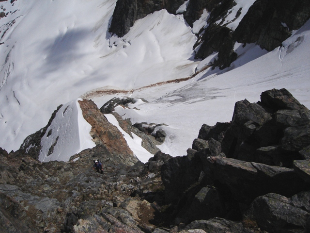
Once above the icefall we traversed right to gain the rock… there may be options here but we stay as high as possible and found reasonable class 3 to a big ledge covered with snow. We crossed the snow then scrambled up the spur to gain the N. Ridge proper at c.8000’. It was about 1:00 PM when we arrived.
|
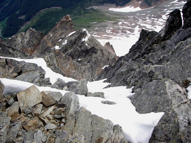
Scrambling up the class 3 spur leading to the North Ridge |
|
|
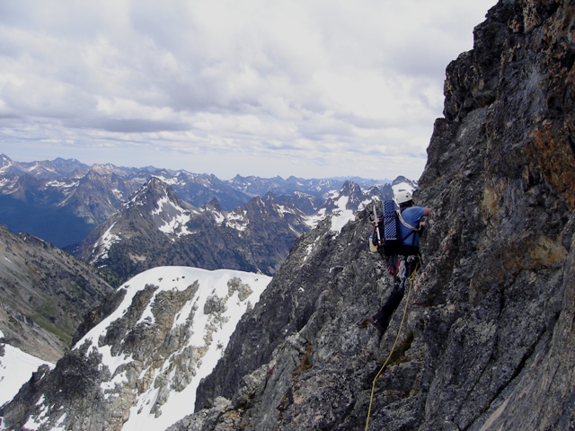
Sergio took over on lead after a brief stop. The north ridge is described as class 3 and easy class 4 in CAG. There is some class 3, plenty of moderate class 4 and if nothing else, the exposure will make it feel like 5.0. Sergio stayed on the crest for the most part but bypassed a step on the left about halfway up. At about 100 feet below the East Ridge we reached a steep snow gully where I took over again.
|
Sergio traversing around a small tower on the North Ridge |
|
|
|
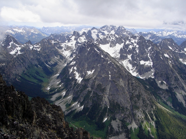
Kimtah Peak from the North Ridge of Mesahchie |
|
|
The gully easily contained the steepest snow we had encountered on the route. I put in a cam and slung a rock before reaching the East Ridge where I was immediately disappointed. I thought it would be a quick and easy scramble to the summit from there but that certainly didn’t appear to be the case. A few drops of rain fell from the sky… what were we in for?
|
The final difficulty before reaching the East Ridge |
|
|
|
Looking down the North Ridge from the East Ridge |
|
|
We spent an hour traversing the East Ridge before finally gaining the summit. One false summit gave way to another, then another… I heard a yell from Sergio when he finally reached the summit. We didn’t sit down, take our packs off or look for a summit register. We did snap a few photos before beginning our search for a safe descent into the rather unsafe west gully leading toward the Mesahchie/Katsuk Col. It was about 5:00PM.
|
Sergio on the summit of Mesahchie Peak |
|
|
|
Fisher Creek headwaters and Black Peak from Mesahchie |
|
|
|
Katsuk Peak from the descent gully |
|
|
After trying a third chimney to the west we found a reasonable descent to the gully (or we just gave up and went down the last available option). After descending the loose gully for 400-500 feet we located the top of another equally loose gully on the left. This took us down another 100 feet before it steepened and reached talus and snow at the Mesahchie/Katsuk Col. From the col the descent route looks like a diagonal band of gray looseness (see the photo below). Sergio wanted to stop for food and so did I but we continued on traversing steep slabs to the first obvious ridge and began descending. After descending about 200 feet down the first obvious ridge it became obvious that this was not the correct ridge. We turned around and headed back to the steep slabs and traversed farther west. Keeping to the right of a tower (the one on the left in the photo above) we located a cairn. I can’t say I wasn’t happy to see it. Keeping just right of the ridge crest we descended steep, loose ramps until reaching snow and finally easier travel when the angle eased. At c.7600’ we located an easy way down from the ridge via a short gully to reach easy snow and heather and a small basin to the east (c.6600’). We arrived there at about 9:00 PM and it was clear that we were both content with a bivy in the basin.
|
Mesahchie and the descent route from near the Katsuk/Mesahchie col |
|
|
We celebrated a bit before calling it a night. It rained a bit during the night but stopped only to resume in the morning. We packed up in a light drizzle and began the 1500’ descent to the Fisher Creek Trail by keeping just left of the stream spilling down from the basin. We reached the trail about an hour later and the trailhead by 11:00 after the 1500’ grind to Easy Pass and the 2800’ descent. Whoever said you can’t have a beer before noon was wrong.
|
Sergio scrambles down the last bit of steep loose rock on Mesahchie |
|
|
References:
Cascade Alpine Guide, Volume 2, 2nd Edition; Fred Beckey; Pages 326-328
Washington's Highest Mountains; Peggy Goldman; Pages 90-92, 93