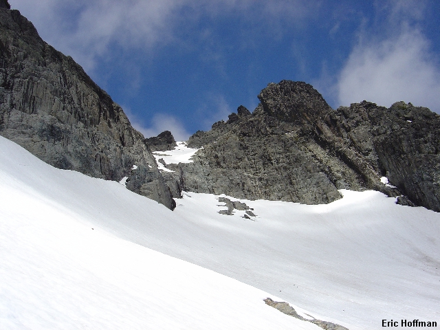
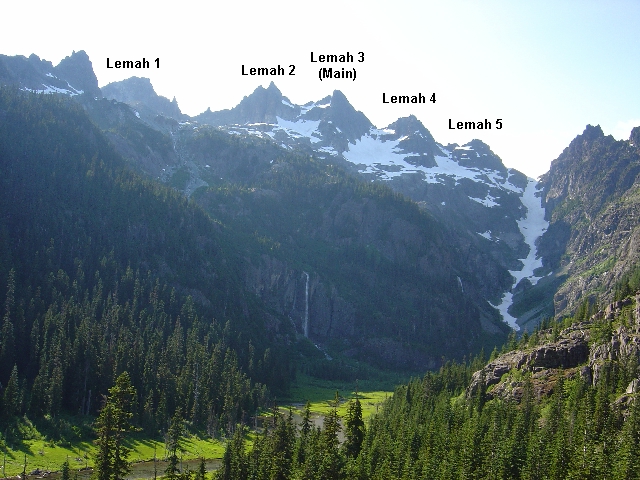
The 5 summits of Lemah Mountain from the approach
I was fresh back from the Tampa Bay area of Florida where I was sent on a business trip. I took advantage of the finer things that Florida has to offer such as air conditioning, the Salvador Dali Museum and a Gator Ceasar Salad, certainly a traditional Italian delight. It "tasted like chicken", if you were wondering. If I got nothing else from Florida, I once again realized why I live in Washington. I was eager to get into the mountains.
I won't say that this was our original destination but Lemah Mountain was worth the effort. Lemah, a native term for "fingers," is an appropriate name for a mountain with 5 distinct summits. The middle "Lemah" is highest. The summits are refered to as Lemah 1, 2, 3 (main), 4 and 5, apparently for lack of imagination. I had visited Lemah 1 on a previous attempt when I had hoped to descend a gully to the Lemah Glacier and climb Lemah 3. The gully was melted out and featured very unstable talus blocks. If you are thinking of taking this approach, yes, the gully is already melted out but would provide a better approach route when snow covered.
I picked up Sergio somewhere around 1:00pm and we headed for Cooper Lake (take the Roslyn-Salmon la Sac Exit on I-90 then follow signs to Cooper Lake and the Pete Lake Trailhead). We arrived at the trailhead around 4:00pm and began hiking the Pete Lake Trail (FST 1323, c.2800'). Upon reaching the junction with the Lemah Lake Trail (c.6mi, c.3000') the rain had started and our summit hopes were dwindling. We continued north on the Lemah Meadows Trail (FST1323.2) for 0.8mi to the Junction with the PCT where we hoped to find a camp site... nothing. Actually, had we continued north on the PCT we would have found several sites but we decide to head back to the Pete Lake-Lemah Meadows junction and camp there. By this time it was raining steadily and we were weighing our options... only two hours back to the trailhead.
We decided to tough it out and hoped the weather would improve as predicted. Around 5:00am the rain stops and by 8:20am we were once again hiking north on the Lemah Mountain Trail to the junction with the PCT. We turned south and continued c.1 mile the the bridge across Lemah Creek (there is a camp site here). We started up on the right side of the creek hoping to find more of a path. The path is not heavily used and is hard to follow. Did I mention the brush was wet? Eventually, we arrived in the marshy basin below a long snow gully that begins on the north side of Lemah 5. Apparently there are two possible ways to get to the Lemah Glacier from here. Neither route is obvious from the marshy area but the first route looked like it had significant brush. We decided to climb up the snow gully and hoped the second option would be better.
|
The 5 summits of Lemah Mountain from the approach |
|
|
First we had to get to the gully. We went back into the trees on the north side of the marshy area and then followed game trails until we reached a small pond. From here we followed the creek closely until beyond the brush. There was a short section of the gully where the snow had melted out at a waterfall. We scrambled up the left side but it is probably better to stay on the right side then return to snow. We continued up to c.4800' where we left the gully and started up on heather along the left side of a stream. There is a rock slide on the left side of the gully 100-200 feet above where we left the snow gully. In about 100 feet we crossed the stream then in another 100' crossed back to the left side. We continued on a rising traverse toward a short rock step just right of a small water fall in a gully. We scrambled up this (wet class 3) to gain a small cirque above.
We headed south on snow and talus, traversing the cirque until we could climb a heather slope to the glacier moraine above. Once on the moraine we headed SW to reach the Lemah Glacier above the terminus lake shown on maps. There is another lake just above where we reached the easy lower glacier. We quickly ascended the moderate slopes below Lemah 2 then traversed north until below the main summit of Lemah.
|
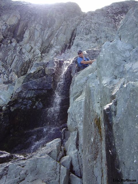
The rock step and summit of Lemah Mountain from the Lemah Glacier |
|
|
It appeared that we might be able to avoid the rock step (refered to as a chute in the guide books) by climbing a ramp on the far left. A sketchy moat crossing to gain the ramp sent us down and to the rock step where we had little difficulty gaining the rock. We started by passing a small waterfall then up a wet gully for about 10 feet before we could work right onto dry rock. The first 10 feet is class 4 with a relatively safe landing.
|
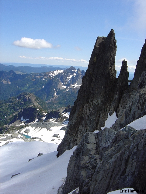
The Three Queens and spires on Lemah 2 |
|
|
|
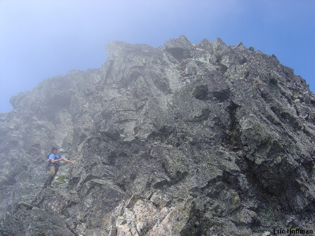
Sergio starting up the rock step |
|
|
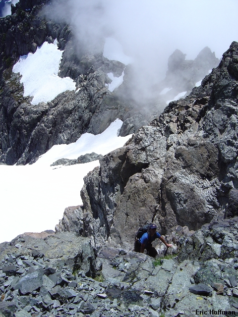
Above the rock step there is a small snow field between Lemah 2 and Lemah 3. The sketch in one of the guides (the one without an index) shows the route just left of the summit rocks. We head for a mostly snow filled gully and start up it. The top looked difficult and we crossed a small snow bridge to loose rock on the right. After about 100 feet of loose class 3 and 4 we reached the ridge just south of the summit.
|
A little off route, Sergio scrambles in a loose class 4 gully |
|
|
I took a short ledge on the west side of the ridge then climbed a gully back to the crest. From there it was a fun, sometimes exposed scramble on solid rock to the summit. Sergio took a different route to the summit that shouldn't be repeated but probably will (loose class 4/5 as he reported).
|
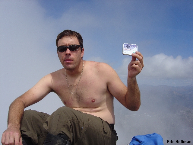
"I never knew Everest could be so easy... and warm" |
|
|
After a short time on the summit with limited views due to the west side cloud cover we head down. The summit register, a film canister, was placed here in 1999 by Jeff Howbert. The few scraps of paper inside were wet. Sergio offers his "Everest" mint canister and I put the papers in a spare zip-lock bag. We didn't have a pen or a pencil so we engraved our names into the side of the canister. Sergio decided to take my route back to the ridge. We continued past the top of the loose class 4 gully we had ascended and find an easier way down to the snow field above the rock step (an ascent gain the ridge where it looks easiest... it is). We retraced our steps the rest of the descent with no complications to arrive at the trailhead around 8:00pm.
|
Sergio near the base of the summit rocks |
|
|
|
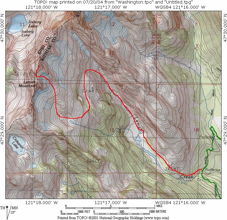
Map Courtesy of TOPO! |
|
|
References:
Cascade Alpine Guide, Volume 1, Second Edition; Fred Beckey; Pages 166-168
Climbing Washington's Mountains; Jeff Smoot; Pages 270, 274-276