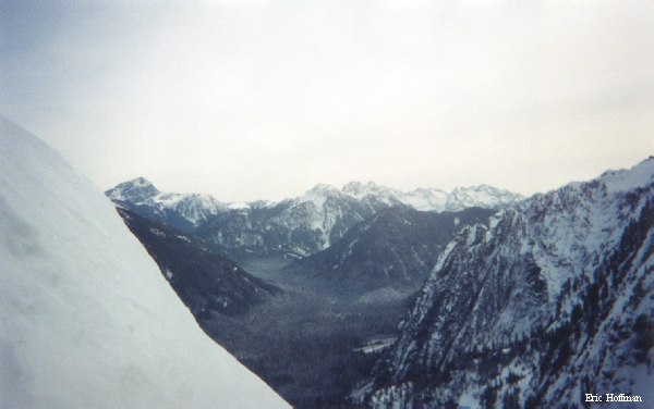
| Skubi Ridge and Hall Peak's NW Face from Silver Gulch |
 |
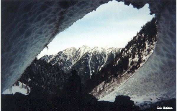
Long Mountain from one of the Silver Gulch Ice Caves |
 |
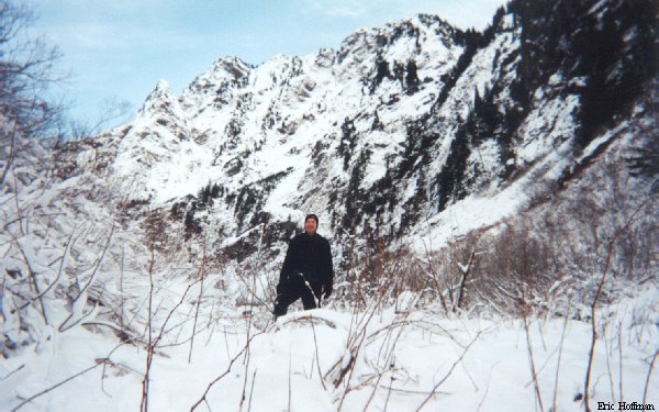
While the Big "4" Ice Caves undoubtedly see thousands of visitors each year, the nearby ice caves below the impressive Northwest Face of Hall Peak likely see less than 100. The approach to these caves is an abandoned mining trail beginning at the private community of Silverton 22 miles east of Granite falls on the Mountain Loop Highway. The Silver Gulch Trail is in reasonable shape despite its status, but ends in 1.5 miles and long before reaching the ice caves. Appoximaiely a half mile of bush-whacking and boulder hopping is required to reach the lower and largest of the ices caves at 3000'. Continuous avalanche activity on the NW face of Hall Peak creates a massive pile of snow and ice that remains throughout the year.
To reach the Silver Gulch Trail, drive the Mountain Loop Highway 22 miles to the community of Silverton then turn right on a spur road and drive approximaitely 0.2 miles to a sharp bend. The trail leaves the road on the west. This area is largely private property and caution should be used when deciding where to park.
From the beginning of the trail, take a left at a fork about 100 feet from the road. The trail starts out wide and easy, but quickly becomes narrow and overgrown as it continues to then up Silver Gulch. Near its end at 2400', the trail become quite overgrown and becomes somewhat difficult to follow. From its end continue along a stream into an large basin below the NW Face of Hall Peak and the area of the ice caves. With the cold temperatures on the day we visited the ice caves, we deemed them safe to enter, but serious accidents are common in ice caves particularly during warmer weather.
| Skubi Ridge and Hall Peak's NW Face from Silver Gulch |
|
Long Mountain from one of the Silver Gulch Ice Caves |
|
Skubi Ridge is the precipitous North Ridge of Hall Peak. The ridge is named in memory of Steve Skubi who died in an avalanche while attempting to climb the ridge in the Spring of 1962. The first successful climb of Hall Peak via Skubi Ridge was made on July 4th of the following year.
An obvious 4000' foot col in Skubi Ridge located between Hall Peak's Summit and Point 4271' can be reached from the area of the ice caves by ascending a snow gulley East of the ice caves. With an angle of 40 degrees as it nears the col and steeper slopes to the North and South, this gulley is likely unsafe during much of the winter and spring. From the col, traverse west into a shallow gulley then ascend the south slope on steep snow (some patches of ice) to the top of the 4271' high point. It may be possible to climb the ridge's crest when better snow conditions exist or when it is free of snow.
While this is not a major high point in the area, it is a great vantage point to view Halls unclimbed NW Face, the equally impressive North Face of Big "4" Mountain, the many peaks of the Monte Cristo area, Sloan Peak, Three Fingers and Whitehorse Mountain. We went to this area with the intent of climbing Hall Peak via the NW Ridge, but difficult routefinding and limited daylight changed our plans. It appears that anyone attempting that route should ascend SE up a steep slope marked by a large snow block (an obvious remnant of last winters avalanche activity) just before the trails end, not the more obvious, parallel running ramp slightly to the east.
| Sloan Peak and the Monte Cristo Group from the 4000' Col on Skubi Ridge |
 |
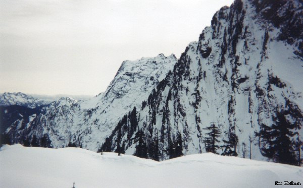
The North Face of Big Four Mountain from Point 4271' |
 |
References: Cascade Alpine Guide Volume 2, Fred Beckey; page 44