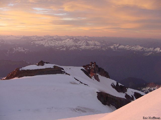
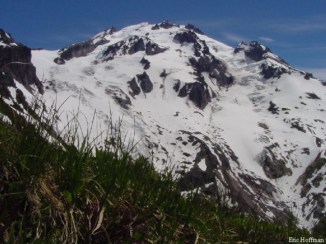
Glacier Peak from Glacier Ridge
 Fr
Fr
This trip was about as much of Glacier Peak as I could hope to see in two days. The solo traverse of the mountain consisted of an ascent of Frostbite Ridge, also known as the North Cleaver, a bivouac on the summit, and a descent down the south side of the mountain via Disappointment Peak Cleaver. I climbed Frostbite Ridge in 2000 and had been to just below Disappointment Peak in 1999, so I had a good idea what I was up against. The few technically challenging sections of the route are reasonably safe, short and easy, making it a good choice for a solo climb.
The Whitechuck trailhead was the spring board for the trip. To get there take the Mountain Loop Highway south from Darrington. Where the pavement ends, turn left onto FSR 23 and follow it to its end and beginning of the approach to Frostbite Ridge. There are no short approaches to climb Glacier Peak, the shortest is the nine mile hike to Boulder Basin, the high camp for the Sitkum and Scimitar Glacier Routes. The approach to Frostbite Ridge consists of more than ten miles of trail then about two more before arriving at the Ptarmigan Glacier. Starting at the trailhead follow FST 643 for 5 miles, then take the Kennedy Ridge Trail, FST 639, for 1.7 miles to the PCT. Take the PCT north for 3.5 miles until on the north side of Glacier Ridge. At the highest point on the traverse, take a path leading to the crest of the ridge. It is possible to take a slightly more direct approach by leaving the PCT where it crosses Glacier Creek but this skips the best part of the approach, Glacier Ridge.
|
Glacier Peak from Glacier Ridge |
|
|
Once on the ridge crest the path continues on the crest for a distance before vanishing in alpine meadows. Continue along the ridge until Ptarmigan Glacier, the first of four crossed on the Frostbite Ridge route. Traverse the Ptarmigan Glacier then the Vista Glacier to a 7900' saddle south of Kennedy Peak. There was running water here on the Kennedy Glacier Side of the Ridge making this a good option for a high camp. From this saddle, ascend the Kennedy Glacier to another minor saddle at 8800' (one crevasse noted at about 8400'). From here the route follows the ridge crest for several hundred feet before it is forced onto the Ermine Glacier below the Rabbit Ears. There was good snow on this portion of the route, but it can be very icy the last few hundred feet to the Rabbit Ears. The Rabbit Ears are not that obvious until you are actually between them but you will know when you are there. From here I got a look at the two sections that I was most concerned about, the steep snow and ice just beyond the Rabbit Ears and the steep snow/ice on the east side of the crater.
|
The two steep sections viewed from the "Rabbit Ears" |
|
|
After the short class 3 down climb from the Rabbit Ears, climb the 60 plus degree snow/ice pitch. This section was much icier than last year, but there was great snow on the far left. Once above this obstacle, it is smooth sailing to the crater. Unfortunately, the crater is nearly 500' feet below the summit and to get to the summit you must climb a steep wall of ice or snow. The ice can still be out flanked on steep snow on the left side but it appears that this area will soon be melted down to hard glacier ice as well. I took on the ice wall itself near the middle. The ice was good and reached an angle of about 65 degrees for 40 feet before moderating. Once above the icy section, the slope is moderately steep and easy.
|
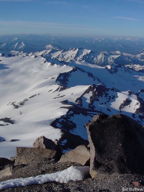
Looking down at the summit crater and the "Rabbit Ears" |
|
|
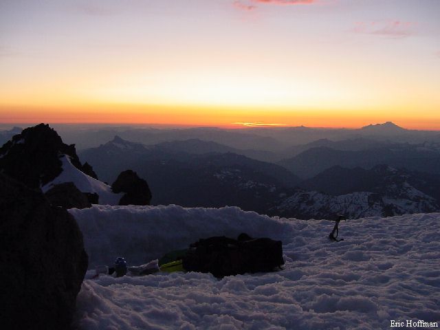
It had taken me ten and a half hours to reach the summit from the trailhead. I had more than enough time to dig a platform, eat dinner and fill my water bottles before the sun set.
|
My summit bivy site at sunset |
|
|
After a very calm night with temperatures reaching just below freezing I watched the sunrise, packed up and began the second leg of the journey. Descending from the summit toward Disappointment peak was trivial, but getting down from there was a bit more difficult than I had expected. Actually more tedious than difficult. The rock is loose and jumbled. I finally ended up traversing to a remaining snow patch and descended to the Gendine Glacier then traversing back to the cleaver. A better, but somewhat crevassed option would be to descend the Cool Glacier then traverse onto the Gendine Glacier and on to the cleaver.
|
The South Ridge from Disappointment Peak |
|
|
Once on the cleaver, follow on or near it until it ends, then ascend a couple hundred feet and descend to Glacier Gap, a glacier saddle between the Suiattle and Whitechuck Glaciers. From here descend south on the upper lobe of the Whitechuck glacier, then travel south east on the lower section nearly to White Mountain (the Whitechuck is easy with few if any crevasses). It is difficult to describe the exact route I took, but the terrain tends to lead one in the right direction. There are multiple routes possible once below the glacier with the general idea of following the stream leaving the terminus lake downstream to the Glacier Peak Meadows. Once in the meadow, cross it to the PCT. Yes, back on the PCT twelve miles from were I left it on Glacier Ridge.
|
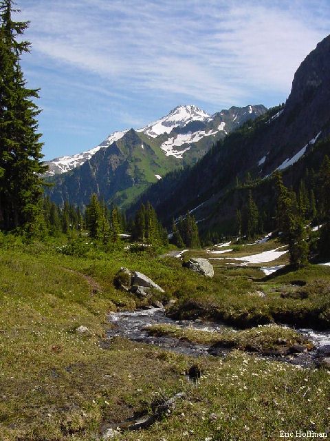
Glacier Peak from Glacier Peak Meadows |
|
|
References:
Cascade Alpine Guide Volume 2, second edition; Fred Beckey; Pages 88-90, 93-95,
96-98
Selected Climbs in the Cascades Volume 2; Nelson and Potterfield; Pages 117-123