Mount Rainier Attempt-Fuhrer
Finger Route
- Destination: The Columbia Crest (Mount Rainier
Summit 14, 411')
- Date: July 16-17, 2002
- Difficulty: 6+
- Payoff: 6+
- Starting Point: Paradise ( 5420')
- High Point: c.12,100' on the
Nisqually Glacier
- Round Trip Distance: c.10 miles
- Equipment: The ten essentials, glacier travel,
helmet
- Mountain Skills: Route finding, glacier travel,
snow and ice to 45 degrees, avalanche assessment
Still on vacation, I will fill in the details later. These photos are from an
attempt that Andy Johnson and I made to climb Mt. Rainier's Fuhrer Finger Route.
The route is usually climbable into August according to the Mike Gauthier
climbing guide, but we were unable to find safe passage across a wide crevasse
spanning the entire width of the Nisqually Glacier between the Wilson Glacier
Headwall and the Nisqually Cleaver at c.12,100'. It appeared that a party may
have outflanked the crevasse on the eastern margin of the Wilson Glacier
Headwall. The line would seem to have been on steep loose rock and steep snow
directly above the crevasse. We passed on that option.
|
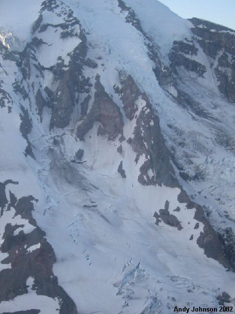
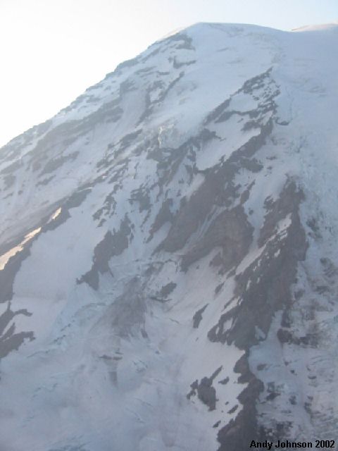
Aerial views of the Fuhrer Finger
Route taken by Andy Johnson on July 14, 2002 Andy
took these photos while doing an aerial recon of a different route on the
mountain. The recon seemed to confirm what the park rangers have been
stating in their reports. While the lower slopes have a deeper snowpack than
usual at this time of year, the upper slopes are at best average. There is a
significant amount of rock melted out and hard ice on many routes. Note the
debris field from the Kautz ice cliff extending well down the Wilson
Glacier
|
|
|
|
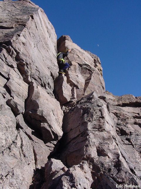
A distraction from camp chores: Andy scrambling on the
"Camp Crag" We camped at c.9100 feet on
Wapowety Cleaver, just below the Turtle Snowfield and above a gendarme. We
had barely gotten our packs off before making some half-hearted attempts to
climb the gendarme. We both thought we could get on top off it, but neither
of us was sure just how we would get down.
|
|
|
|
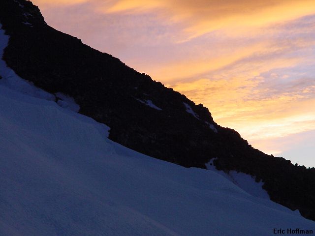
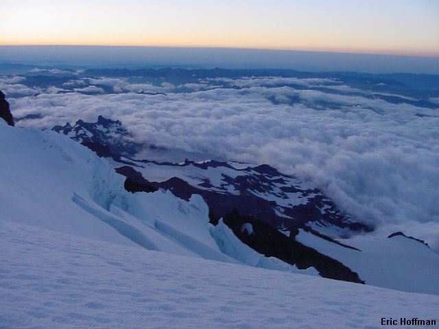
A view from the Nisqually Glacier near sunrise We
left camp around 2:30am and crossed the Wilson Glacier. A few crevasses had
to be negotiated by end running or by snow bridge. The crossing is
threatened by icefall from the Kautz Ice Cliff more than 2000 feet above.
The evening we arrived, a large section cleaved and tumbled down onto the
Wilson Glacier, some debris reaching a wide crevasse that we traversed below
then crossed on our way to Fuhrer Finger. Fuhrer Finger is a couloir
that ascends 30 to 35 degree snow slopes to the "Hourglass". Above
the "Hourglass the route veers left and the angle increases to 40 to 45
degrees, finally reaching the Nisqually Glacier above 11,000 feet. An
icefall forced us rightward to the middle of the Nisqually where we were
stopped short at c.12,100' by a wide crevasse.
|
|
|
|
A view from near 12,000 Feet on the
Nisqually Glacier
|
|
|
|
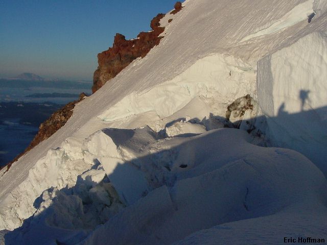
The western side of the impassable crevasse In
two locations we could see tracks going up to the crevasse and continuing on
the upper side but the bridges where no longer there. After trying to find a
bridge across the crevasse on our right and finding nothing (the crevasse is
visible in the sunrise photo above), we began looking to the icefall on our
left. The crevasse entered the icefall, appeared to turn sharply downward
then turned and continued all the way to the Wilson Glacier Headwall. It was
difficult to tell just what was going on in the icefall, so we went in for
a closer look.
|
|
|
|
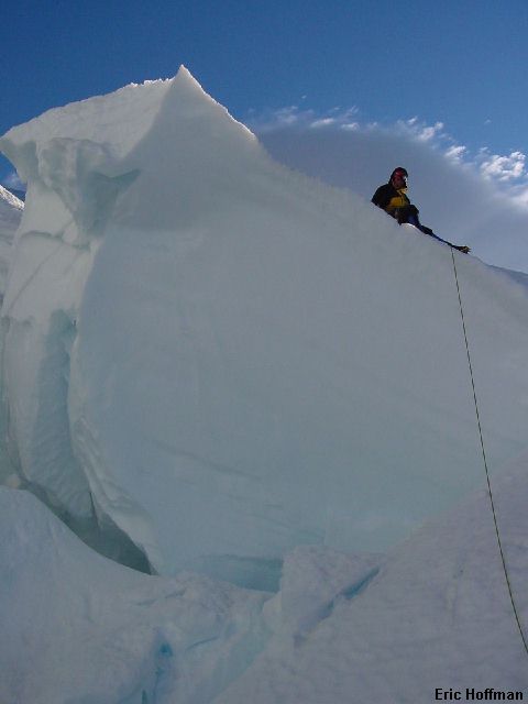
Andy belaying me into the icefall with
the summit lenticular cloud behind him
|
|
|
|
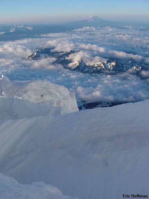
The Tatoosh Range, the Goat Rocks and
Mount Adams from the icefall After crossing some
easy ice blocks we found that getting across the crevasse in the icefall was
not an option. We called it quits and descended the route back to camp. It
was about 7:00 as we exited the couloir and rocks were already beginning to
fall.
|
|
|
References:
Cascade Alpine Guide, Volume 1, Second Edition; Fred Beckey; Pages 95, 96, 97
Mount Rainier, A Climbing Guide; Mike Gauthier; Pages 92, 93-99, 100