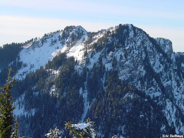
The Dutchess to the Duke with sufficient snow (photo from low on Mount Kent; Feb 2002)
This was a day that started good and ended great, but that had nothing to do with the climb. I started the day in a suit and a tie, but it ended in apparel I was more accustomed to. The great ending may have an impact on future trip reports, namely the ones I have been fortunate enough to post in the middle of the week. Probably more to come on that but, there was sun and snow to be had on this afternoon. This only beta I have found on The Dutchess spawned from Phil Fortier, Dave Burdick and company's "Royal Traverse" from the Dutchess to the Duke earlier this year. Phil Fortier and Dave Burdick have posted reports on the traverse with some relevant information. I had noticed these sub-alpine crags while driving on I-90 and certainly during my ventures to Mount Kent, as I am sure some of the members of the traverse party had. The traverse party made the ascents during summer conditions, which clearly would be a mix of advantages and disadvantages. The advantages being a higher start and dry rock, the disadvantages being the quality of the rock and considerable brush. My interest in these summits was their potential for reasonably accessible winter climbs and with some fairly obvious gullies that could provide some interesting climbing avenues...providing there is sufficient snow. Whether or not there was sufficient snow on this trip is debatable.
|
The Dutchess to the Duke with sufficient snow (photo from low on Mount Kent; Feb 2002) |
|
|
From what appears to be a logging platform on a FSR 9020 spur (est. 2500'; keep right at the first junction after crossing Alice Creek), where snow indicated that this was as far as I was going to drive, I started hiking. I kept left at the next two spurs and arrived at the base of a mostly snow covered talus basin NW of the Dutchess. Here I left the road and headed toward an obvious coulior with some hanging ice. After some postholing I reached the bottom of the couloir and found that the ice was less than continuous. I traversed right then climbed thin snow to reach a NNW trending ridge, which appeared to be an easy route to the summit from below as well as in the photo from Mount Kent. It proved to be a bit more difficult than I had anticipated but was passable (thin snow on steep rock and steep forest floor). I reached what appeared to be a crest when viewed form below but found it to be two almost converging gullies, separated by a an easy but precariously narrow rock fin. After climbing a tangle of snow cover rock and downed trees I reached easier terrain on the SW slope of The Dutchess. The slope was moderate and easy for a few hundred feet then rock bands on the left and right converged into a gully system (basically one gully but with several variants, expect brush and mossy rock unless there is sufficient snow cover). I climbed upward with short traverses to the right, left, right and then back to the left to navigate more difficult terrain with thin snow cover. Finally, I reached a minor saddle between two high points on the ridge. It wasn't obvious which of the two was higher, I went left to reach a craggy outcrop that appeared to be the highest point. Was this The Dutchess? Whether it was or it wasn't, the view was good to Mount Kent and beyond. For the first time I could see the less than spectacular couloir that I had climbed to the summit of Mount Kent in 2001 that I had dubbed Eric's Couloir.
|
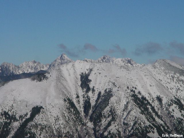
Mount Kent-Eric's Couloir is the semi-obvious snow gully (left branch) just left of center |
|
|
|
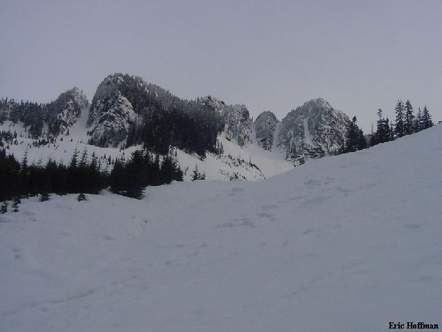
Bandera Mountain in the foreground, Kaleetan Peak and Chair Peak in the background |
|
|
|
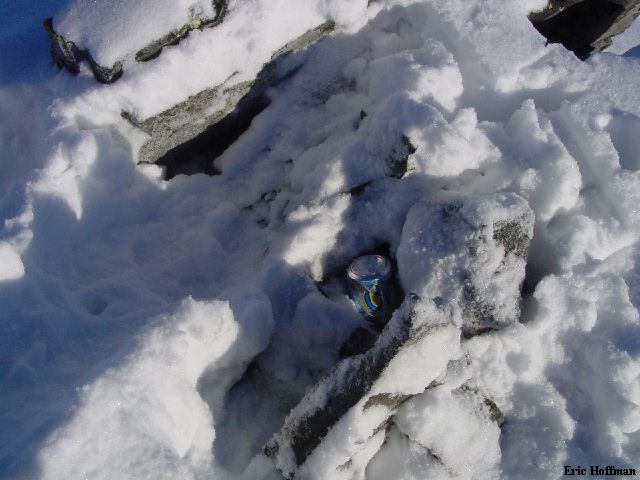
A minor archeological dig reveals the "summit register" |
|
|
After signing the summit register (the first since the traverse party had placed it there), I started down. I followed the path of least resistance, contouring right as much as possible. I ended up back at the minor basin below The Dutchess. I wouldn't rule out a ski descent if there is sufficient snow. I reached my car and warmed my cell phone on the defroster so I could return a call..somehow related to the suit and tie that I was wearing earlier in the morning. Three hours round trip from the logging platform but, expect it to be a longer trip when there is sufficient snow.
References:
See the links above, beyond that...good luck