Double Peak-SE Route
- Destination: Double Peak (6207')
- Date: May 3 , 2003
- Difficulty: 4+
- Payoff: 6
- Starting Point: Highway 123 ( c.3000')
- High Point: Double Peak [South] Summit
(6207')
- Round Trip Distance: c.7 miles
- Equipment: The ten essentials, ice axe, crampons
- Mountain Skills: Route finding, avalanche
assessment, snow to 45 degrees, class 3 rock
|
|

 Map Courtesy of National Geographics, Created with TOPO!
|
I had read about Double Peak in the Cascade Alpine Guide before but it wasn't
until I went to Governors Ridge and Tamanos Mountain that my interest in the
peak really grew. Located in Mount Rainier Park, SE of the Cowlitz Chimneys and
Tamanos Mountain, Double Peak isn't among the most visible peaks in the area but
may grab your attention if you are driving Highway 123
on the east side of Rainier. There were two paragraphs in the climbing guide
about the peak. After reading the description a couple of times with a map in
hand it started making sense...except the part about 3 creeks which still
doesn't make sense.
|
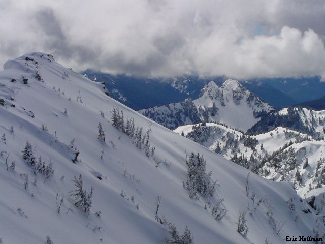
Double Peak from Tamanos Mountain
(4/27/03)
|
|
|
My original plans for the weekend got scrubbed so Andy Johnson; Jonny, a left
over from my original plans; and myself headed for Double Peak. Double Peak is
one of those obscure peaks that I seem to be attracted to. Andy and Jonny met me
at the Silver Springs cabin... my plan Double peak. You never know how this type
of climb is going to turn out, but this one turned out good. We had a couple of
setbacks before leaving the cabin: Andy had forgotten snowshoes and Jonny had
forgotten crampons. We all decided to go without snowshoes, but like Andy, I
brought my crampons, Jonny was coming along anyhow.
I drove from the cabin. After crossing Cayuse Pass we took highway 123 until
about 0.7 miles south of the Owyhigh Lake Trailhead. The plan was to descend to
the East Side Trail where it crosses Chinook Creek. Alternately, you can start
from the Owyhigh Lakes Trailhead. From a pull-over area along the highway,
we descended through trees and the evil plants that grow above streams to reach
Chinook Creek. We ended up a couple hundred yards downstream of the bridge which
crosses above a waterfall...hmmm. Once on the trail, we crossed
to the west side of the creek and headed south about 1/4 of a mile (just after
crossing the next bridge).
We left the trail a hundred yards beyond the bridge and started through
somewhat brushy forest. The brush eased as the slope turned into a broad,
sometimes steep, forested rib. We stayed generally to the right but not too close to the stream. We
encountered two minor rock bands on the way up and skirted right each time. At
about 4000', we began a rising traverse up the slope on our left (more rising
than traversing) to reach a ridge crest above the lower of two basins on the
east side of Double Peak. We followed the ridge until it was relatively
easy to descend into the upper basin. We were now immediately east of the peak
and getting our first view of the summit.
|
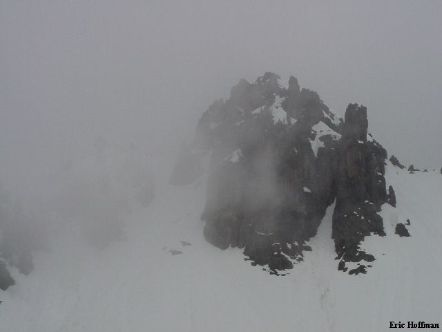
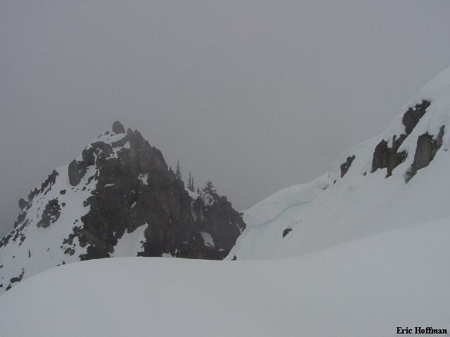
Our First Look at the Summit of Double Peak
|
|
|
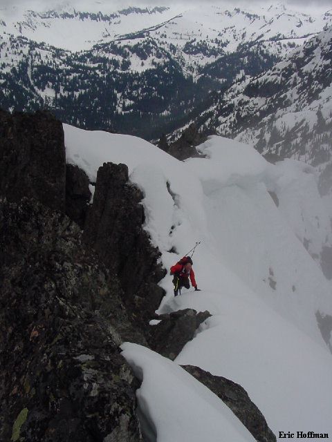
We had little information on the route and were happy to see a gully
left of the summit reaching high on the SE ridge. Andy and I put on our crampons...Jonny
didn't have his but continued up until he found that the runnels in the upper gully
were solid. With crampons, Andy and I reached the top of the gully (400', 45 degrees max)
then took another minor gully (class 2) to reach the summit ridge a couple
hundred feet from the summit.
|
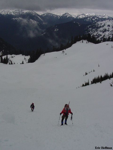
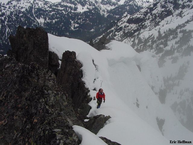
Andy and Jonny Near the Base of the Gully
|
|
|
The summit ridge was an interesting mix of snow and rock. With a bit of
exposure at times, class 3 rock and short sections sometimes steep snow reached the
summit. I was a bit surprised to find a summit register here with about 30
entries since it was put here in '94 (there are few registers in the park). Hmmm...I wonder how high the south summit is.
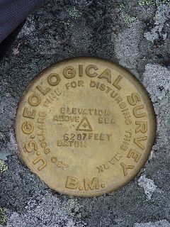
It was also interesting
to note that the Benchmark appears to be relative new and shows an elevation of
6207 Feet.
|
The gully to the SE Ridge viewed from
the Summit of Double Peak
|
|

|
|
Andy on the Summit Ridge
|
|
|
|
I couldn't decide which one I liked
better |
|
|
|
The North Summit of Double Peak
|
|
|
|
Correct your Map and Guide Book, the
Elevation is NOT 6199 Feet |
|
|
We deviated a bit on the descent, dropping into the upper basin then to the
lower by way of a fairly steep gully. From there we picked up or tracks and
descended to Chinook Creek. Expect brush on the route so go when there is
still snow!
The next day I headed into Crystal Lakes basin, where for the second week in
a row I found powder skiing (less than 2 inches) on a solid base. I had to look for the
solid base, but I had a good idea of where to start. Most of the snow pack has
rounded but is in serious need of a deep freezing.
References:
Cascade Alpine Guide, Volume 1, 2nd Edition; Fred Beckey; Page 133
USGS Chinook Pass 7.5 Minute Series