Just one of the warning signs
I hadn't heard a lot about Big Craggy and West Craggy other than they were pretty easy scrambles and they both qualify as top 100 peaks. Beckey states that the south flank of Big Craggy is a 30 degree scree slope. There is a 5.8 Grade III route on the “Craggy” NE Buttress that is, apparently, solid after the first pitch. I am a bit skeptical about that. Ignoring all of the warnings that this was probably not the best time to take on this scree fest, I headed to Winthrop to make the ascents.
|
Just one of the warning signs |
|
|
From just west of Winthrop I drove West Chewuch Road (becomes FSR 51) for a about 9.5 miles then FSR 5130 for what seems like forever (a little over 12 miles) I arrived at the Copper Glance Lake Trailhead (c.3800’). There were a lot of orange coats on patrol defending the forest against the relentless assaults of the gorilla warfare tactics of the deer. The trail to Copper Glance Lake (FST 519) effectively begins on abandoned roadway/tramway (FSR 505). The tramway ascends steadily to its origin at the abandoned mine at c.1.5 miles, c.5100’. I stopped briefly to investigate the mine which seems to go quite some distance underground. There is a second shaft just above.
The continuing trail heads upward through forest and meadows to a crossing of Copper Glance Creek at c. 1.6 miles. I continued up the path for a couple hundred yards then turned NW aiming for the open terrain shown on the map below Isabella Ridge. Some bushwhacking and windfall is unavoidable but short lived. Skirting below an extensive talus slope it wasn’t apparent where the summit of West Craggy was. I made my way up the drainage before heading NE and ascending tedious scree to the ridge between Big Craggy and West Craggy Peaks. Once on the ridge it is a scree slog to the east to reach the top of Big Craggy. The top seems to be farther away than is really necessary…
|
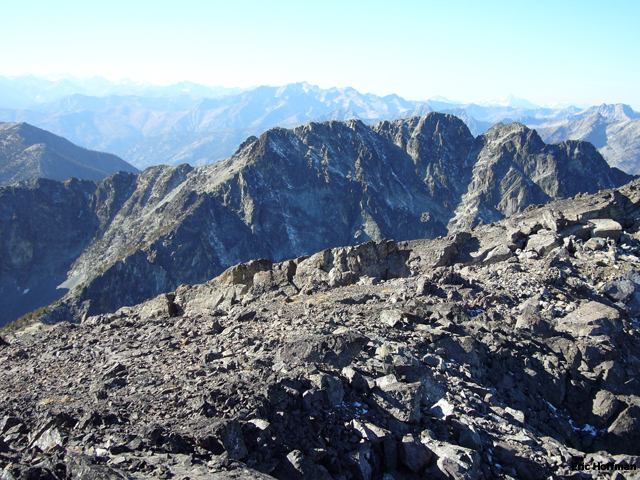
West Craggy from Big Craggy |
|
|
After a brief stay on Big Craggy Peak's summit I returned to the flattish section of ridge (c.7700’) connecting Big Craggy to West Craggy. Staying near the ridge I traversed toward West Craggy keeping just below the crest on the south side eventually reaching a small notch that leads to a talus and rock gully that gains Isabella ridge with occasional class 2 scrambling. Once on the ridge it is more scree/talus hiking to the summit. The lack of scrambling was a bit disappointing.
|
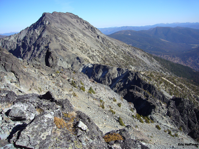
Big Craggy and the connecting ridge to West Craggy |
|
|
|
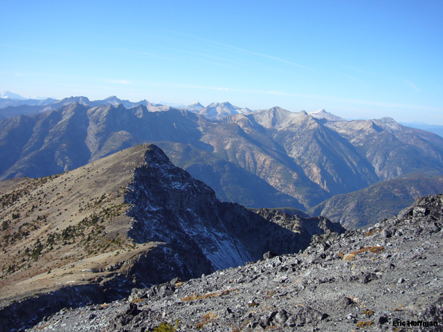
Looking into the heart of the Pasayten Wilderness |
|
|
Returning to the notch on the connecting ridge I descended into the talus basin below West Craggy and Isabella Ridge. After the knee jarring descent back to the trail I returned to the trailhead… further knee jarring should be expected. The ascents took a total of 6.5 hours including the return to the trailhead.
References:
Cascade Alpine Guide, Volume 3, 2nd Edition; Fred Beckey; Page 217
75 Scrambles in Washington; Peggy Goldman; Pages 73-75