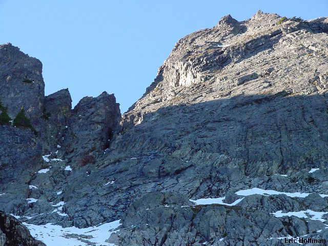
Below the chimneys and the East Face
Chair Peak is not the highest peak in the Snoqualmie Pass area but its appearance and accessibility make it a very popular objective. There are several summit routes that range in difficulty from a class 3 route via the South Shoulder to a class 5.5 route on the East Face. The NE Buttress is about the only route reported to have good rock and seems to be the most popular, at least in conversation. I had previously made one serious attempt on Chair Peak via the southeast route and some exploratory hikes in the area. I reached the crest of the south shoulder by climbing the class 4 chimney described in the Cascade Alpine Guide. From there I watch two climbers rappelling down what seemed to be the main summit gully mentioned in the guide. The pair of climbers were kicking loose rock down the gully as they tried to locate a rappel anchor to get over a steep, cliffy section. The route looked harder than advertised...I bailed.
Further reading about the route still led me to believe that there was in fact a class 3ish route on the south shoulder with more difficult variations possible that make the route shorter and more interesting. Photos, however, all seemed to suggest that there was a step in the main summit gully. There was only one way to find out for sure.
I left the Alpental parking lot/Snow Lake Trailhead around 8:00am, arriving at the Snow Lake/Source Lake junction in 1.5 miles. I continued on the trail another 0.5 miles to Source Lake, though the basin east of Chair Peak can also be reached by following the old trail on the Snow Lake divide. At source lake the trail enters a talus field and maintenance stops. The trail works up through the talus, then crosses a stream just below a small waterfall (often not much more than a trickle). On the other side of the stream the trail gains a bit of elevation then gains the crest of the Snow Lake Divide, eventually intersecting with the Snow Lake Trail.
Leave the trail just before reaching the crest of the divide at a rock slide. The rock slide can be climbed to avoid steep, brushy slopes. After climbing c.400 feet (just before the rock slide narrows into a gully between cliffs, there are currently cairns), a path traverses left on talus then through about 100 yards of trees to emerge in a snow and talus basin immediately east of Chair Peak. I was heading for the two chimneys adjacent to the east face. The left chimney is class 4 an the same chimney I had climbed on the previous attempt.
|
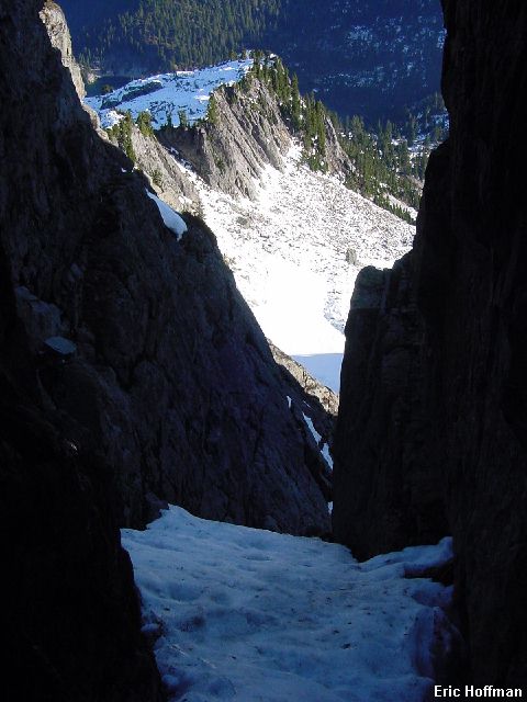
Below the chimneys and the East Face |
|
|
I climbed the basin to the base of the two chimneys and climbed snow and rock to then into the chimney. Much of the climbing is class 3 on sometimes loose rock but there are a couple of trickier moves including an awkward stem under a roof (you may be able to avoid this by climbing right before reaching the roof). There was considerable snow in the chimney that was mostly well consolidated and frozen leaving little choice but to wear crampons while climbing the chimney. In two locations I set up a solo belay. A rope is advised along with some runners. A light rack may be useful but there are good anchors with slings at the more difficult sections.
|
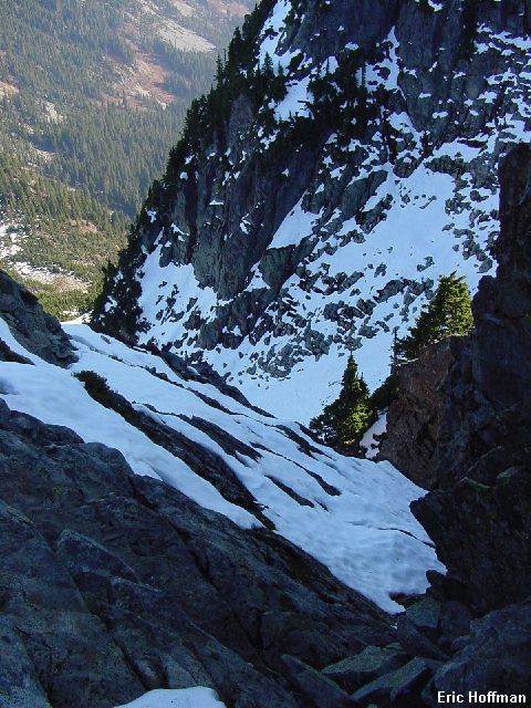
In the Chimney |
|
|
The chimney ended with snow covered slabby rock on the right. I crossed a patch of thin snow then traversed to the crest between the left and right chimneys then climbed to the top. I was now above the notch at the top of the right chimney. For the lack of an easier way down, I made a short rappel down to the notch (about a 30 foot rappel; alternative is a steep, loose class 3 down climb hidden by trees when viewed from above).
|
At the top of the chimney |
|
|
From the notch I climbed an obvious gully that is hidden when viewing Chair Peak from most vantage points. The gully climbed 200-300 feet (class 3) then ended at a short rocky face. I climbed out of the gully on the left then up a broad gully leading to the summit area. When descending from the summit, the correct gully to get to the top of the chimneys is not obvious. Look for the top of the correct gully when about 100 feet below the summit.
|
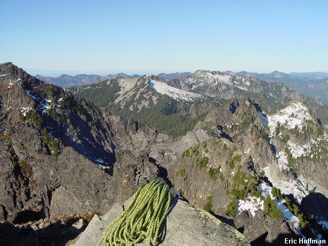
Looking toward Snoqualmie Pass |
|
|
|
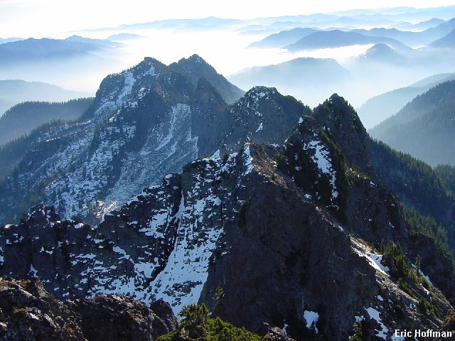
The Kaleetan-Roosevelt Traverse from Chair Peak |
|
|
|
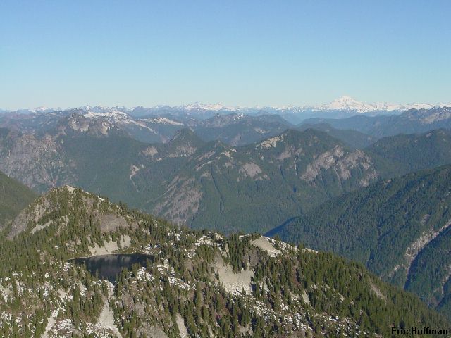
View to the north, Gem Lake in foreground |
|
|
There is a way to climb or descend Chair Peak on class 3 rock. From the top of the chimneys begin traversing south just below the ridge crest on the west side (there is considerable loose rock). After about 200 yards there is a patch of trees before the ridge appears to turn from a SW direction to the south. Cross the ridge and descend easy slopes (class 2 at the top, otherwise talus or snow) keeping close to the cliffs on the left. At c. 5400' the cliffs on the left ease and and the crest is easily crossed. Once across, descend near cliffs back down to the basin below the east face. An uneventful hike with only a few other people on the Snow Lake Trail ended the trip (5.5 hours total).
References:
Cascade Alpine Guide, Volume 1, 2nd Edition; Fred Beckey; Pages 146-147,
150-151, 153