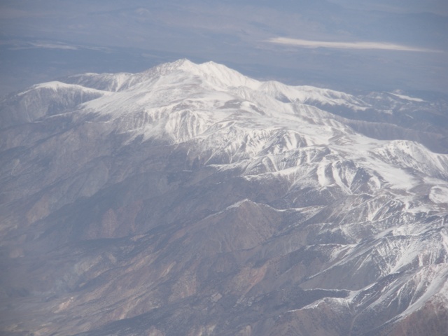
Arial view of the White Mountains in winter
In the photo below Boundary Peak is the shorter summit at upper center. Boundary?s higher neighbor is Montgomery Peak standing at 13,441.? The official California-Nevada border is approximately at the saddle between the two summits. The border between the two states was a controversy for decades. The USGS map still shows the line surveyed by Allexey W. Von Schmidt in 1872 which placed Boundary Peak in California. Had that become the official boundary Wheeler Peak in Great Basin National Park would be the highest in Nevada.
|
Arial view of the White Mountains in winter |
|
|
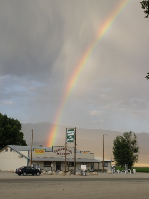
After a long drive through the desolate state of Neveda I found myself in the ?town? of Dyer where there is a view of Boundary Peak, thunderstorms permitting. Also in Dyer there is a convenience store that sells gas and a restaurant/bar/casino called ?The Boonies?. I stopped in for a bite to eat and was soon chatting with the owner that once resided in Washington. He offered to let me stay in the ?back? trailer, not to be confused with the front, middle, left or right trailers. He said he was offering because I was from Washington but I think he really just wanted me to stick around and spend money at his establishment. It still sounded better than the back of my car.
|
I didn't find a pot of gold there either... |
|
|
The following morning I headed north on Highway 264 almost to the junction with Highway 773 where there is a gravel road signed ?Trail Canyon.? I turned there and traveled the increasingly bumpy road arriving at the B & B mine in at 11 miles where I took a right toward the mine then an immediate left. At 13 miles there is a small reservoir that was boiling with fish. Beyond there the road is fairly rough so you may elect to walk some portion of the remaining 1.5 miles to the trailhead.
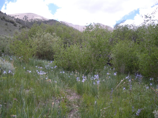
There was one car with Oregon plates at the trailhead when I arrive around 7:00AM. By 7:15 I was hiking through an oasis, literally. I had driven all the way across Nevada and not seen any vegetation quite like this in the state which made for pleasant hiking the first couple of miles.
|
Hiking through the Trail Canyon oasis |
|
|
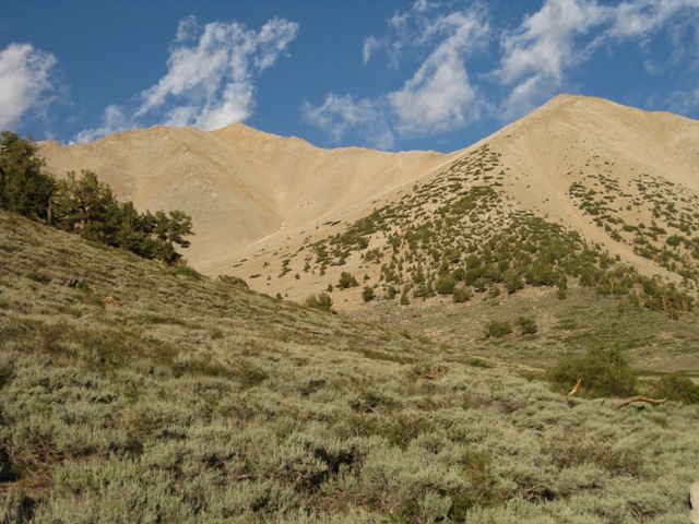
I spotted a person on the vast scree slope ahead ?moving slowly. The oasis gave way to sage brush then the sage brush gave way to scree. The path continued more or less straight up and was not too bad at first but as the slope steepened it became clear that this path was probably from people descending. I had enough and traversed right to gain the NE Ridge at ca.12,200 Feet where there is a well defined path.
|
Leaving the oasis for less pleasant hiking (photo Courtesy of Ardel Frick) |
|
|
|
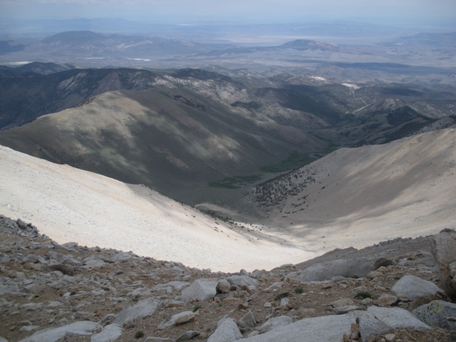
Looking down the scree slope from the Northeast Ridge |
|
|
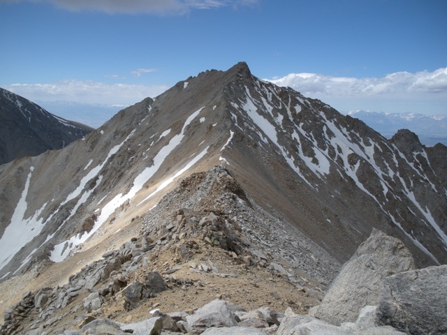
The path sticks close to the ridge with the occasional detour on the north side. A few hundred feet higher I ran into Ardel Frick of Portland, Oregon. She was even happier to see the path than I was. We hiked and chatted, mostly about the scree slope, and reached the anticlimactic summit around 10:40AM. You can scramble up Montgomery Peak from Boundary via a loose class 3 ridge ?if you want.
|
Montgomery Peak, CA - higher but not calling me |
|
|
On the descent Ardel and I decided to follow the path and see where we went wrong. We ran into a couple other people who had approached the peak from Queen Mine and said the road was in good condition to the mine (6 miles of gravel instead of 14.5). Not far from where I gained the ridge a path dropped onto the scree face but we decided to follow the Queen Mine route to Trail Canyon Saddle because it seemed like it would be more interesting.
|
Descending the Northeast Ridge |
|
|
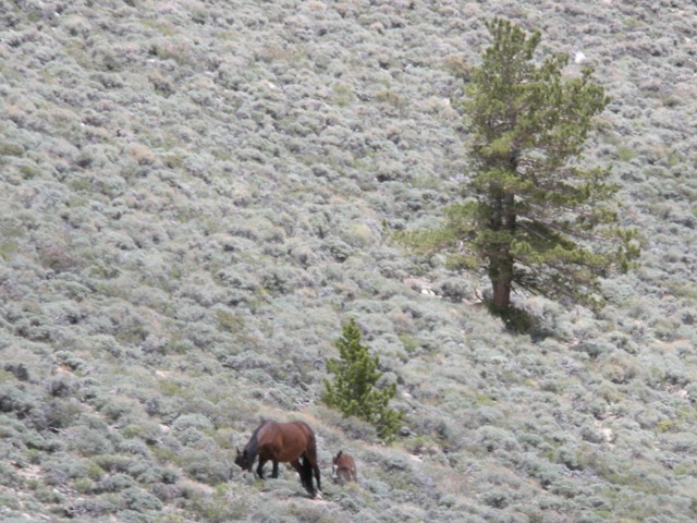
The path traverses then descends north through rubble to reach Trail Canyon Saddle at ca.10,800 Feet. From there we headed east keeping on the right side of a wash where there is occasionally a path. Part way down we saw a small herd of wild horses and a deer bounding through the bristlecone pines. After the trees ended we located the path in the sage brush and hiked through the oasis back to the trailhead. The trip took me about 6 hours with a fairly leisurely return.
|
A wild mare and her foal near Trail Canyon Saddle |
|
|
References:
Summitpost.com