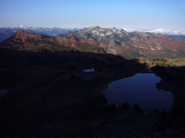
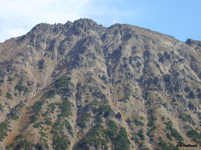
The SW Face of Big Chiwaukum from the Wildhorse Trail
Having made something of a ski tour into the Chiwaukum Mountains, I was somewhat compelled to go take care of the unfinished business. Big Chiwaukum, the unofficial name of the highest point in the Chiwaukum Mountains, is not a particularly well know or frequently climbed mountain. The ascent can certainly be done in a single day but the timing worked better for me to do it as a two day climb.
I arrive at the Whitepine Creek Trailhead (c.2800’) at the end of FSR 6950 (turn off is c.14 miles east of Stevens Pass) a little after 1:00 PM. By 1:30 I was hiking the low angled Whitepine Trail (FST 1582). In 2.5 miles of minor ups and downs the trail reaches the junction with the Wildhorse Trail (FST 1592, c.3200’).
The Wildhorse Trail gains elevation fairly steadily to about 5200’ then begins a more level traverse. At c.4 miles, 5400’ the trail crosses the open basin below the SW Face of Big Chiwaukum where a way trail leads up into the basin, a more direct alternative if attempting the route in a day. I continued on the Wildhorse trail to about 6 miles where it reaches a junction with the Lake Grace Trail (FST 1593, c.5400’). Not well maintained, if at all, but there is a sign marking the beginning of the frequently hard to follow path. The trail wanders through meadows for about a mile to reach Lake[s] Grace at 6242’. It took about 4.5 hours to reach the lakes from the trailhead.
|
The SW Face of Big Chiwaukum from the Wildhorse Trail |
|
|
After a night at the lake I started up what appears to be the best, though indirect, route up to the open scree slopes south of Big Chiwaukum by ascending and traversing heather slopes toward Upper Grace Lake. This route avoided scrub trees and steep water courses but left me in a talus field well south of the summit. I decided to ascend to the ridge where I hoped to get a better idea of just where the true summit actually was. Upon reaching the ridge I was still uncertain of the exact location but it was clearly well north of my location.
|
Lake[s] Grace with Mount Daniel in the left background |
|
|
After a night at the lake I started up what appears to be the best, but indirect, route up to the open scree slopes south of Big Chiwaukum by ascending and traversing heather slopes until toward Upper Grace Lake. This route avoided scrub trees and steep water courses but left me in a talus field well south of the summit. I decided to ascend to the ridge where I hoped to get a better idea of just where the true summit actually was. Upon reaching the ridge I was still uncertain of the exact location but it was clearly well north of my location.
|
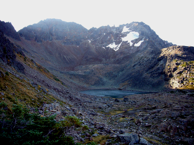
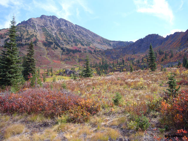
Snowgrass Mountain and Upper Grace Lake |
|
|
|
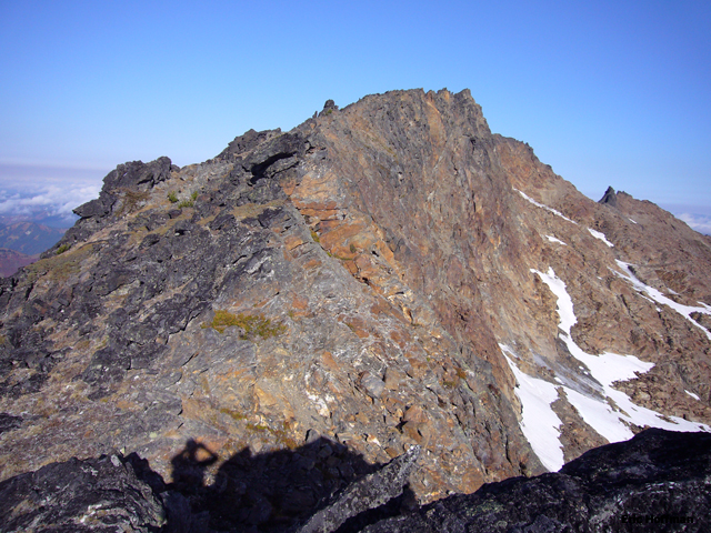
On the summit ridge... where is the summit? |
|
|
I following the ridge until it became craggy then traversed below the crest on the SW Face for a few hundred yards then crossed the obvious south trending rib and continued to the first major gully. Descending slightly into the gully then back up to near the ridge crest I reached a narrow chimney that led to a ridge notch. I climbed the chimney (class 3) to the notch then followed the ridge for about 50 feet (class 3/4) before I was forced onto the SW Face. After traversing 20-30 feet I was able to scramble back to the ridge then to the summit (class 3). The summit views would have been better if not for the haze. The last entry in the summit register was by Paul Klenke and company on the 10th of September (20 days between ascents seems to be about normal for the late spring/early fall season). Since most of the route to the summit was hiking and only about 100 vertical feet of scrambling it took only 1.5 hours to reach the summit from camp at Lake Grace. The scramble itself is a mix of loose and solid rock. Every hold should be considered suspect until tested, in other words, it is a typical Cascade scramble.
|
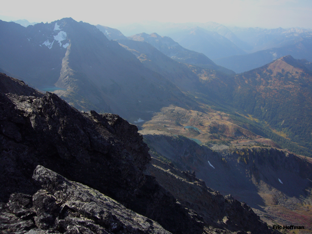
The view to the south from the summit |
|
|
I retraced my steps down the SW face then tried to take a shortcut the last 500’ back to the lake. This “shortcut” led to a slippery watercourse and scrub tree… should have stuck to the indirect route. After packing up camp I decided to avoid the rather circuitous route to the lake and traversed to the ridge separating the Lake Grace basin from the basin below the SW Face of Big Chiwaukum. Descending the ridge, which is steep in places, saved a significant amount of time and distance. It took 3 hours to reach the trailhead from Lake Grace.
|
Close up of the upper SW Face- Happy scrambling |
|
|
References:
Cascade Alpine Guide, Volume 1, 2nd Edition; Fred Beckey; Pages 220-221
Climging Washington's Mountains; Jeff Smoot; Pages 211-216